Garfield, Kansas
Garfield, Kansas | |
|---|---|
 City Hall, Library, Post Office (2009) | |
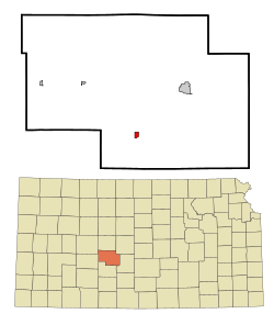 Location within Pawnee County and Kansas | |
 | |
| Coordinates: 38°4′35″N 99°14′42″W / 38.07639°N 99.24500°WCoordinates: 38°4′35″N 99°14′42″W / 38.07639°N 99.24500°W | |
| Country | United States |
| State | Kansas |
| County | Pawnee |
| Founded | 1870s |
| Incorporated | 1910 |
| Named for | James A. Garfield |
| Area | |
| • Total | 0.54 sq mi (1.39 km2) |
| • Land | 0.54 sq mi (1.39 km2) |
| • Water | 0.00 sq mi (0.00 km2) |
| Elevation | 2,077 ft (633 m) |
| Population | |
| • Total | 190 |
| • Estimate (2019)[3] | 169 |
| • Density | 314.13/sq mi (121.37/km2) |
| Time zone | UTC-6 (CST) |
| • Summer (DST) | UTC-5 (CDT) |
| ZIP code | 67529 |
| Area code | 620 |
| FIPS code | 20-25750 [4] |
| GNIS ID | 0475938 [5] |

Garfield is a city in Pawnee County, Kansas, United States. At the 2010 census, the city population was 190.[6]
History[]
Garfield is named for James A. Garfield, the 20th President of the United States.[7]
The first post office in Garfield was established in 1873.[8]
Geography[]
Garfield is located at 38°4′35″N 99°14′42��W / 38.07639°N 99.24500°W (38.076310, -99.244994).[9] According to the United States Census Bureau, the city has a total area of 0.54 square miles (1.40 km2), all of it land.[10]
Demographics[]
| Historical population | |||
|---|---|---|---|
| Census | Pop. | %± | |
| 1910 | 333 | — | |
| 1920 | 368 | 10.5% | |
| 1930 | 451 | 22.6% | |
| 1940 | 335 | −25.7% | |
| 1950 | 297 | −11.3% | |
| 1960 | 278 | −6.4% | |
| 1970 | 261 | −6.1% | |
| 1980 | 277 | 6.1% | |
| 1990 | 236 | −14.8% | |
| 2000 | 198 | −16.1% | |
| 2010 | 190 | −4.0% | |
| 2019 (est.) | 169 | [3] | −11.1% |
| U.S. Decennial Census | |||
2010 census[]
At the 2010 census,[2] there were 190 people, 82 households and 49 families residing in the city. The population density was 351.9 per square mile (135.9/km2). There were 102 housing units at an average density of 188.9 per square mile (72.9/km2). The racial makeup was 92.6% White, 2.1% Native American, and 5.3% from two or more races. Hispanic or Latino of any race were 6.8% of the population.
There were 82 households, of which 17.1% had children under the age of 18 living with them, 52.4% were married couples living together, 6.1% had a female householder with no husband present, 1.2% had a male householder with no wife present, and 40.2% were non-families. 32.9% of all households were made up of individuals, and 21.9% had someone living alone who was 65 years of age or older. The average household size was 2.32 and the average family size was 2.90.
The median age was 49.4 years. 20.5% of residents were under the age of 18; 6.9% were between the ages of 18 and 24; 16.9% were from 25 to 44; 35.3% were from 45 to 64; and 20.5% were 65 years of age or older. The gender makeup of the city was 45.8% male and 54.2% female.
2000 census[]
At the 2000 census,[4] there were 198 people, 83 households and 62 families residing in the city. The population density was 369.3 per square mile (142.6/km2). There were 97 housing units at an average density of 180.9 per square mile (69.8/km2). The racial makeup was 97.98% White, 0.51% African American, 0.51% Native American, 0.51% from other races, and 0.51% from two or more races. Hispanic or Latino of any race were 0.51% of the population.
There were 83 households, of which 31.3% had children under the age of 18 living with them, 60.2% were married couples living together, 8.4% had a female householder with no husband present, and 25.3% were non-families. 24.1% of all households were made up of individuals, and 10.8% had someone living alone who was 65 years of age or older. The average household size was 2.39 and the average family size was 2.74.
25.3% of the population were under the age of 18, 6.6% from 18 to 24, 21.2% from 25 to 44, 26.3% from 45 to 64, and 20.7% who were 65 years of age or older. The median age was 42 years. For every 100 females, there were 98.0 males. For every 100 females age 18 and over, there were 94.7 males.
The median household income was $38,500 and the median family income was $39,583. Males had a median income of $23,750 and females $21,250. The per capita income was $15,767. About 4.5% of families and 5.8% of the population were below the poverty line, including 2.1% of those under the age of eighteen and 4.8% of those 65 or over.
Education[]
The community is served by Fort Larned USD 495 public school district.
See also[]
References[]
- ^ "2019 U.S. Gazetteer Files". United States Census Bureau. Retrieved July 24, 2020.
- ^ Jump up to: a b "U.S. Census website". United States Census Bureau. Retrieved July 6, 2012.
- ^ Jump up to: a b "Population and Housing Unit Estimates". United States Census Bureau. May 24, 2020. Retrieved May 27, 2020.
- ^ Jump up to: a b "U.S. Census website". United States Census Bureau. Retrieved January 31, 2008.
- ^ "US Board on Geographic Names". United States Geological Survey. October 25, 2007. Retrieved January 31, 2008.
- ^ "2010 City Population and Housing Occupancy Status". U.S. Census Bureau. Retrieved September 15, 2011.[dead link]
- ^ Gannett, Henry (1905). The Origin of Certain Place Names in the United States. Govt. Print. Off. pp. 134.
- ^ "Kansas Post Offices, 1828-1961". Kansas Historical Society. Archived from the original on October 9, 2013. Retrieved June 22, 2014.
- ^ "US Gazetteer files: 2010, 2000, and 1990". United States Census Bureau. February 12, 2011. Retrieved April 23, 2011.
- ^ "US Gazetteer files 2010". United States Census Bureau. Archived from the original on July 2, 2012. Retrieved July 6, 2012.
Further reading[]
External links[]
- Garfield - Directory of Public Officials
- USD 495, local school district
- Garfield City Map, KDOT
| hide Municipalities and communities of Pawnee County, Kansas, United States | ||
|---|---|---|
| Cities |  | |
| Unincorporated communities | ||
| ||
| show Authority control |
|---|
- Cities in Kansas
- Cities in Pawnee County, Kansas
- Kansas populated places on the Arkansas River