Gauriganga
Gauriganga Municipality
गौरीगंगाा नगरपालिका गौरीगंगाा नगरपालिका | |
|---|---|
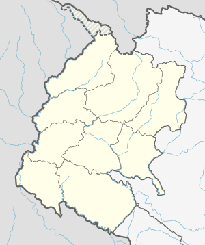 Gauriganga Municipality Location in Nepal | |
| Coordinates: 28°46′N 80°46′E / 28.77°N 80.76°ECoordinates: 28°46′N 80°46′E / 28.77°N 80.76°E | |
| Country | |
| Province | Sudurpashchim Province |
| District | Kailali District |
| Municipality | Gauriganga Municipality |
| Ward | 11 |
| Government | |
| • Mayor | Bhim Bahadur Deuba (NCP) |
| • Deputy Mayor | Anchala Chaudhary (NCP) |
| Area | |
| • Total | 244.44 km2 (94.38 sq mi) |
| Population (2011) | |
| • Total | 55,314 |
| • Density | 230/km2 (590/sq mi) |
| Languages | |
| • Official language | Nepali |
| • Local language | Khas (Bajhangi, Achhami, Doteli, Bajureli), Tharu, Khas Nepali, etc |
| Time zone | UTC+5:45 (NST) |
| Post code | 10900 |
| Area code(s) | 091 |
| Website | www |


Gauriganga Municipality is a municipality in Kailali District in the Sudurpashchim Province. At the time of the 2011 Nepal census it had a population of 55,314 living in 5,293 individual households. It is Surrounded by Ghodaghodi Municipality in the west, Godawari Municipality in the east, Mohanyal and Chure Rural Municipality in the north and Dhangadhi Sub Metropolitan City and Kailari Rural Municipality in the south.
Census[]
Total population of Gauriganga Municipality]] is 55,314,. Khas Kshatriya is the dominant caste followed by Tharu Damai(Dholi or Nepali) (Biswakarma) Ethnic group. Brahmin Ranked third with. The male to female sex-ratio is 96.47. Total 5,293 household.[1]
References[]
- ^ Nepal census 2011
External links[]
- UN map of the municipalities of Kailali District
- Official website of ddc Kaialali
- City Population - Gauriganga Municipality in Nepal
Headquarters: Dhangadhi | ||
| Sub-metropolitan cities | 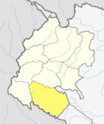 | |
| Municipalities | ||
| Rural municipalities | ||
| Former VDCs | ||
List of municipalities and rural municipalities of Nepal | ||
This article about a location in the Kailali District of Nepal is a stub. You can help Wikipedia by . |
- Populated places in Kailali District
- Municipalities in Kailali District
- Nepal municipalities established in 2017
- Sudurpashchim Province geography stubs