Ghana's material cultural heritage
The monuments list is taken from the Ghana Museums and Monuments Board, according to their description "legal custodian of Ghana's material cultural heritage (movable and immovable heritage)"[1] GMMB classifies the monuments:
The ID used on this page in reference to the Regions of Ghana are based on the ISO Regional ID standards.
A. Western Region[]
| ID | Description | Region | Original function | Built | Location | Address | Comment | Coordinates | Image |
|---|---|---|---|---|---|---|---|---|---|
| GH-WP-001 | Fort Apollonia | Western | Fort | 1765 and 1771 | Beyin | 4°45′00″N 2°01′00″W / 4.75°N 2.016667°W |  | ||
| GH-WP-002 | Fort Saint Anthony | Western | Fort | 1515; expanded in 1642 and 1872 by Dutch | Axim | 4°52′02″N 2°14′23″W / 4.8671749°N 2.239667°W |  | ||
| GH-WP-003 | Fort Groß Friedrichsburg | Western | Fort | 1683 | Princestown | article only in german | 4°47′28″N 2°08′02″W / 4.791111°N 2.133889°W |  | |
| GH-WP-004 | Fort Dorothea | Western | Fort | 1684–1687; 1698–1711; April 1712–1717 | Akwida | 4°45′00″N 2°01′00″W / 4.75°N 2.016667°W |  | ||
| GH-AA-005 | Museum of Nzema Culture & History | Western | Museum | Fort Apollonia |  | ||||
| GH-WP-005 | Fort Metal Cross | Western | Fort | 1683 | Dixcove | 4°47′27″N 1°57′01″W / 4.790936°N 1.950362°W |  | ||
| GH-WP-006 | Fort Batenstein | Western | Fort | Between 1595 and 1600 | Butre | 4°49′18″N 1°55′16″W / 4.8216314°N 1.9211483°W | 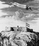 | ||
| GH-WP-007 | Fort Orange | Western | Fort | 1690 | Sekondi | 4°56′09″N 1°42′26″W / 4.9357°N 1.7073°W |  | ||
| GH-WP-008 | Fort St. Sebastian | Western | Fort | 1590 | Shama | 5°01′45″N 1°37′16″W / 5.029111°N 1.621061°W |  | ||
| GH-WP-00P | Nzulezu Stilt Settlement | Western | Settlement | Lake Tadane |  |
B. Central Region[]
| ID | Description | Region | Original function | Built | Location | Address | Comment | Coordinates | Image |
|---|---|---|---|---|---|---|---|---|---|
| GH-CP-001 | Fort Komenda | Central | Fort | 1957 | British Komenda |  | |||
| GH-CP-002 | Fort Vredenburg | Central | Fort | Dutch Komenda |  | ||||
| GH-CP-003 | Castle of St. George's | Central | Castle | 1482 | Elmina | Also known as Elmina Castle[2] | 5°05′00″N 1°21′00″W / 5.083333°N 1.35°W | 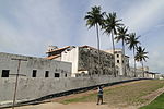 | |
| GH-AA-003 | Cape Coast Castle Museum | Central Region | Museum | Cape Coast | Museum is located within the castle. Photography not allowed there | 5°06′12″N 1°14′33″W / 5.103333°N 1.2425°W | 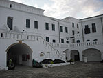 | ||
| GH-AA-004 | Elmina Castle Museum | Central Region | Museum | Elmina | 5°05′00″N 1°21′00″W / 5.083333°N 1.35°W |  | |||
| GH-CP-004 | Fort St. Jago | Central | Fort | 1555 and 1558 | Elmina | 5°05′00″N 1°21′00″W / 5.083333°N 1.35°W | 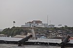 | ||
| GH-CP-005 | Fort Goede Hoop a.k.a. Fort Good Hope |
Central | Fort | 1705 | Senya Beraku | 5°23′15″N 0°29′23″W / 5.3874°N 0.4898°W |  | ||
| CE-GH-CP-006 | Fort Lijdzaamheid a.k.a. Patience, Leydsaemheyt |
Central | Fort | 1697 | Apam | 5°17′36″N 0°44′32″W / 5.29336°N 0.74226°W |  | ||
| GH-CP-007 | Fort Amsterdam (Ghana) | Central | Fort | 1631, fort rebuilt by the English in 1645 | 5°12′09″N 1°05′25″W / 5.2025°N 1.090278°W |  | |||
| GH-CP-008 | The Little Fort | Central | Fort | Anomabu | 5°11′12″N 1°06′32″W / 5.1865638°N 1.1089244°W | ||||
| GH-CP-009 | Fort William (Ghana) a.k.a. Anomabu Castle |
Central | Fort | 1640 | Anomabu | 5°10′00″N 1°07′00″W / 5.1667°N 1.1167°W | 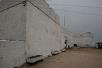 | ||
| GH-CP-010 | Fort Nassau | Central | Fort | 1612 | Moree | 5°08′00″N 1°12′00″W / 5.133333°N 1.2°W |  | ||
| GH-CP-011 | Fort Fredericksburg | Central | Fort | 4°52′00″N 1°47′00″W / 4.8666667°N 1.7833333°W | 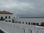 | ||||
| GH-CP-012 | Cape Coast Castle | Central | Castle | 1653 | Cape Coast | 5°06′18″N 1°14′50″W / 5.105056°N 1.247234°W | 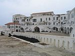 | ||
| GH-CP-013 | Fort McCarthy | Central | Castle | 1822 | Cape Coast | 5°06′N 1°15′W / 5.1°N 1.25°W | 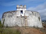 | ||
| GH-CP-014 | Central | Fort | 1712 | Cape Coast |  | ||||
| GH-CP-015 | Fort William (Lighthouse) | Central | Fort | 1753 | Cape Coast | 5°06��N 1°15′W / 5.1°N 1.25°W | 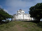 | ||
| GH-CP-016 | Fort Royal | Central | Fort | Cape Coast | 5°06′N 1°15′W / 5.1°N 1.25°W |  |
C. Greater Accra Region[]
| ID | Description | Region | Original function | Built | Location | Address | Comment | Coordinates | Image |
|---|---|---|---|---|---|---|---|---|---|
| GH-AA-001 | National Museum | Greater Accra | Museum | 1957 | Barnes Road, Accra | 5°33′24″N 0°12′28″W / 5.556667°N 0.207778°W |  | ||
| GH-AA-002 | Museum of Science & Technology | Greater Accra | Museum | 1963 | Barnes Road, Accra. | Ghana Museum of Science and Technology |  | ||
| GH-AA-006 | Ussher Fort | Greater Accra | Fort | 1649 | , Accra | 
| |||
| GH-AA-008 | James Fort | Greater Accra | Fort | 1673 | John Evans Atta Mills High Street, Accra | James Fort Ghana |  | ||
| GH-AA-010 | Christiansborg Castle a.k.a. Osu Castle |
Greater Accra | Fort | 1659 | Osu, Accra |  | |||
| GH-AA-011 | Fort Augustaborg | Greater Accra | Fort | 1787 | Teshie |  | |||
| GH-AA-012 | Museum of Archaeology | Greater Accra | Museum | University of Ghana, Department of Archeology, Accra |  | ||||
| GH-EP-001 | Fort Vernon | Greater Accra | Fort | 1742 | Prampram | 5°43′29″N 0°07′00″E / 5.7247051°N 0.1167463°E |  | ||
| GH-EP-002 | Holy Trinity Church Accra | Greater Accra | Church | 1894 | Accra High street |  | |||
| GH-EP-002 | Fort Fredensborg | Eastern | Fort | 1736 - 42 | Old Ningo | 5°45′00″N 0°11′00″E / 5.75°N 0.1833333°E |  |
E. Volta Region[]
| ID | Description | Region | Original function | Built | Location | Address | Comment | Coordinates | Image |
|---|---|---|---|---|---|---|---|---|---|
| GH-TV-001 | Fort Prinzenstein | Volta | Fort | 1734 | Keta | 5°54′39″N 0°59′31″E / 5.910833°N 0.991944°E | 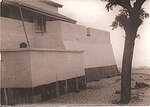 | ||
| GH-TV-002 | Volta Regional Museum | Volta | Museum | 1973 | Ho |  |
F. Ashanti Region[]
| ID | Description | Region | Original function | Built | Location | Address | Comment | Coordinates | Image |
|---|---|---|---|---|---|---|---|---|---|
| GH-AH-001 | Fort Kumasi | Ashanti | Fort | 1820 | Kumasi |  | |||
| GH-AH-002 | Kumasi Military Museum | Ashanti | Museum | Kumasi | 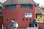 | ||||
| GH-AH-003 | Yaw Tano Shrine a.k.a. Tano Yaw Shrine |
Ashanti | Shrine | Ejisu-Besease | at Besease, about 20.8 km on the Kumasi-Accra road. | 5°33′26″N 1°11′45″W / 5.5572433°N 1.1959147°W |  | ||
| GH-AH-004 | Akwasi Sima Shrine a.k.a. Kwasi Kuma Shrine |
Ashanti | Shrine | Adarkwa Jachie | about 16 km on the Kumasi-Ejisu road. |  | |||
| GH-AH-005 | Tano Abenamu Subunu Shrine | Ashanti | Shrine | Abirem is about 12.8 km from Kumasi on the Antoa Road, Coord of Antoa Road | 6°42′30″N 1°36′20″W / 6.7082007°N 1.605463°W | 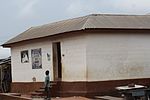 | |||
| GH-AH-006 | Tano Kwadwo Shrine | Ashanti | Shrine | Saaman is about 12.6 km north-east of Kumasi, on the former Odumakoma Tempong road that led toNorthern Ghana. |  | ||||
| GH-AH-007 | Atuo Kosua Shrine | Ashanti | Shrine | off the Ejisu-Onwi road. | 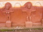 | ||||
| GH-AH-008 | Kentinkrono Shrine | Ashanti | Shrine | Kentinkrono | At Kentinkrono, about 20.8km on the Kumasi-Ejisu road. |  | |||
| GH-AH-009 | Tano Odomankoma Shrine | Ashanti | Shrine | Bogwiase | foot of the rocky Mampong scarp, about 10 km from Effiduase, in theSekyere West District. |  | |||
| GH-AH-010 | Asawase Shrine a.k.a. Tano Banie Shrine |
Ashanti | Shrine | near Ejisu | to the south of Ejisu, about 10 km on the second-class road linking Ejisu and Apromase. |  | |||
| GH-AH-011 | Asenemaso Shrine | Ashanti | Shrine | Kumasi-Sunyani road, at a distance of about 15 km from Kejetia. |  |
G. Northern Region[]
| ID | Description | Region | Original function | Built | Location | Address | Comment | Coordinates | Image |
|---|---|---|---|---|---|---|---|---|---|
| GH-NP-001 | Larabanga Mosque | Northern Region | Mosque | 14th Century | Laribanga | 
| |||
| GH-NP-002 | Bole Mosque | Northern Region | Mosque | Bole Mosque is in West Gonja District, in the Northern Region. | 
| ||||
| GH-NP-003 | Babatu's grave | Northern Region | Old Grave | Yendi | Babatu was a notorious slave raider from Niger. There are remains of his grave and some equipment he and his army used in capturing slaves on Grunsi land. | 
| |||
| GH-NP-004 | The German cemetery | Northern Region | Cemetery | Yendi | German cemetery popularly called "German grave” contains graves of German and Dutch soldiers who died in their colonization efforts in a war with Dagombas. | 
| |||
| GH-NP-005 | Naa Dataa Tua | Northern Region | Cemetery | Yendi | Na Dataa Tua is a site is a place where men who had affairs with the Ya-Na's wives were beheaded. At the site are a sacrificial stone and a baobab tree, at the base of which the victims were beheaded. | 
| |||
| GH-NP-006 | Tamale Central Mosque | Northern Region | Mosque | Tamale | The oldest mosque in the Capital of the northern region.
. |

| |||
| GH-NP-007 | Dakpema tomb | Northern Region | Cemetery | Tamale | The ancient cave where mortal remains of Dakpemas (kings of Tamale kingdom) are kept.
. |

| |||
| GH-NP-008 | Laribanga Mystery Stone | Northern Region | Mystic stone | Tamale | Larabanga Mystery Stone During the British times, in Ghana there was a road that was laid near the Larabanga Mosque, a stone was removed during the process to make way for the road. The next day, the stone was found again on the same place it was displaced from.
. |
 |
H. Upper East[]
| ID | Description | Region | Original function | Built | Location | Address | Comment | Coordinates | Image |
|---|---|---|---|---|---|---|---|---|---|
| GH-UE-001 | Upper East Regional Museum | Upper East | Museum | Bolgatanga | 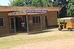
| ||||
| GH-UE-002 | Old Navrongo Catholic Cathedral Building | Upper East | Church | 1920 | Navrongo | 
| |||
| GH-UE-003 | Pikworo Slave camp | Upper East | Slave camp | 1704 | Paga |  |
hI. Upper West[]
| ID | Description | Region | Original function | Built | Location | Address | Comment | Coordinates | Image |
|---|---|---|---|---|---|---|---|---|---|
| GH-UW-001 | Gwollu Defence Wall | Upper West | Monument | Gwollu | Gwollu is 70 km north of Wa, in the Upper West Region of Ghana | 
| |||
| GH-UW-003 | Wa Naa's Palace | Upper West | Palace | Wa | 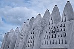
| ||||
| GH-UW-003 | Wechiau Mosque | Upper West | Mosque | Wechiau | 
| ||||
| GH-UW-004 | Dondoli Mosque | Upper West | Mosque | Wa | This 19th Century mosque is in Wa, the capital of the Upper West Region. |  |
Archeological Sites[]
The Museum of Archeology, University of Ghana is listed on the QMMB site.[3]
References[]
- ^ What is QMMB, accessed 2012-07-27
- ^ "Africa & the Middle East".
- ^ Museum of Archeology, University of Ghana
Categories:
- Heritage registers in Ghana
- Wiki Loves Monuments
