Gheorgheni
Gheorgheni
Gyergyószentmiklós | |
|---|---|
 | |
 Flag 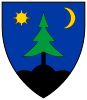 Coat of arms | |
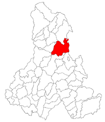 Location in Harghita County | |
 Gheorgheni Location in Romania | |
| Coordinates: 46°43′12″N 25°35′24″E / 46.72000°N 25.59000°ECoordinates: 46°43′12″N 25°35′24″E / 46.72000°N 25.59000°E | |
| Country | Romania |
| County | Harghita |
| Government | |
| • Mayor (2020–2024) | Tibor Csergő[1] (UDMR) |
| Area | 90.17 km2 (34.81 sq mi) |
| Elevation | 816 m (2,677 ft) |
| Population (2011)[2] | 18,377 |
| • Density | 200/km2 (530/sq mi) |
| Time zone | EET/EEST (UTC+2/+3) |
| Postal code | 535500 |
| Area code | (+40) 02 66 |
| Vehicle reg. | HR |
| Website | www |

Gheorgheni (Romanian pronunciation: [ɡe̯orˈɡenʲ]; Hungarian: Gyergyószentmiklós Hungarian pronunciation: [ˈɟɛrɟoːsɛntmikloːʃ] (![]() listen)) is a municipality in Harghita County, Romania.
It lies in the Székely Land, an ethno-cultural region in eastern Transylvania. The city administers four villages:
listen)) is a municipality in Harghita County, Romania.
It lies in the Székely Land, an ethno-cultural region in eastern Transylvania. The city administers four villages:
- Covacipeter / Kovácspéter
- Lacu Roșu / Gyilkostó
- Vargatac / Vargatag
- Visafolio / Visszafolyó
Nearby are two natural sites, the Red Lake and Cheile Bicazului, a narrow canyon through the Eastern Carpathian Mountains forming the border with Neamț County.
History[]

The city historically formed part of the Székely Land region of Transylvania. It was first mentioned in 1332. It belonged to the Kingdom of Hungary with several interruptions, the Eastern Hungarian Kingdom and the Principality of Transylvania, administratively the town belonged to Gyergyószék. Between 1867–1918 it fell within Csík County, in the Kingdom of Hungary. After World War I, by the terms of the Treaty of Trianon of 1920, it became part of Romania and fell within Ciuc County. Since 1940, as a result of the Second Vienna Award, it belonged to Hungary again. After World War II, it became part of Romania. Between 1952 and 1960, it formed part of the Magyar Autonomous Region, then, of the Mureș-Hungarian Autonomous Region until it was abolished in 1968. Since then, the commune is part of Harghita County.
Demographics[]
Ethnic composition of Gheorgheni municipality
The confessional composition of the municipality of Gheorgheni
As of 2011, the city had a population of 17,705, of which 86.13% (15,250) are Hungarians forming a majority. 1,988 or 11.22% are Romanians. Demographic movement according to the censuses:

Politics[]
The City Council has 19 members:
| Party | Seats | Current Council | |||||||||||
|---|---|---|---|---|---|---|---|---|---|---|---|---|---|
| Hungarian Civic Party | 10 | ||||||||||||
| Democratic Alliance of Hungarians in Romania | 6 | ||||||||||||
| Independent politician | 2 | ||||||||||||
| National Liberal Party (Romania) | 1 | ||||||||||||
Twinnings[]
 Békés, Hungary
- Budapest 17th District, Hungary
- Cegléd, Hungary
- Eger, Hungary
- Kiskunmajsa, Hungary
- Siófok, Hungary
- Szigetszentmiklós, Hungary
 Bačka Topola, Serbia
 Alaverdi, Armenia
References[]
| Wikimedia Commons has media related to Gheorgheni. |
- ^ "Results of the 2020 local elections". Central Electoral Bureau. Retrieved 9 June 2021.
- ^ "Populaţia stabilă pe judeţe, municipii, oraşe şi localităti componenete la RPL_2011" (in Romanian). National Institute of Statistics. Retrieved 4 February 2014.

| show Authority control |
|---|
- Populated places in Harghita County
- Localities in Transylvania
- Cities in Romania
- Székely communities
- Gheorgheni