Gibson Township, Susquehanna County, Pennsylvania
Gibson Township, Susquehanna County, Pennsylvania | |
|---|---|
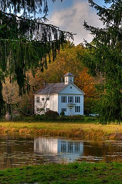 The old Gibson Schoolhouse | |
 Location of Pennsylvania in the United States | |
| Coordinates: 41°44′00″N 75°37′59″W / 41.73333°N 75.63306°WCoordinates: 41°44′00″N 75°37′59″W / 41.73333°N 75.63306°W | |
| Country | United States |
| State | Pennsylvania |
| County | Susquehanna |
| Settled | 1792 |
| Incorporated | 1812 |
| Area | |
| • Total | 32.13 sq mi (83.22 km2) |
| • Land | 31.89 sq mi (82.59 km2) |
| • Water | 0.24 sq mi (0.62 km2) |
| Population (2010) | |
| • Total | 1,221 |
| • Estimate (2016)[2] | 1,177 |
| • Density | 36.91/sq mi (14.25/km2) |
| Time zone | UTC-5 (EST) |
| • Summer (DST) | UTC-4 (EDT) |
| ZIP code | 18847 |
| Area code(s) | 570 & 272 |
| FIPS code | 42-115-29024 |

Gibson Township is a township in Susquehanna County, Pennsylvania, United States. The population was 1,221 at the 2010 census.
History[]

Gibson Township was formed from the north part of Clifford Township on November 24, 1813.[3] The new township was named for district president judge Honorable John B. Gibson.[4]
The Gibson Village Historic District consists of about 32 buildings located at routes 848 and 547.[5]
The Bridge in Gibson Borough was added to the National Register of Historic Places in 1988.[6]
Geography[]
According to the United States Census Bureau, the township has a total area of 32.14 square miles (83.2 km2), of which, 31.9 square miles (83 km2) of it is land and 0.24 square miles (0.62 km2) of it (0.75%) is water.
Gibson Township is bordered by New Milford, Jackson, Ararat, Herrick, Clifford, Lenox, and Harford townships.
Communities[]
The following villages are located in Gibson Township:
Demographics[]
| Historical population | |||
|---|---|---|---|
| Census | Pop. | %± | |
| 2010 | 1,221 | — | |
| 2016 (est.) | 1,177 | [2] | −3.6% |
| U.S. Decennial Census[16] | |||
As of the census[17] of 2010, there were 1,221 people, 481 households, and 351 families residing in the township. The population density was 38.3 people per square mile (14.8/km2). There were 644 housing units at an average density of 20.2/sq mi (7.9/km2). The racial makeup of the township was 97.8% White, 0.4% African American, 0.1% Asian, 0.2% from other races, and 1.5% from two or more races. Hispanic or Latino of any race were 2.2% of the population.
There were 481 households, out of which 27.4% had children under the age of 18 living with them, 61.7% were married couples living together, 5.4% had a female householder with no husband present, and 27% were non-families. 22.9% of all households were made up of individuals, and 10.8% had someone living alone who was 65 years of age or older. The average household size was 2.54 and the average family size was 2.94.
In the township the population was spread out, with 21.7% under the age of 18, 61.3% from 18 to 64, and 17% who were 65 years of age or older. The median age was 46 years.
The median income for a household in the township was $46,154, and the median income for a family was $51,146. Males had a median income of $43,750 versus $31,359 for females. The per capita income for the township was $20,202. About 7.2% of families and 10.5% of the population were below the poverty line, including 14.5% of those under age 18 and 11.1% of those age 65 or over.
References[]
- ^ "2016 U.S. Gazetteer Files". United States Census Bureau. Retrieved Aug 14, 2017.
- ^ a b "Population and Housing Unit Estimates". Retrieved June 9, 2017.
- ^ "Township Incorporations, 1790 to 1853". Susquehanna County Historical Society. Archived from the original on 23 June 2015. Retrieved 18 January 2016.
- ^ "Gibson Township". Susquehanna County Historical Society. Archived from the original on 15 July 2015. Retrieved 18 January 2016.
- ^ "Gibson Village Historic District". PHMC Cultural Resources Database. Pennsylvania Historical and Museum Commission. Retrieved 11 March 2016.
- ^ "National Register Information System". National Register of Historic Places. National Park Service. July 9, 2010.
- ^ a b c d e f g h "GIBSON: SECOND CLASS TOWNSHIP MAP" (PDF). Pennsylvania Department of Transportation. Commonwealth of Pennsylvania. 22 July 1998. Retrieved 11 February 2017.
- ^ "Columbia Corners". Geographic Names Information System. United States Geological Survey. 2 August 1979. Retrieved 25 January 2015.
- ^ "Gelatt". Geographic Names Information System. United States Geological Survey. 2 August 1979. Retrieved 25 January 2015.
- ^ "Gibson". Geographic Names Information System. United States Geological Survey. 2 August 1979. Retrieved 25 January 2015.
- ^ "Kentuck Corners". Geographic Names Information System. United States Geological Survey. 2 August 1979. Retrieved 25 January 2015.
- ^ "Palma". Geographic Names Information System. United States Geological Survey. 1 December 1989. Retrieved 25 January 2015.
- ^ "Smiley". Geographic Names Information System. United States Geological Survey. 2 August 1979. Retrieved 25 January 2015.
- ^ "South Gibson". Geographic Names Information System. United States Geological Survey. 2 August 1979. Retrieved 25 January 2015.
- ^ "Union Hill". Geographic Names Information System. United States Geological Survey. 2 August 1979. Retrieved 25 January 2015.
- ^ "Census of Population and Housing". Census.gov. Retrieved June 4, 2016.
- ^ "U.S. Census website". United States Census Bureau. Retrieved 2011-05-14.
External links[]
Municipalities and communities of Susquehanna County, Pennsylvania, United States | ||
|---|---|---|
| Boroughs | 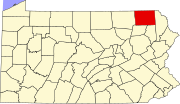 | |
| Townships | ||
| Unincorporated communities | ||
| ||
- Populated places established in 1792
- Townships in Susquehanna County, Pennsylvania
- Townships in Pennsylvania