Susquehanna Depot, Pennsylvania
Susquehanna Depot, Pennsylvania
Susquehanna, Pennsylvania | |
|---|---|
 Post Office on Main Street | |
 Location of Susquehanna Depot in Susquehanna County, Pennsylvania. | |
 Susquehanna Depot Location in Pennsylvania | |
| Coordinates: 41°56′41″N 75°36′14″W / 41.94472°N 75.60389°WCoordinates: 41°56′41″N 75°36′14″W / 41.94472°N 75.60389°W | |
| Country | United States |
| State | Pennsylvania |
| County | Susquehanna |
| Borough Council | 1794 |
| Incorporated | 1853 |
| Government | |
| • Mayor | Nancy Hurley |
| Area | |
| • Total | 0.79 sq mi (2.05 km2) |
| • Land | 0.74 sq mi (1.91 km2) |
| • Water | 0.05 sq mi (0.14 km2) |
| Population (2010) | |
| • Total | 1,643 |
| • Estimate (2019)[2] | 1,513 |
| • Density | 2,052.92/sq mi (792.70/km2) |
| Time zone | UTC-5 (EST) |
| • Summer (DST) | UTC-4 (EDT) |
| Zip Code | 18847 |
| Area code(s) | 570 |
| FIPS code | 42-75568 |


Susquehanna Depot, often referred to simply as Susquehanna, is a borough in Susquehanna County, Pennsylvania, located on the Susquehanna River 23 miles (37 km) southeast of Binghamton, New York. In the past, railroad locomotives and railroad cars were made here. It is also known for its Pennsylvania Bluestone quarries.[3]
The behavioral scientist B. F. Skinner was born in Susquehanna.[4] The American writer John Gardner lived the last few years of his life in Susquehanna, where he died in a motorcycle accident in 1982.[5]
The borough population was 1,643 as of the 2010 census.
History[]
The New York and Erie Railroad (later reorganized as the Erie Railroad) built a rail line through the county in 1848, including the Starrucca Viaduct, a monumental structure spanning Starrucca Creek. Concurrently the railroad established workshops in what would eventually be known as Susquehanna Depot. Initially, 350 workers were employed. The line opened for traffic in 1851.[6]

The borough was incorporated on August 19, 1853 from part of Harmony Township.[7] In 1863 the Erie shops were expanded to cover 8 acres (3.2 ha), and they employed 700 workers by 1865, and later over 1,000.[6] The complex included a 33-stall roundhouse, a rail yard, a foundry, gas works, oil works, and offices.[8] By 1887, the shops were producing five locomotives per month.[7] The Susquehanna railroad station, which included a large hotel called the Starrucca House, opened in 1865.[9]

The railroad converted the Starrucca House to offices and staff housing c. 1903.[10] A new roundhouse complex was constructed between 1904 and 1911, and other shop buildings were added through the 1920s. In 1928 the railroad relocated its locomotive shops to Hornell, New York, and moved other shops out of Susquehanna in 1929, but retained a coach shop with reduced staffing through the 1950s. In 1952 Erie closed the roundhouse, as it converted its steam locomotive roster to diesel locomotives. By the end of the decade, Erie had moved all of its remaining shop operations to Meadville.[8]
Erie merged into the Erie–Lackawanna Railroad (EL) in 1960, and the latter ended passenger train service in 1968.[6] EL went bankrupt in 1972 and was absorbed into Conrail in 1976. Most of the railroad shop buildings were demolished in 1980-81.[8]
With the demise of the local railroad industry, Susquehanna now has many small resident-owned businesses scattered along Main Street. Recent renovations to several Main Street buildings mark the first significant upturn in the local economy in several decades.
The Erie Railroad Station was added to the National Register of Historic Places in 1972.[11]
Geography[]
Susquehanna Depot is located at 41°56′41″N 75°36′14″W / 41.94472°N 75.60389°W (41.944601, -75.604025).[12]
According to the United States Census Bureau, the borough has a total area of 0.83 square miles (2.1 km2), of which, 0.77 square miles (2.0 km2) of it is land and 0.06 square miles (0.16 km2) of it (7.23%) is water.
Demographics[]
| Historical population | |||
|---|---|---|---|
| Census | Pop. | %± | |
| 1860 | 2,080 | — | |
| 1870 | 2,729 | 31.2% | |
| 1880 | 3,467 | 27.0% | |
| 1890 | 3,872 | 11.7% | |
| 1900 | 3,813 | −1.5% | |
| 1910 | 3,478 | −8.8% | |
| 1920 | 3,764 | 8.2% | |
| 1930 | 3,203 | −14.9% | |
| 1940 | 2,740 | −14.5% | |
| 1950 | 2,646 | −3.4% | |
| 1960 | 2,591 | −2.1% | |
| 1970 | 2,319 | −10.5% | |
| 1980 | 1,994 | −14.0% | |
| 1990 | 1,760 | −11.7% | |
| 2000 | 1,690 | −4.0% | |
| 2010 | 1,643 | −2.8% | |
| 2019 (est.) | 1,513 | [2] | −7.9% |
| Sources:[13][14][15] | |||
As of the census[16] of 2010, there were 1,643 people, 636 households, and 436 families residing in the borough. The population density was 2,133.8 people per square mile (823.9/km2). There were 767 housing units at an average density of 996.1 per square mile (389.1/km2). The racial makeup of the borough was 97.1% White, 0.4% African American, 0.3% American Indian or Alaska Native, 1% Asian, 0.4% some other race, and 0.8% from two or more races. Hispanic or Latino of any race were 2% of the population.
There were 636 households, out of which 32.4% had children under the age of 18 living with them, 41.8% were married couples living together, 19.3% had a female householder with no husband present, and 31.4% were non-families. 26.4% of all households were made up of individuals, and 10.1% had someone living alone who was 65 years of age or older. The average household size was 2.50 and the average family size was 2.99.
In the borough, the population was spread out, with 25.1% under the age of 18, 60.4% from 18 to 64, and 14.5% who were 65 years of age or older. The median age was 38 years.
The median income for a household in the borough was $35,197, and the median income for a family was $42,422. Males had a median income of $33,929 versus $27,969 for females. The per capita income for the borough was $17,637. About 16.6% of families and 20.8% of the population were below the poverty line, including 27.8% of those under age 18 and 10.8% of those age 65 or over.
References[]
- ^ "2019 U.S. Gazetteer Files". United States Census Bureau. Retrieved July 28, 2020.
- ^ a b "Population and Housing Unit Estimates". United States Census Bureau. May 24, 2020. Retrieved May 27, 2020.
- ^ Susquehanna County, Pennsylvania. "Susquehanna County: The Heart of Pennsylvania Bluestone." Accessed 2011-08-29.
- ^ "About B.F. Skinner". B.F. Skinner Foundation. Retrieved 2009-09-20.
- ^ 1949-, Silesky, Barry (2004). John Gardner : literary outlaw (1st ed.). Chapel Hill, N.C.: Algonquin Books of Chapel Hill. ISBN 9781565122185. OCLC 52806174.CS1 maint: numeric names: authors list (link)
- ^ a b c Stracuzzi, Francine A. "Erie Railroad's Effect on the Borough of Susquehanna: Susquehanna Depot." Accessed 2011-08-28.
- ^ a b "Harmony Township". Susquehanna County Historical Society. Retrieved 9 March 2013.
- ^ a b c Coppock, Gary F. (1992). "Borough of Susquehanna Depot Early History." From Phase I Archaeological Survey Report for the Susquehanna River Bridge Replacement Project.
- ^ Historic American Engineering Record, National Park Service, Washington, DC. "Erie Railway, Susquehanna Station & Hotel." Repository: Library of Congress, Prints and Photographs Division, Washington, D.C. Call no. HAER PA,58-SUSQ,3- . Survey No. HAER PA-8.
- ^ Dahl, John C.(2001). "Great Railroad Stations: Susquehanna, Pennsylvania."
- ^ "National Register Information System". National Register of Historic Places. National Park Service. July 9, 2010.
- ^ "US Gazetteer files: 2010, 2000, and 1990". United States Census Bureau. 2011-02-12. Retrieved 2011-04-23.
- ^ "Census of Population and Housing". U.S. Census Bureau. Retrieved 11 December 2013.
- ^ "U.S. Census website". United States Census Bureau. Retrieved 2008-01-31.
- ^ "Incorporated Places and Minor Civil Divisions Datasets: Subcounty Resident Population Estimates: April 1, 2010 to July 1, 2012". Population Estimates. U.S. Census Bureau. Archived from the original on 17 June 2013. Retrieved 11 December 2013.
- ^ "U.S. Census website". United States Census Bureau. Retrieved 2011-05-14.
External links[]
| Wikimedia Commons has media related to Susquehanna Depot, Pennsylvania. |
Municipalities and communities of Susquehanna County, Pennsylvania, United States | ||
|---|---|---|
| Boroughs | 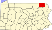 | |
| Townships | ||
| Unincorporated communities | ||
| ||
Authority control | |
|---|---|
| General | |
| National libraries | |
| Other | |
- Boroughs in Susquehanna County, Pennsylvania
- Populated places established in 1794
- Pennsylvania populated places on the Susquehanna River
- 1853 establishments in Pennsylvania