Glendale, Kansas
Glendale, Kansas | |
|---|---|
 Location within Saline County and Kansas | |
 | |
| Coordinates: 38°53′54″N 97°52′30.1″W / 38.89833°N 97.875028°WCoordinates: 38°53′54″N 97°52′30.1″W / 38.89833°N 97.875028°W | |
| Country | United States |
| State | Kansas |
| County | Saline |
| Elevation | 1,388 ft (423 m) |
| Time zone | UTC-6 (CST) |
| • Summer (DST) | UTC-5 (CDT) |
| ZIP code | 67425 |
| Area code | 785 |
| FIPS code | 20-26450 |
| GNIS ID | 476626 |

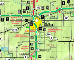
Glendale is an unincorporated community in Glendale Township of Saline County, Kansas, United States.[1] It lies at 38°53′54″N 97°52′30.1″W / 38.89833°N 97.875028°W, or about 15 miles northwest of Salina, along a Kansas and Oklahoma Railroad line.[1]
Demographics[]
As a part of Saline County, Glendale is a part of the Salina micropolitan area.[2]
Education[]
The community is served by Twin Valley USD 240 public school district.
References[]
- ^ a b Saline County Planning Department. "Web mapping application". Saline County planning map. Archived from the original on February 13, 2010. Retrieved 2010-04-06.
- ^ Nussle, Jim (2008-11-20). "Micropolitan Statistical Areas" (PDF). List 1-9. Office of Management and Budget, Executive Office of the President. p. 97. Retrieved 2010-04-02.
Further reading[]
External links[]
Municipalities and communities of Saline County, Kansas, United States | ||
|---|---|---|
| Cities |  | |
| Unincorporated communities | ||
| Townships | ||
| Footnotes | †This populated place is designated a Census-Designated Place (CDP) by the United States Census Bureau. ‡This populated place also has portions in an adjacent county or counties. | |
| ||
Categories:
- Unincorporated communities in Saline County, Kansas
- Salina, Kansas micropolitan area
- Unincorporated communities in Kansas