Hedville, Kansas
Hedville, Kansas | |
|---|---|
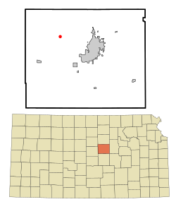 Location within Saline County and Kansas | |
 | |
| Coordinates: 38°51′46″N 97°45′41″W / 38.86278°N 97.76139°WCoordinates: 38°51′46″N 97°45′41″W / 38.86278°N 97.76139°W | |
| Country | United States |
| State | Kansas |
| County | Saline |
| Elevation | 1,273 ft (388 m) |
| Time zone | UTC-6 (CST) |
| • Summer (DST) | UTC-5 (CDT) |
| ZIP code | 67401 |
| Area code | 785 |
| FIPS code | 20-31250 |
| GNIS ID | 476784 |

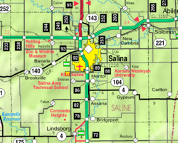
Hedville is an unincorporated community in Ohio Township, Saline County, Kansas, United States. It lies along Hedville Road and a Kansas and Oklahoma Railroad line, 1.0 mile (1.6 km) south of Interstate 70, northwest of Salina.
Geography[]
Mulberry Creek flows through the community.[1] Its elevation is 1,270 feet (387 m), and it is located at 38°51′46″N 97°45′41″W / 38.86278°N 97.76139°W (38.8627816, -97.7614282).[2]
Demographics[]
As a part of Saline County, Hedville is a part of the Salina micropolitan area.[3]
Education[]
The community is served by Ell-Saline USD 307 public school district.
References[]
- ^ DeLorme. Kansas Atlas & Gazetteer. 4th ed. Yarmouth: DeLorme, 2009, 48. ISBN 0-89933-342-7.
- ^ U.S. Geological Survey Geographic Names Information System: Hedville, Kansas
- ^ Update of Statistical Area Definitions and Guidance on Their Uses Archived 2008-11-17 at the Wayback Machine, Office of Management and Budget, 2007-11-20. Accessed 2008-08-14.
Further reading[]
External links[]
Municipalities and communities of Saline County, Kansas, United States | ||
|---|---|---|
| Cities |  | |
| Unincorporated communities | ||
| Townships | ||
| Footnotes | †This community is designated a Census-Designated Place (CDP) by the United States Census Bureau. ‡This community also has portions in an adjacent county or counties. | |
| ||
Categories:
- Unincorporated communities in Saline County, Kansas
- Unincorporated communities in Kansas