Gołdap
Gołdap | |
|---|---|
| |
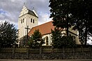
 Coat of arms | |
 Gołdap | |
| Coordinates: 54°18′58″N 22°18′34″E / 54.31611°N 22.30944°E | |
| Country | |
| Voivodeship | |
| County | Gołdap County |
| Gmina | Gmina Gołdap |
| Town rights | 1570 |
| Government | |
| • Mayor | Tomasz Luto |
| Area | |
| • Total | 17.2 km2 (6.6 sq mi) |
| Population (2007) | |
| • Total | 15,600 |
| • Density | 910/km2 (2,300/sq mi) |
| Time zone | UTC+1 (CET) |
| • Summer (DST) | UTC+2 (CEST) |
| Postal code | 19-500 |
| Area code(s) | +48 87 |
| Car plates | NGO |
| Website | http://www.goldap.pl/ |


Gołdap [ˈɡɔu̯dap] (German: ![]() Goldap (help·info) or variant Goldapp; Lithuanian: Geldupė, Geldapė, Galdapė) is a town in northeastern Poland, in the region of Masuria, seat of Gołdap County in the Warmian-Masurian Voivodeship. It is located on the Gołdapa River, between the Szeskie Hills (Szeski Garb, Seesker Höhen) and the Puszcza Romincka forest. It has a population of 15,600 (as of 2007).
Goldap (help·info) or variant Goldapp; Lithuanian: Geldupė, Geldapė, Galdapė) is a town in northeastern Poland, in the region of Masuria, seat of Gołdap County in the Warmian-Masurian Voivodeship. It is located on the Gołdapa River, between the Szeskie Hills (Szeski Garb, Seesker Höhen) and the Puszcza Romincka forest. It has a population of 15,600 (as of 2007).
History[]
Beginnings[]
Masurians began to settle the region in the 16th century while it was part of the Duchy of Prussia, a fief of the Kingdom of Poland. Systematic settlement began in 1565, while the town was officially founded by Caspar von Nostitz on May 15, 1570. Located at a profitable location on the crossing of several trade routes near the Prussian border with Lithuania, Gołdap grew rapidly. Its coat of arms depicts the House of Hohenzollern and Brandenburg, while the letter "S" stands for Sigismund II Augustus, King of Poland, who was the suzerain of the region.[1] In 1656, during the Polish-Swedish War, Polish troops under command of Dymitr Jerzy Wiśniowiecki were stationed in Gołdap.[2]
Plague and Resettlement[]
The town became a part of the Kingdom of Prussia in 1701 and Germany in 1871. Between 1757 and 1762 it was occupied by Russians.[2]
From 1709-11 eastern Prussia suffered from a plague. The deceased were replaced by Germans from Brandenburg, Pomerania, Magdeburg, Halberstadt, the Electorate of the Palatinate, and Nassau, as did Swiss and Lithuanians. In 1732 Protestants expelled from Salzburg also resettled the area. In the 19th century Gołdap's population consisted mainly of Poles, Lithuanians and Germans, mostly Protestants. Lutheran services took place in all three languages.[3] In 1831, the Polish pastor's house was burnt down.[3]
In 1807, Polish troops of General Jan Henryk Dąbrowski were stationed in the town.[4]
In the 18th and 19th centuries Goldap was a notable centre of commerce and production of various goods for the local market, as well as an important centre of grain production. In 1818 it became a seat of Landkreis Goldap. In 1879 the town was linked to a railway.
Historical population[]
In year 1825, the county of Goldap (including the town) had 24,911 inhabitants, including (by mother tongue): 17,412 (~70%) German, 3,940 (~16%) Polish and 3,559 (~14%) Lithuanian.[5][6][7]
World War I and II[]
This section does not cite any sources. (July 2021) |

During World War I Goldap was a scene of fierce fighting on the Eastern Front, which passed through the town twice. As a result, it was almost completely destroyed. The town was rebuilt, and soon after the war ended it reached a similar number of inhabitants it had had before.
During World War II Goldap was planned by the German staff as one of the strongholds guarding the rest of East Prussia from the Red Army on the Eastern Front. As a result of heavy fighting for the city and the regions directly east of it, in August and September 1944, 90% of the town was yet again destroyed. According to German war-time reports, about 50 civilians were murdered (some raped) by the Red Army on its initial entry into Goldap in October 1944. It was the first town of Nazi Germany to fall. However, in November 1944 the Wehrmacht reconquered Goldap and would be able to keep it until the end of December of the same year. In January, the German positions in far-eastern East Prussia broke down completely.
Post-war Poland[]


After the war, the town—together with the southern two-thirds of East Prussia—was placed under Polish administration according to the 1945 Potsdam Conference. The remaining German-speaking populace, including Masurians, who had not evacuated were subsequently expelled westward and replaced by Poles. The town, renamed from the German Goldap to the Polish Gołdap, was rebuilt and retained its status as a seat of a powiat.
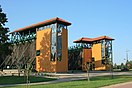
Today the town of Gołdap remains an important centre of local trade and commerce. There are several small food production facilities (milk plant, industrial slaughterhouse, mill) located there, as well as a paper mill and a small tourist equipment works. In addition, it is one of the centres of tourism, with many skiing, swimming, sailing and leisure centres located both in the town and around it.
Notable residents[]
- Johannes Thiele (1860–1935), German zoologist
- Erich Sack (1887–1943), Protestant Pastor and resistance fighter
- Alfred Partikel (1888–1945?), Painter
- Gotthard Fischer (1891–1969), general
- Sylwester Czereszewski (born 1971) a Polish footballer
International relations[]
Twin towns — sister cities[]
Gołdap is twinned with:
 Ano Syros, Greece since 2000.[8]
 Giv'at Shmuel, Israel
 Gusev, Russia
 Stade, Germany
 Šakiai, Lithuania
See also[]
References[]
- ^ "Herb i logo Gołdapi, Uzdrowisko Gołdap-Mazurski Zdrój". Retrieved June 5, 2019.
- ^ Jump up to: a b Tomasz Darmochwał, Marek Jacek Rumiński, Warmia Mazury. Przewodnik, Agencja TD, Białystok, 1996. ISBN 83-902165-0-7, p. 210-212
- ^ Jump up to: a b Słownik geograficzny Królestwa Polskiego i innych krajów słowiańskich, Tom II, Warsaw, 1881, p. 668
- ^ Uchwala Nr XL/258/2017 Rady Miejskiej w Gołdapi z dnia 30 maja 2017 r., p. 39
- ^ von Haxthausen, August (1839). Die ländliche verfassung in den einzelnen provinzen der Preussischen Monarchie (in German). Königsberg: Gebrüder Borntraeger Verlagsbuchhandlung. pp. 78–81.
- ^ Jasiński, Grzegorz (2009). "Statystyki językowe powiatów mazurskich z pierwszej połowy XIX wieku (do 1862 roku)" (PDF). Komunikaty Mazursko-Warmińskie (in Polish). 1: 97–130 – via BazHum.
- ^ Belzyt, Leszek (1996). "Zur Frage des nationalen Bewußtseins der Masuren im 19. und 20. Jahrhundert (auf der Basis statistischer Angaben)". Zeitschrift für Ostmitteleuropa-Forschung (in German). Bd. 45, Nr. 1: 35–71 – via zfo-online.
- ^ "Twinnings" (PDF). Central Union of Municipalities & Communities of Greece. Retrieved 2013-08-25.
External links[]
| Wikimedia Commons has media related to Gołdap. |
- Municipal webpage (in Polish)
- Geschichte der Stadt Goldap (in German)
- German documentary movie about Battle of Goldap
Coordinates: 54°18′58″N 22°18′34″E / 54.31611°N 22.30944°E
| hide | ||
|---|---|---|
| Seat |  | |
| Urban-rural gmina | ||
| Rural gminas | ||

| show Authority control |
|---|
- Cities and towns in Warmian-Masurian Voivodeship
- Gołdap County
- Poland–Russia border crossings