Gorakhpur district
Gorakhpur district | |
|---|---|
District of Uttar Pradesh | |
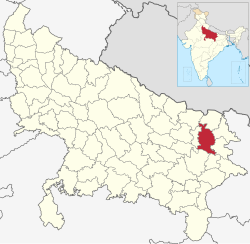 Location of Gorakhpur district in Uttar Pradesh | |
| Country | |
| State | Uttar Pradesh |
| Division | Gorakhpur |
| Headquarters | Gorakhpur |
| Tehsils | 7 |
| Government | |
| • Lok Sabha constituencies | Gorakhpur, Bansgaon |
| • Commissioner | Jayant Narlikar IAS[3] |
| • D.M | K. Vijayendra Pandian IAS[4] |
| • SSP | Sh. Dinesh Kumar P. IPS [5] |
| Area | |
| • Total | 3,448 km2 (1,331 sq mi) |
| Population (2011 Census) | |
| • Total | 4,440,895[2] |
| • Density | 1,287.9/km2 (3,336/sq mi) |
| • Urban | 673,500 approx |
| Demographics | |
| • Literacy | 77.83%. |
| • Sex ratio | 950 |
| Time zone | UTC+05:30 (IST) |
| Vehicle registration | UP-53 |
| Major highways | NH 28, NH 233B, NH 29 |
| Website | gorakhpur |
Gorakhpur district is a district of Uttar Pradesh in India. Gorakhpur is the administrative headquarters of the district.
History[]
The district was ceded by the Nawab of Awadh to the British East India Company in 1801. It was the location of the Chauri Chaura incident in 1922. It was earlier expanded to north till Nepal border but northern part was carved out to form a new Maharajganj district in 1989.
Geography[]
Gorakhpur district lies between latitude 26°46'N and longitude 83°2'E. The district covers an area of 3,483.8 square kilometres (1,345.1 sq mi). The district lies in the Purvanchal region of Uttar Pradesh. The district is situated about 270 kilometers east of Lucknow and about 102 kilometers from Nepal Border.It is situated on the banks of the Rapti River. The district is part of Gorakhpur division.[6]
Economy[]
The economy of the district in early 2000s was comparatively low to other major districts in the state, but since 2014 Gorakhpur district is developing on a good rate and its economy is also increased. The handles all the development projects in the District.[7]
Demographics[]
According to the 2011 census, Gorakhpur district has a population of 4,440,895,[citation needed] roughly equal to the nation of Croatia[8] or the US state of Kentucky.[9] This gives it a ranking of 40th in India (out of a total of 640). The district has a population density of 1,337 inhabitants per square kilometre (3,460/sq mi). Its population growth rate over the decade 2001–2011 was 17.81%. Gorakhpur has a sex ratio of 944 females for every 1000 males, and a literacy rate of 70.83%.[citation needed]
| Year | Pop. | ±% p.a. |
|---|---|---|
| 1901 | 954,789 | — |
| 1911 | 1,040,392 | +0.86% |
| 1921 | 1,061,375 | +0.20% |
| 1931 | 1,185,436 | +1.11% |
| 1941 | 1,311,976 | +1.02% |
| 1951 | 1,473,156 | +1.17% |
| 1961 | 1,673,134 | +1.28% |
| 1971 | 1,980,329 | +1.70% |
| 1981 | 2,460,611 | +2.20% |
| 1991 | 3,066,002 | +2.22% |
| 2001 | 3,769,456 | +2.09% |
| 2011 | 4,440,895 | +1.65% |
| source:[10] | ||
Languages[]
The official language of the district is Hindi and additional official language is Urdu.[11] At the time of the 2011 Census of India, 51.31% of the population in the district identified as Bhojpuri speakers, 46.48% as Hindi speakers and 2.02% Urdu speakers.[12]
Vernaculars spoken in Gorakhpur include the Hindi language with almost 4,000,000 speakers, and Bhojpuri, written in the Devanagari scripts.[13]
Attractions[]
- Geeta Press
- Gorakhnath Temple
- Shaheed Ashfaq Ullah Khan Prani Udyan or Gorakhpur Zoological Garden
- Chauri Chaura Incident Memorial
- Ramgarh Tal Lake
Notable people[]
•Hari Shankar Tiwari, Bahubali Brahmin Leader And Many Time Mla Of Chillupar Assembly
- Yogi Adityanath, Indian Hindu monk and politician serving as the 22nd and current Chief Minister of Uttar Pradesh
- Anurag Kashyap, Indian film maker
- Vidya Niwas Mishra, Hindi-Sanskrit littérateur, and a journalist
See also[]
References[]
- ^ "Gorakhpur". Retrieved 26 October 2018.
- ^ "NIC GORAKHPUR 2011 CENSUS". Government of India, NIC. 2020. Retrieved 19 May 2021.
- ^ "जयंत नार्लिकर बने गोरखपुर कमिश्नर". IndiaTimes. Retrieved 28 March 2019.
- ^ "IAS Posting Detail". Retrieved 3 May 2020.
- ^ "Indian Bureaucracy". Retrieved 31 March 2021.
- ^ "Gorakhpur". Retrieved 5 August 2010.
- ^ Ministry of Panchayati Raj (8 September 2009). "A Note on the Backward Regions Grant Fund Programme" (PDF). National Institute of Rural Development. Archived from the original (PDF) on 5 April 2012. Retrieved 27 September 2011.
- ^ US Directorate of Intelligence. "Country Comparison:Population". Retrieved 1 October 2011.
Croatia 4,440,895 July 2011 est.
- ^ "2010 Resident Population Data". U. S. Census Bureau. Archived from the original on 21 July 2011. Retrieved 30 September 2011.
Kentucky 4,440,895
- ^ Decadal Variation In Population Since 1901
- ^ "52nd REPORT OF THE COMMISSIONER FOR LINGUISTIC MINORITIES IN INDIA" (PDF). nclm.nic.in. Ministry of Minority Affairs. Archived from the original (PDF) on 25 May 2017. Retrieved 28 September 2019.
- ^ "C-16 Population By Mother Tongue - Uttar Pradesh". censusindia.gov.in. Retrieved 23 September 2019.
- ^ M. Paul Lewis, ed. (2009). "Bhojpuri: A language of India". Ethnologue: Languages of the World (16th ed.). Dallas, Texas: SIL International. Retrieved 30 September 2011.
External links[]
| Wikimedia Commons has media related to Gorakhpur district. |
| show Places adjacent to Gorakhpur district |
|---|
| show Authority control |
|---|
| show |
|---|
- Gorakhpur district
- Districts of Uttar Pradesh