Faizabad district
A request that this article title be changed to is under discussion. Please do not move this article until the discussion is closed. |
Faizabad district | |
|---|---|
District of Uttar Pradesh | |
| Ayodhya district | |
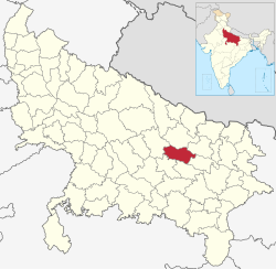 Location of Faizabad district in Uttar Pradesh | |
| Country | India |
| State | Uttar Pradesh |
| Division | Faizabad |
| Headquarters | Ayodhya |
| Tehsils | 5 |
| Government | |
| • Lok Sabha constituencies |
|
| • Vidhan Sabha constituencies | |
| Area | |
| • Total | 2,522 km2 (974 sq mi) |
| Population | |
| • Total | 2,470,996 |
| • Density | 980/km2 (2,500/sq mi) |
| • Urban | 689,354 |
| Demographics | |
| • Literacy | 69.57% |
| • Sex ratio | 961 |
| Time zone | UTC+05:30 (IST) |
| Major highways | NH 27, NH 330, National Highway 330A (India), SH 30 |
| Website | http://ayodhya.nic.in |
Faizabad district, officially Ayodhya district, is one of the 75 districts of Indian state of Uttar Pradesh. The city of Ayodhya, which is also notable for being the birth place of Hindu deity Rama, is the administrative headquarters of the district.[1][3] The official name of the district was changed from Faizabad to Ayodhya in November 2018 under Uttar Pradesh chief minister Yogi Adityanath.[4] The district occupies an area of 2,522 square kilometres (974 sq mi),[1] and had a population of 2,470,996 in the 2011 census.[1][2]
Demographics
Faizabad district: mother-tongue of population, according to the 2011 Census.[5]
According to the 2011 Indian census, the district had a population of 2,470,996, of which males were 1,259,628 and females were 1,211,368. Population in the age group of 0–6 years was 360,082. This gave it a ranking of 178th in India (out of a total of 640). The district had a population density of 1,054 inhabitants per square kilometre (2,730/sq mi). Its population growth rate over the decade 2001-2011 was 18.16%. The district had a sex ratio of 961 females for every 1000 males. The total number of literates in the district were 1,450,901, which constitutes 58.7% of the population. The effective literacy rate of 7+ population was 70.63%.[2]
At the time of the 2011 Census of India, 96.62% of the population in the district spoke Hindi (or languages considered to be the dialects of Hindi like Awadhi, Banjari, Bhojpuri, Chhattisgarhi, or Garhwali) and 3.14% Urdu as their first language.[5]
| hideFaizabad district: mother-tongue of population, according to the 2011 Census.[5] | |||
|---|---|---|---|
| Mother tongue code | Mother tongue | People | Percentage |
| 002007 | Bengali | 584 | 0.02% |
| 004001 | Dogri | 831 | 0.03% |
| 006030 | Awadhi | 333,602 | 13.50% |
| 006066 | Banjari | 302 | 0.01% |
| 006102 | Bhojpuri | 804 | 0.03% |
| 006142 | Chhattisgarhi | 788 | 0.03% |
| 006195 | Garhwali | 135 | 0.01% |
| 006240 | Hindi | 2,050,978 | 83.00% |
| 011016 | Malayalam | 182 | 0.01% |
| 015043 | Odia | 557 | 0.02% |
| 016038 | Punjabi | 763 | 0.03% |
| 019014 | Sindhi | 2,432 | 0.10% |
| 022015 | Urdu | 77,484 | 3.14% |
| – | Others | 1,554 | 0.06% |
| Total | 2,470,996 | 100.00% | |
| Year | Pop. | ±% p.a. |
|---|---|---|
| 1901 | 739,402 | — |
| 1911 | 693,018 | −0.65% |
| 1921 | 694,764 | +0.03% |
| 1931 | 714,938 | +0.29% |
| 1941 | 782,639 | +0.91% |
| 1951 | 873,686 | +1.11% |
| 1961 | 960,818 | +0.96% |
| 1971 | 1,107,515 | +1.43% |
| 1981 | 1,361,862 | +2.09% |
| 1991 | 1,684,747 | +2.15% |
| 2001 | 2,088,928 | +2.17% |
| 2011 | 2,470,996 | +1.69% |
| source:[6] | ||
Education
In 1975, Avadh University, later renamed the Dr. Ram Manohar Lohia Avadh University, was established in Faizabad city.
References
- ^ Jump up to: a b c d e "About district". District Ayodhya, Government of Uttar Pradesh. Retrieved 27 July 2021.
- ^ Jump up to: a b c "Census of India: Search Details – Faizabad District". www.censusindia.gov.in. Retrieved 6 November 2019.
- ^ Tully, Mark (2017), India in Slow Motion, Penguin Random House India Private Limited, pp. 18–, ISBN 978-93-5118-097-5
- ^ "Faizabad district to be renamed as Ayodhya, says UP CM Yogi Adityanath". The Financial Express. 6 November 2018. Retrieved 9 November 2019.
- ^ Jump up to: a b c C-16 Population By Mother Tongue – Uttar Pradesh (Report). Office of the Registrar General & Census Commissioner, India. Retrieved 15 July 2020.
- ^ "Census of India Website : Office of the Registrar General & Census Commissioner, India". www.censusindia.gov.in. Retrieved 7 January 2020.
External links
| Wikimedia Commons has media related to Ayodhya district. |
| Look up Faizabad in Wiktionary, the free dictionary. |
| show Places adjacent to Faizabad district |
|---|
Coordinates: 26°47′N 82°08′E / 26.783°N 82.133°E

| show Authority control |
|---|
| show |
|---|
- Faizabad district
- Districts of Uttar Pradesh
- Faizabad division