Gosnell, Arkansas
Gosnell, Arkansas | |
|---|---|
| Motto(s): Moving Forward, Moving Strong | |
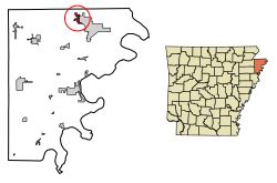 Location of Gosnell in Mississippi County, Arkansas. | |
| Coordinates: 35°57′48″N 89°58′2″W / 35.96333°N 89.96722°WCoordinates: 35°57′48″N 89°58′2″W / 35.96333°N 89.96722°W | |
| Country | United States |
| State | Arkansas |
| County | Mississippi |
| Government | |
| • Mayor | Teresa Walker |
| Area | |
| • Total | 1.67 sq mi (4.32 km2) |
| • Land | 1.67 sq mi (4.32 km2) |
| • Water | 0.00 sq mi (0.00 km2) |
| Elevation | 249 ft (76 m) |
| Population (2010) | |
| • Total | 3,548 |
| • Estimate (2019)[1] | 3,116 |
| • Density | 1,866.99/sq mi (720.71/km2) |
| Time zone | UTC-6 (Central (CST)) |
| • Summer (DST) | UTC-5 (CDT) |
| ZIP codes | 72315, 72319 |
| Area code(s) | 870 |
| FIPS code | 05-27700 |
| GNIS feature ID | 0077044 |
| Website | cityofgosnell |

Gosnell is a city in Mississippi County, Arkansas, United States. The population was 3,548 at the 2010 census.
Geography[]
Gosnell is located in the Arkansas Delta at 35°57′48″N 89°58′2″W / 35.96333°N 89.96722°W (35.963308, -89.967224).[3] According to the United States Census Bureau, the city has a total area of 1.7 square miles (4.4 km2), all land.
Ecologically, Gosnell is located within the St. Francis Lowlands ecoregion near its border with the ecoregion; both subregions of the larger Mississippi Alluvial Plain . The St. Francis Lowlands are a flat region mostly covered with row crop agriculture today, though also containing sand blows and sunken lands remaining from the 1811–12 New Madrid earthquakes. Waterways have mostly been channelized, causing loss of aquatic and riparian wildlife habitat.[4] The Big Lake National Wildlife Refuge, which preserves some of the bottomland hardwood forest typical of this ecoregion prior to development for row agriculture lies just west of Gosnell.
History[]
The Gosnell region was surrounded by water in its early days. It is bordered on the west by Big Lake, which in the days before the automobile and railroads was used as a boat transportation route linking the settlement to the larger cities of Arkansas, Missouri, and Tennessee. Landowners along Big Lake took advantage of a thriving commercial hunting and fishing business. Pelts and packed fish could be shipped to market along the lake or by the two bayous to the Mississippi River.
To the east of the settlement is the Pemiscot Bayou. The road from Blytheville passed the Indian mound and store before traveling across the Pemiscot Bayou. Families with land along the Pemiscot traveled in boats into the Lumerate Bayou, which ran through Blytheville's business district. The road to Gosnell came to be called the Pole Road. When stretches of the road became bad, the community would turn out to cut logs to place across the mud of the road, making it passable again.
Because the land was sparsely settled, it was of little concern to either side during the Civil War. All of Mississippi County had fewer than 4,000 residents at this time. Men from the area joined Confederate units from other parts of Arkansas. Aside from a few Union raids from Missouri, the county did not suffer much from the war.
Much of the land between Blytheville and Big Lake was purchased in the late 1800s by Lemael Gosnell, a dentist and pioneer farmer. In time, the community came to be named for him.
Gosnell was incorporated as a first-class city on March 12, 1968. Gosnell's first mayor after incorporation was Andy Bevill. Since then, Gosnell has had only four mayors: Carl Ledbetter, Dick Reams, Don Marhsall and currently Teresa Walker.[5]
Historical sites[]
Leaving Blytheville on Chickasawba Avenue, one reaches Gosnell Road. Upon traveling 1.3 miles one comes to the place of the famous Chickasawba Indian Mound 25 feet high and base circumference approximately 130 feet. This mound must have been either a Signal or a Temple Mound as no pottery or skeleton bones have been found here.[6]
Demographics[]
| Historical population | |||
|---|---|---|---|
| Census | Pop. | %± | |
| 1970 | 1,386 | — | |
| 1980 | 3,215 | 132.0% | |
| 1990 | 3,783 | 17.7% | |
| 2000 | 3,968 | 4.9% | |
| 2010 | 3,548 | −10.6% | |
| 2019 (est.) | 3,116 | [1] | −12.2% |
| U.S. Decennial Census[7] 2014 Estimate[8] | |||
2010 census[]
As of the census[9] of 2010, there were 3,548 people, 1,387 households, and 951 families residing in the city. The racial makeup of the city was 72.9% White, 22.0% Black or African American, 0.4% Native American, 1.0% Asian, 1.6% from other races, and 2.1% from two or more races. Hispanic or Latino of any race were 3.5% of the population.
There were 1,238 households, out of which 48.1% had children under the age of 18 living with them, 45.9% were married couples living together, 23.2% had a female householder with no husband present, 7.8% had a male householder with no wife present, and 23.2% were non-families. 19.2% of all households were made up of individuals, and 4.8% had someone living alone who was 65 years of age or older. The average household size was 2.87 and the average family size was 3.26.
The median income for a household in the city was $43,722, and the median income for a family was $46,389. The per capita income for the city was $15,917.
2000 census[]
As of the census[9] of 2000, there were 3,968 people, 1,369 households, and 1,074 families residing in the city. The population density was 2,367.1 people per square mile (911.9/km2). There were 1,578 housing units at an average density of 941.3 per square mile (362.7/km2). The racial makeup of the city was 80.12% White, 15.15% Black or African American, 0.43% Native American, 1.01% Asian, 1.86% from other races, and 1.44% from two or more races. Hispanic or Latino of any race were 3.45% of the population.
There were 1,369 households, out of which 48.3% had children under the age of 18 living with them, 54.9% were married couples living together, 18.4% had a female householder with no husband present, and 21.5% were non-families. 17.5% of all households were made up of individuals, and 4.1% had someone living alone who was 65 years of age or older. The average household size was 2.90 and the average family size was 3.29.
In the city, the population was spread out, with 34.9% under the age of 18, 10.8% from 18 to 24, 32.0% from 25 to 44, 17.5% from 45 to 64, and 4.8% who were 65 years of age or older. The median age was 28 years. For every 100 females, there were 96.7 males. For every 100 females age 18 and over, there were 92.1 males.
The median income for a household in the city was $31,423, and the median income for a family was $37,176. Males had a median income of $30,995 versus $17,625 for females. The per capita income for the city was $13,371. About 15.5% of families and 17.1% of the population were below the poverty line, including 16.5% of those under age 18 and 31.4% of those age 65 or over.
Economy[]
Gosnell used to depend on the nearby Blytheville/Eaker Air Force Base but since its closing in the early 1990s, the city has lost many of its inhabitants.[10] The city is home to the Gosnell School District, which as of 2011 has an enrollment of 1438 K-12.[11]
Annual cultural events[]
Gosnell's Annual Cotton Festival in October.[12]
Education[]
Public education is available to elementary and secondary school students at Gosnell School District, which leads to graduation from Gosnell High School. The district and high school mascot and athletic emblem is the Pirate with the spirit colors of blue and gold.
Government[]
Mayor - Teresa Walker Position 1 - James Haynes
Position 2 - Richard Brown
Ward 2 -
Position 1 - Jason Taylor
Position 2 - Josh Trapp
Ward 3 -
Position 1 - Kurtis Payne
Position 2 - Steve Nelson
State and federal representation[]
Arkansas's 1st congressional district - United States Congressman Rick Crawford
United States Senator - Mark Pryor
The United States Postal Service operates one post office in Gosnell.
see also Politics and government of Arkansas
Climate[]
Gosnell has a humid subtropical climate (Köppen climate classification Cfa).
Totals and averages[13]
| hideClimate data for Gosnell, Arkansas | |||||||||||||
|---|---|---|---|---|---|---|---|---|---|---|---|---|---|
| Month | Jan | Feb | Mar | Apr | May | Jun | Jul | Aug | Sep | Oct | Nov | Dec | Year |
| Average high °F (°C) | 45 (7) |
50 (10) |
59 (15) |
70 (21) |
79 (26) |
88 (31) |
90 (32) |
90 (32) |
83 (28) |
72 (22) |
60 (16) |
48 (9) |
70 (21) |
| Average low °F (°C) | 29 (−2) |
33 (1) |
41 (5) |
51 (11) |
61 (16) |
69 (21) |
72 (22) |
71 (22) |
63 (17) |
51 (11) |
42 (6) |
32 (0) |
51 (11) |
| Average precipitation inches (mm) | 3.67 (93) |
4.31 (109) |
4.54 (115) |
4.91 (125) |
5.23 (133) |
3.90 (99) |
4.02 (102) |
2.61 (66) |
2.88 (73) |
4.08 (104) |
4.70 (119) |
5.07 (129) |
49.92 (1,268) |
| Source: [14] | |||||||||||||
Other information[]
Tornado activity[]
Gosnell area historical tornado activity is slightly above the Arkansas state average and is 220% greater than the overall U.S. average. On May 15, 1968, an F4 (maximum wind speeds 207-260 mph) tornado 5.6 miles away from the Gosnell city center killed 35 people and injured 364 people and caused between $5,000 and $50,000 in damages.
On April 16, 1998, an F4 tornado 10.1 miles away from the city center killed two people and injured twelve and caused $350,000 in damages.
Earthquake activity[]
Gosnell-area historical earthquake activity is significantly above Arkansas state average. It is 91% greater than the overall U.S. average.
On 3/25/1976 at 00:41:20, a magnitude 5.0 (4.9 MB, 5.0 LG, Class: Moderate, Intensity: VI - VII) earthquake occurred 30.3 miles away from the city center On 5/4/1991 at 01:18:54, a magnitude 5.0 (4.4 MB, 4.6 LG, 5.0 LG, Depth: 3.1 mi) earthquake occurred 42.3 miles away from Gosnell center On 4/27/1989 at 16:47:49, a magnitude 4.7 (4.6 MB, 4.7 LG, 4.3 LG, Class: Light, Intensity: IV - V) earthquake occurred 11.5 miles away from the city center On 9/26/1990 at 13:18:51, a magnitude 5.0 (4.7 MB, 4.8 LG, 5.0 LG, Depth: 7.7 mi) earthquake occurred 86.6 miles away from the city center On 3/25/1976 at 01:00:11, a magnitude 4.5 (4.1 MB, 4.5 LG) earthquake occurred 37.7 miles away from Gosnell center On 11/29/1996 at 05:41:33, a magnitude 4.3 (4.3 LG, 4.1 LG, Depth: 12.6 mi) earthquake occurred 3.8 miles away from the city center Magnitude types: regional Lg-wave magnitude (LG), body-wave magnitude (MB)
Natural disasters[]
The number of natural disasters in Mississippi County (11) is near the US average (12). Major Disasters (Presidential) Declared: 7 Emergencies Declared: 4
Causes of natural disasters: Storms: 6, Floods: 5, Tornadoes: 4, Winter Storms: 4, Hurricane: 1 (Note: Some incidents may be assigned to more than one category).
See also[]
- Gosnell (disambiguation)
References[]
- ^ Jump up to: a b "Population and Housing Unit Estimates". United States Census Bureau. May 24, 2020. Retrieved May 27, 2020.
- ^ "2019 U.S. Gazetteer Files". United States Census Bureau. Retrieved June 30, 2020.
- ^ "US Gazetteer files: 2010, 2000, and 1990". United States Census Bureau. 2011-02-12. Retrieved 2011-04-23.
- ^
 This article incorporates public domain material from the United States Geological Survey document: Woods, A.J., Foti, T.L., Chapman, S.S., Omernik, J.M.; et al. "Ecoregions of Arkansas" (PDF).CS1 maint: multiple names: authors list (link) (color poster with map, descriptive text, summary tables, and photographs)
- ^ http://www.encyclopediaofarkansas.net/encyclopedia/entry-detail.aspx?entryid=936
- ^ http://www.mcagov.com/history/gosnell
- ^ "Census of Population and Housing". Census.gov. Retrieved June 4, 2015.
- ^ "Annual Estimates of the Resident Population for Incorporated Places: April 1, 2010 to July 1, 2014". Archived from the original on May 22, 2015. Retrieved June 4, 2015.
- ^ Jump up to: a b "U.S. Census website". United States Census Bureau. Retrieved 2008-01-31.
- ^ Schulte, Bret. “A Rough Road Once the Pentagon Pulls the Plug.” U.S. News and World Report. May 23, 2005, p. 30.
- ^ http://nces.ed.gov/ccd/districtsearch/district_detail.asp?Search=2&ID2=0500029
- ^ http://www.couriernews.net/story/1770347.html
- ^ http://www.usclimatedata.com/climate.php?location=USAR0063
- ^ http://www.weather.com/weather/wxclimatology/monthly/graph/72319
- ^ http://www.city-data.com/city/Gosnell-Arkansas.html#ixzz2TDtHsIG2
External links[]
| show Municipalities and communities of Mississippi County, Arkansas, United States |
|---|

| show Authority control |
|---|
- Cities in Arkansas
- Cities in Mississippi County, Arkansas