Gransee
Gransee | |
|---|---|
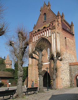 City gate | |
 Coat of arms | |
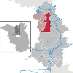
show Location of Gransee within Oberhavel district | |
 Gransee | |
| Coordinates: 53°00′25″N 13°09′31″E / 53.00694°N 13.15861°ECoordinates: 53°00′25″N 13°09′31″E / 53.00694°N 13.15861°E | |
| Country | Germany |
| State | Brandenburg |
| District | Oberhavel |
| Municipal assoc. | Gransee und Gemeinden |
| Subdivisions | 13 districts |
| Government | |
| • Mayor (2019–24) | Mario Gruschinske[1] (SPD) |
| Area | |
| • Total | 121.15 km2 (46.78 sq mi) |
| Elevation | 55 m (180 ft) |
| Population (2020-12-31)[2] | |
| • Total | 5,849 |
| • Density | 48/km2 (130/sq mi) |
| Time zone | UTC+01:00 (CET) |
| • Summer (DST) | UTC+02:00 (CEST) |
| Postal codes | 16775 |
| Dialling codes | 03306 |
| Vehicle registration | OHV |
| Website | www.gransee.de |


Gransee is a town in the Oberhavel district, in Brandenburg, Germany. It is situated 20 km south of Fürstenberg/Havel, and 55 km northwest of Berlin. An important monument in the centre of town is the cast-iron and stone Memorial to Queen Luise (Luisendenkmal), which was designed by the German architect Karl Friedrich Schinkel in the neo-gothic style.
A sport airfield is situated in the eastern part of the town. It is one of the major drop zones in the vicinity of Berlin.
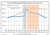
Demography[]
|
|
|
Local council[]
The local council has 19 members:
- Christian Democratic Union: 5 seats
- Social Democratic Party of Germany: 5 seats
- The Left: 3 seats
- Voters association Gransee: 3 seats
- Voters association Citizens for Gransee: 2 seats
- Mayor: 1 seat
Local elections in Brandenburg May 25, 2014
Photogallery[]

Watch tower
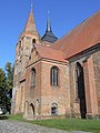
St. Mary's Church in Gransee

Church in Altlüdersdorf

Church in Dannenwalde
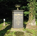
Queen Louise memorial in Seilershof


Meseberg palace
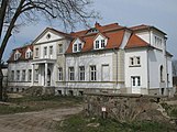
Manor in Wentow

Manor in Dannenwalde


People[]
- Emma Trosse (1863-1949), German teacher and poet
See also[]
- Battle of Gransee (1316)
- Gransee und Gemeinden
References[]
- ^ Landkreis Oberhavel Wahl der Bürgermeisterin / des Bürgermeisters, accessed 2 July 2021.
- ^ "Bevölkerung im Land Brandenburg nach amtsfreien Gemeinden, Ämtern und Gemeinden 31. Dezember 2020". Amt für Statistik Berlin-Brandenburg (in German). June 2021.
- ^ Detailed data sources are to be found in the Wikimedia Commons.Population Projection Brandenburg at Wikimedia Commons
| Wikimedia Commons has media related to Gransee. |
| show Authority control |
|---|
This Brandenburg location article is a stub. You can help Wikipedia by . |
- Municipalities in Brandenburg
- Localities in Oberhavel
- Province of Brandenburg
- Bezirk Potsdam
- Brandenburg geography stubs