Grayson, Georgia
Grayson, Georgia | |
|---|---|
| Motto(s): "Steadfast and True"[1] | |
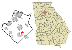 Location in Gwinnett County and the state of Georgia | |
| Coordinates: 33°53′36″N 83°57′20″W / 33.89333°N 83.95556°WCoordinates: 33°53′36″N 83°57′20″W / 33.89333°N 83.95556°W | |
| Country | United States |
| State | Georgia |
| County | Gwinnett |
| Government | |
| • Mayor | Allison Wilkerson |
| Area | |
| • Total | 2.52 sq mi (6.54 km2) |
| • Land | 2.47 sq mi (6.39 km2) |
| • Water | 0.06 sq mi (0.15 km2) |
| Elevation | 1,096 ft (334 m) |
| Population (2010) | |
| • Total | 2,666 |
| • Estimate (2019)[3] | 4,452 |
| • Density | 1,805.35/sq mi (697.02/km2) |
| Time zone | UTC-5 (Eastern (EST)) |
| • Summer (DST) | UTC-4 (EDT) |
| ZIP code | 30017 |
| Area code(s) | 770 |
| FIPS code | 13-34596[4] |
| GNIS feature ID | 0314805[5] |
| Website | www |

Grayson is a city in Gwinnett County, Georgia, United States. The population was 2,666 at the 2010 census,[6] up from 765 in 2000.
Geography[]
Grayson is located southeast of the center of Gwinnett County at 33°53′36″N 83°57′20″W / 33.89333°N 83.95556°W (33.893306, -83.955420).[7] Georgia State Route 20 is the main highway through town, leading north 5 miles (8 km) into Lawrenceville, the county seat, and southeast five miles to Loganville. Georgia State Route 84 (Grayson Parkway) leads southwest five miles to Snellville. According to the United States Census Bureau, the city has a total area of 2.53 square miles (6.55 km2), of which 2.47 square miles (6.40 km2) is land and 0.06 square miles (0.15 km2), or 2.30%, is water.[6]
Grayson suffered a damaging tornado on June 27, 1994, killing a 10-year-old girl. The city has been benefitting from exurban growth in eastern Gwinnett County, especially in the late 1990s and through the 2000s.
Demographics[]
| Historical population | |||
|---|---|---|---|
| Census | Pop. | %± | |
| 1910 | 278 | — | |
| 1920 | 322 | 15.8% | |
| 1930 | 245 | −23.9% | |
| 1940 | 228 | −6.9% | |
| 1950 | 227 | −0.4% | |
| 1960 | 282 | 24.2% | |
| 1970 | 366 | 29.8% | |
| 1980 | 464 | 26.8% | |
| 1990 | 529 | 14.0% | |
| 2000 | 765 | 44.6% | |
| 2010 | 2,666 | 248.5% | |
| 2019 (est.) | 4,452 | [3] | 67.0% |
| U.S. Decennial Census[8] | |||
As of 2010, Grayson had a population of 2,666. The racial and ethnic composition of the population was 62.8% white, 23.8% black or African American, 0.4% Native American, 9.0% Asian, and 4% from other races. 4.8% of the population was Hispanic or Latino of any race.[9]
As of the census[4] of 2000, there were 765 people, 276 households, and 226 families residing in the city. The population density was 435.8 people per square mile (167.8/km2). There were 288 housing units at an average density of 164.1 per square mile (63.2/km2). The racial makeup of the city was 94.77% White, 3.53% African American, 0.39% Asian, 0.65% Pacific Islander, 0.26% from other races, and 0.39% from two or more races. Hispanic or Latino of any race were 0.92% of the population.
There were 276 households, out of which 44.6% had children under the age of 18 living with them, 68.1% were married couples living together, 9.1% had a female householder with no husband present, and 17.8% were non-families. 15.2% of all households were made up of individuals, and 7.6% had someone living alone who was 65 years of age or older. The average household size was 2.77 and the average family size was 3.02.
In the city, the population was spread out, with 29.5% under the age of 18, 4.6% from 18 to 24, 34.0% from 25 to 44, 22.5% from 45 to 64, and 9.4% who were 65 years of age or older. The median age was 35 years. For every 100 females, there were 99.7 males. For every 100 females age 18 and over, there were 91.8 males.
The median income for a household in the city was $51,750, and the median income for a family was $61,618. Males had a median income of $37,500 versus $36,250 for females. The per capita income for the city was $22,695. About 6.3% of families and 8.2% of the population were below the poverty line, including 5.2% of those under age 18 and 13.6% of those age 65 or over.
Government[]
Local government[]
The city government of Grayson consists of a mayor and four council members.
The current mayor and council members are:[10]
- Mayor: Allison Wilkerson
- Council members: Bob Foreman, Gene Ussery, James Gillespie, and Linda Jenkins.
Arts and culture[]
Modeled after Snellville Days in nearby Snellville, Grayson Day Festival, held annually on a Saturday at the end of April, features a parade down Main Street, food vendors, crafts, and live music. The city and local businesses sponsor the event, which takes place mostly in the centrally located Grayson City Park. The football team, marching band, and cheerleaders from Grayson High School, as well as other local organizations, politicians, and groups make the parade a favorite tradition among residents.
History[]
The city of Grayson was first called Trip.[11] In 1901, John Ellery Jacobs, the postmaster and civic leader, wrote to the post office department requesting that Trip, Georgia be changed to Berkley, Georgia. On December 6, 1901, the General Assembly of Georgia approved an act to incorporate the town and change the name. Shortly after, Ellery Jacobs was notified that there was already a Berkley, Georgia. He then suggested Graymount (because there was a clear view of Stone Mountain), but it was also taken. He then suggested the name of Grayson, Georgia.
Education[]
The county operates Gwinnett County Public Schools.
Gwinnett County Public Library operates the Grayson Branch in Grayson.[12]
Notable people[]
- Joyce Chandler - Educator and politician. Member of Georgia House of Representatives. Resident of Grayson.[13]
- Austin Meadows - Baseball player. Grew up in Grayson.
- Nikki Merritt - Politician. Member of the Georgia State Senate.Resident of Grayson.
- Chuck Robbins - Chairman and chief executive officer (CEO) of Cisco Systems. Born in Grayson.[14]
In popular culture[]
- Grayson was featured in Outbreak, authored by Robin Cook, which was published in 1987.[15]
References[]
- ^ "Welcome to the City of Grayson, GA!". City of Grayson. Retrieved November 29, 2016.
- ^ "2019 U.S. Gazetteer Files". United States Census Bureau. Retrieved July 9, 2020.
- ^ Jump up to: a b "Population and Housing Unit Estimates". United States Census Bureau. May 24, 2020. Retrieved May 27, 2020.
- ^ Jump up to: a b "U.S. Census website". United States Census Bureau. Retrieved 2008-01-31.
- ^ "US Board on Geographic Names". United States Geological Survey. 2007-10-25. Retrieved 2008-01-31.
- ^ Jump up to: a b "Geographic Identifiers: 2010 Demographic Profile Data (G001): Grayson city, Georgia". American Factfinder. U.S. Census Bureau. Retrieved November 29, 2016.[dead link]
- ^ "US Gazetteer files: 2010, 2000, and 1990". United States Census Bureau. 2011-02-12. Retrieved 2011-04-23.
- ^ "Census of Population and Housing". Census.gov. Retrieved June 4, 2015.
- ^ 2010 general profile of population and housing characteristics of Grayson from the US Census
- ^ "Mayor / City Council". cityofgrayson.org. Retrieved April 9, 2021.
- ^ Krakow, Kenneth K. (1975). Georgia Place-Names: Their History and Origins (PDF). Macon, GA: Winship Press. p. 97. ISBN 0-915430-00-2.
- ^ "Hours & Locations Archived 2010-07-26 at the Wayback Machine." Gwinnett County Public Library. Retrieved on February 24, 2010.
- ^ "Joyce Chandler's Biography". Vote Smart. Retrieved April 9, 2021.
- ^ "Q&A: Chuck Robbins, CEO of Cisco Systems". mercurynews.com. July 30, 2015. Retrieved April 9, 2021.
- ^ Cook, Robin (11 September 2014). Outbreak. Pan Macmillan. p. 117. ISBN 978-1-4472-4676-3.
External links[]
| hide Municipalities and communities of Gwinnett County, Georgia, United States | ||
|---|---|---|
| Cities |  | |
| Towns | ||
| CDP | ||
| Unincorporated communities |
| |
| Footnotes | ‡This populated place also has portions in an adjacent county or counties | |
| ||
| Authority control |
|
|---|
- Cities in Georgia (U.S. state)
- Cities in Gwinnett County, Georgia
- Cities in the Atlanta metropolitan area
- Populated places established in 1879