Greater Ville, St. Louis
The Greater Ville | |
|---|---|
Neighborhood of St. Louis | |
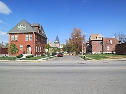 Dick Gregory Place, Greater Ville, October 2012 | |
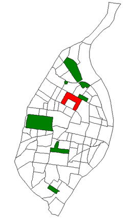 Location (red) of Greater Ville within St. Louis | |
| Country | United States |
| State | Missouri |
| City | St. Louis |
| Wards | 4, 21 |
| Area | |
| • Total | 0.96 sq mi (2.5 km2) |
| Population (2020)[1] | |
| • Total | 4,545 |
| • Density | 4,700/sq mi (1,800/km2) |
| ZIP code(s) | Parts of 63107, 63113, 63115 |
| Area code(s) | 314 |
| Website | stlouis-mo.gov |
The Greater Ville is a neighborhood of St. Louis, Missouri. The area is bounded by Marcus Avenue on the northwest, Natural Bridge Avenue on the northeast, Dr. Martin Luther King Drive and St. Louis Avenue on the south via North Taylor Avenue and Sarah Street, and North Vandeventer Avenue on the southeast. The Greater Ville surrounds The Ville neighborhood.
Demographics[]
In 2020 Greater Ville's racial makeup was 95.2% Black, 1.3% White, 0.2% Native American, 2.5% Two or More Races, and 0.8% Some Other Race. 1.1% of the people were of Hispanic or Latino origin. [2]
In 2010 Greater Ville's racial makeup was 97.4% Black, 0.7% White, 0.2% Native American, 1.4% Two or More Races, and 0.2% Some Other Race. 0.7% of the population was of Hispanic or Latino origin.[3]
References[]
- ^ "2020 Census Neighborhood Results".
- ^ https://www.stlouis-mo.gov/government/departments/planning/research/documents/upload/Total-Population-by-Neighborhood-Census-2020-Redistricting-Release-2.pdf
- ^ "Archived copy". Archived from the original on 2012-05-16. Retrieved 2012-08-16.
{{cite web}}: CS1 maint: archived copy as title (link)
Coordinates: 38°39′52″N 90°14′12″W / 38.6644°N 90.2366°W

This St. Louis location article is a stub. You can help Wikipedia by . |
- Neighborhoods in St. Louis
- St. Louis geography stubs