Mark Twain/I-70 Industrial, St. Louis
Mark Twain/I-70 Industrial | |
|---|---|
Neighborhood of St. Louis | |
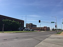 Mark Twain/I-70 Industrial in May 2018. View from Union Boulevard and Brown intersection facing south. | |
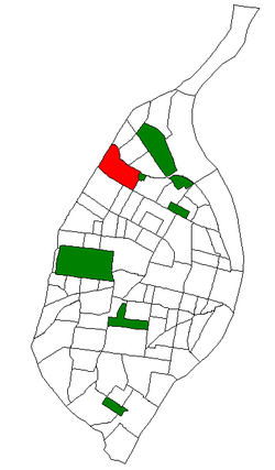 Location (red) of Mark Twain I-70 Industrial within St. Louis | |
| Country | United States |
| State | Missouri |
| City | St. Louis |
| Wards | 22 |
| Area | |
| • Total | 1.21 sq mi (3.1 km2) |
| Population (2020)[1] | |
| • Total | 902 |
| • Density | 750/sq mi (290/km2) |
| ZIP code(s) | Part of 63115, 63120 |
| Area code(s) | 314 |
| Website | stlouis-mo.gov |
Mark Twain/I-70 Industrial is a neighborhood of St. Louis, Missouri. It is bound by I-70 to the north, North Kingshighway to the east, Natural Bridge Road to the south, and the city limit to the west.
Demographics[]

View of Mark Twain/I-70 Industrial as seen from Bircher Boulevard. I-70 is visible as well.
In 2020 Mark Twain/I-70 Industrial's racial makeup was 92.5% Black, 3.7% White, 0.2% Asian, 0.1% American Indian, 3.0% Two or More Races, and 0.6% Some Other Race. 1.3% of the population was of Hispanic or Latino origin.[2]
References[]
- ^ "2020 Census Neighborhood Results".
- ^ "City of St. Louis" (PDF). Retrieved 2021-09-25.
Coordinates: 38°41′13″N 90°15′40″W / 38.687°N 90.261°W

This St. Louis location article is a stub. You can help Wikipedia by . |
Categories:
- Neighborhoods in St. Louis
- St. Louis geography stubs