Guadarrama
This article does not cite any sources. (December 2009) |
Guadarrama
| |
|---|---|
Municipality | |
 Flag  Seal | |
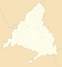
 Guadarrama Location of Guadarrama within Spain | |
| Coordinates: 40°40′22″N 4°05′20″W / 40.67278°N 4.08889°WCoordinates: 40°40′22″N 4°05′20″W / 40.67278°N 4.08889°W | |
| Country | |
| Autonomous Community | |
| Comarca | |
| Municipality | Guadarrama |
| Government | |
| • Mayor | Diosdado Soto Pérez (PP) |
| Area | |
| • Total | 56.98 km2 (22.00 sq mi) |
| Elevation | 981 m (3,219 ft) |
| Population (2018)[1] | |
| • Total | 15,785 |
| • Density | 280/km2 (720/sq mi) |
| Demonym(s) | guadarrameño, -ña |
| Website | Guadarrama's Town Council |
Guadarrama is a town and municipality in the comarca, in the Community of Madrid, Spain.
Its population is 13,032 (winter, according to a 2006 census); the population swells to approximately 60,000 in summer.
Founded by Arabs, its name comes from arabic Wadi-ar-ramla river (dry riverbed).
Guadarrama achieved the status of "villa" under Fernando V of Castile (II of Aragon) on November 22, 1504. Fernando VI ordered the building of a road to A Coruña through the Guadarrama Pass, through which passed the Grande Armée with Napoleon searching For John Moore's Army in 1808.
This town was absolutely destroyed during the Spanish Civil War, as it was for almost three years a battlefront. All one can see in this town today is new, built in the mid-20th century.
It was the location for some scenes in the 1964 film The Fall of the Roman Empire.
It is close to Sierra de Guadarrama, a mountain range that is visited by Madrid residents seeking cooler temperatures, especially in summer.
See also[]
References[]
- ^ Municipal Register of Spain 2018. National Statistics Institute.
| Wikimedia Commons has media related to Guadarrama. |
- Municipalities in the Community of Madrid
- Madrid geography stubs


