Guraidhoo (Thaa Atoll)
Guraidhoo | |
|---|---|
Inhabited island | |
 Thaa Guraidhoo | |
 Guraidhoo Location in Maldives | |
| Coordinates: 02°19′25″N 73°19′00″E / 2.32361°N 73.31667°ECoordinates: 02°19′25″N 73°19′00″E / 2.32361°N 73.31667°E | |
| Country | Maldives |
| Administrative atoll | Thaa Atoll |
| Distance to Malé | 205.86 km (127.92 mi) |
| Dimensions | |
| • Length | 0.775 km (0.482 mi) |
| • Width | 0.375 km (0.233 mi) |
| Population (2019)[1] | |
| • Total | 2,010 (including foreigners) |
| Time zone | UTC+05:00 (MST) |

Guraidhoo (Dhivehi: ގުރައިދޫ) is one of the inhabited islands of Thaa Atoll.
Geography[]
The island is 205.86 km (128 mi; 111 nmi) south of the country's capital, Malé.[2] Guraidhoo is an inhabited island in the south of Male, Maldives.
Due to the rapid increase of the population the government had decided to increase the land area of this tiny island. So in 2014 the government had more than 60 ha (150 acres) of land reclaimed from the western side of the island. Due to this, the island will experience more economic development.
Climate[]
A tropical climate throughout the year yet raining seasons come accordingly. Rainy season also comes according to the climate of Maldives. In rainy seasons roads get flooded with mud and water caused by undeveloped roads.
Demography[]
| Year | Pop. | ±% |
|---|---|---|
| 2006 | 1,137 | — |
| 2019 | 2,010 | +76.8% |
| 2006-2019: Census populations Source: [3] | ||
Economy[]
The islanders most economical activity is fishing and some agricultural activities. Also small businesses are increasing rapidly in Thaa Guraidhoo. "Guraidhoo Store" is an island council owed shop which imports most necessary goods required by the community. An industrial ice plant is located which makes it a central commercial island for fishing industry in the area. In addition Thaa Guraidhoo port is well built that makes it a destination to stop by for travellers. Recently, a new resort called Maalifushi was opened in that atoll where by Guraidhoo is the closest island to resort. This new resort has given many job opportunities for the youth of Guraidhoo.
The island can be described as a trading point to the other islands in the atoll. The infrastructure and development in the island is an example for other islands of the Maldives. The island's port is well built and it is a transit point to many boats coming and going from Male', especially for the Boats from Addu Laamu Atoll, G.dh, G.Alifu, Addu Atoll and Yaviyani Atoll.
The council of the island along with the government is working towards building an economic hub in this atoll. For this, the island had forward a perfect proposal to the government. That includes;
- Establishment of an international airport.
- International transit port.
- International yacht marina.
With the above projects, this island will be the most developed island in the Maldives. These projects may be commenced in 2020.
Guraidhoo is the most developed island in the atoll. The island has a health post giving medical care for its islanders as well as the nearby island which is also managed by its women. Tha Guraidhoo women had been involving its economic, social and development work significantly, where they contribute to the island. The land reclamation project had been completed few years ago. The land use plan has been sent to the ministry of planning for approval, Recently, the Harbour development project has been started and expected to complete the harbor project within 3 months time which were conducted by MTCC.[clarification needed]
Education[]
The island has a secondary school named . It provides education to both boys and girls from grade 1 to grade 10. It had created some successful students who are amongst national top ten achievers on the GCE O/Level Exams. It also has a pre-school giving education which was previously managed by its people especially the women. Lately pre-school was named "Guraidhoo Pre-School (GPS)" which is managed under island council. Higher education opportunities are not available, therefore a huge number of the island's population migrates to capital city (Male') for educational development.
Healthcare[]
Gallery[]

Thaa Guraidhoo
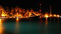
Thaa Guraidhoo Harbor

References[]
- ^ "Table PP5: Resident Population by sex, nationality and locality (administrative islands), 2014" (PDF). Population and Households Census 2014. National Bureau of Statistics. p. 35. Retrieved 13 August 2018.
- ^ "Coordinate Distance Calculator". Boulter.com. Retrieved 13 August 2018.
- ^ "Table 3.3: Total Maldivian Population by Islands" (PDF). National Bureau of Statistics. Retrieved 13 August 2018.
Island-level constituencies of the Maldives | ||
|---|---|---|
| Haa Alif | ||
| Haa Dhaalu | ||
| Shaviyani | ||
| Noonu | ||
| Raa | ||
| Baa | ||
| Lhaviyani | ||
| Kaafu | ||
| Alif Alif | ||
| Alif Dhaalu |
| |
| Vaavu | ||
| Meemu |
| |
| Faafu | ||
| Dhaalu | ||
| Kolhumadulu (Thaa) | ||
| Laamu | ||
| Gaafu Alif | ||
| Gaafu Dhaalu | ||
| Gnaviyani |
| |
- Islands of the Maldives