Gurara, Nigeria
Gurara | |
|---|---|
LGA | |
 View of Gurara waterfall | |
 Gurara Location in Nigeria | |
| Coordinates: 9°21′N 7°05′E / 9.350°N 7.083°ECoordinates: 9°21′N 7°05′E / 9.350°N 7.083°E | |
| Country | |
| State | Niger State |
| Government | |
| • Local Government Chairman and the Head of the Local Government Council | Adamu Gani |
| Area | |
| • Total | 954 km2 (368 sq mi) |
| Population (2006 census) | |
| • Total | 90,974 |
| Time zone | UTC+1 (WAT) |
| 3-digit postal code prefix | 910 |
| ISO 3166 code | NG.NI.GU |

Gurara is a Local Government Area in Niger State, Nigeria, adjoining the Federal Capital Territory. Its headquarters are in the town of Gawu. Major inhabitants are the Gwari people. The Gurara Waterfalls is found here.
It has an area of 954 km2 and a population of 90,974 at the 2006 census.
The postal code of the area is 910.[1]
References[]
- ^ "Post Offices- with map of LGA". NIPOST. Archived from the original on 2012-11-26. Retrieved 2009-10-20.
State capital: Minna | ||
| Local Government Areas | 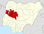 | |
This Niger State, Nigeria location article is a stub. You can help Wikipedia by . |
Categories:
- Local Government Areas in Niger State
- North Central Nigeria geography stubs