Shiroro
Shiroro | |
|---|---|
LGA | |
 Shiroro Location of Shiroro in Nigeria | |
| Coordinates: 9°57′25″N 6°49′55″E / 9.95694°N 6.83194°ECoordinates: 9°57′25″N 6°49′55″E / 9.95694°N 6.83194°E | |
| Country | |
| State | Niger State |
| Government | |
| • Local Government Chairman and the Head of the Local Government Council | Suleiman Dauda Chukuba |
| Time zone | UTC+1 (WAT) |

Shiroro is a Local Government Area in Niger State, Nigeria. Its headquarters is in the town of Kuta, which has fifteen [15] wards as follows:
- Allawa
- Bangajiya
- Bassa/kukoki
- Egwa/gwada
- Erena
- Galkogo
- Gurmana
- Gussoro
- Kato
- Kushaka/kurebe
- Kwaki/chukuba
- Manta
- Pina
- She
- Ubandoma
and their major language is Gbagyi. [1][2]
It has an area of 5,015 square kilometres (1,936 sq mi) and a population of 235,404 at the 2006 census.
The postal code of the area is 921.[3]
See also[]
References[]
- ^ "Shiroro". Open Street Map. Retrieved 13 June 2018.
- ^ "Shiroro". Google Maps. Google. Retrieved 13 June 2018.
- ^ "Post Offices- with map of LGA". NIPOST. Archived from the original on 2012-11-26. Retrieved 2009-10-20.
State capital: Minna | ||
| Local Government Areas | 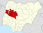 | |
This Niger State, Nigeria location article is a stub. You can help Wikipedia by . |
Categories:
- Local Government Areas in Niger State
- North Central Nigeria geography stubs