Hämeenkoski
Hämeenkoski | |
|---|---|
Former municipality | |
| Hämeenkosken kunta Hämeenkoski kommun | |
 Coat of arms | |
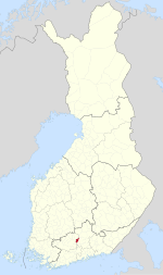 Location of Hämeenkoski in Finland | |
| Coordinates: 61°01.5′N 025°09′E / 61.0250°N 25.150°ECoordinates: 61°01.5′N 025°09′E / 61.0250°N 25.150°E | |
| Country | Finland |
| Region | Päijänne Tavastia |
| Sub-region | Lahti sub-region |
| Charter | 1865 |
| Consolidated | 2016 |
| Government | |
| • Municipal manager | Kari Mustonen |
| Area | |
| • Total | 195.62 km2 (75.53 sq mi) |
| • Land | 187.76 km2 (72.49 sq mi) |
| • Water | 7.86 km2 (3.03 sq mi) |
| Population (2015-06-30)[2] | |
| • Total | 2,125 |
| • Density | 11/km2 (28/sq mi) |
| Time zone | UTC+2 (EET) |
| • Summer (DST) | UTC+3 (EEST) |
| Website | www.hameenkoski.fi |

Hämeenkoski (Finnish pronunciation: [ˈhæmeːŋˌkoski]; Koski Hl until 1995, see Koski Tl) is a former municipality of Finland. It was merged to the municipality of Hollola on 1 January 2016.[3]
It is located in the province of Southern Finland and is part of the Päijänne Tavastia region. The municipality had a population of 2,125 (30 June 2015)[2] and covered an area of 195.62 km2 (75.53 sq mi) of which 7.86 km2 (3.03 sq mi) was water.[1] The population density was 11.3176/km2 (29.313/sq mi). The municipality was unilingually Finnish.
Lake Pääjärvi is situated at the border between Hämeenkoski and Hämeenlinna (formerly Lammi).
References[]
- ^ a b "Area by municipality as of 1 January 2011" (PDF) (in Finnish and Swedish). Land Survey of Finland. Retrieved 9 March 2011.
- ^ a b "Väestötietojärjestelmä rekisteritilanne 30.06.2015" (in Finnish and Swedish). Population Register Center of Finland. Archived from the original on 3 October 2013. Retrieved 17 July 2015.
- ^ Ojansivu, Merja (25 January 2015). "Lahti ja Nastola yhdistyvät ensi vuoden alusta". Helsingin Sanomat (in Finnish). Helsinki: Sanoma Media Finland Oy. Retrieved 3 January 2016.
External links[]
 Media related to Hämeenkoski at Wikimedia Commons
- Municipality of Hämeenkoski – Official website
| Municipalities |  | |
|---|---|---|
| Former municipalities | ||
| Authority control |
|
|---|
This Southern Finland location article is a stub. You can help Wikipedia by . |
Categories:
- Hollola
- Former municipalities of Finland
- Populated places established in 1865
- Southern Finland Province geography stubs