Hämeenkyrö
Hämeenkyrö
Tavastkyro | |
|---|---|
Municipality | |
| Hämeenkyrön kunta Tavastkyro kommun | |
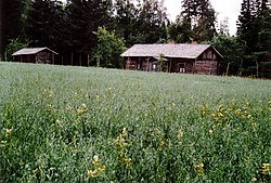 The birth-place of Finnish Nobel laureate F. E. Sillanpää | |
 Coat of arms | |
 Location of Hämeenkyrö in Finland | |
| Coordinates: 61°38′N 023°12′E / 61.633°N 23.200°ECoordinates: 61°38′N 023°12′E / 61.633°N 23.200°E | |
| Country | |
| Region | Pirkanmaa |
| Sub-region | Tampere sub-region |
| Government | |
| • Municipality manager | Antero Alenius |
| Area (2018-01-01)[1] | |
| • Total | 505.10 km2 (195.02 sq mi) |
| • Land | 463.76 km2 (179.06 sq mi) |
| • Water | 41.34 km2 (15.96 sq mi) |
| Area rank | 187th largest in Finland |
| Population (2021-03-31)[2] | |
| • Total | 10,384 |
| • Rank | 93rd largest in Finland |
| • Density | 22.39/km2 (58.0/sq mi) |
| Population by native language | |
| • Finnish | 99% (official) |
| • Swedish | 0.1% |
| • Others | 0.9% |
| Population by age | |
| • 0 to 14 | 16.9% |
| • 15 to 64 | 58.7% |
| • 65 or older | 24.4% |
| Time zone | UTC+02:00 (EET) |
| • Summer (DST) | UTC+03:00 (EEST) |
| Municipal tax rate[5] | 22% |
| Website | www.hameenkyro.fi |

Hämeenkyrö (Finnish: [ˈhæmeːnˌkyrø]; Swedish: Tavastkyro) is a municipality of Finland. It is part of the Pirkanmaa region, and is located 36 kilometres (22 mi) from Tampere. The municipality has a population of 10,384 (31 March 2021)[2] and covers an area of 505.10 square kilometres (195.02 sq mi) of which 41.34 km2 (15.96 sq mi) is water.[1] The population density is 22.39 inhabitants per square kilometre (58.0/sq mi).
The neighboring municipalities of Hämeenkyrö are Ikaalinen, Nokia, Sastamala and Ylöjärvi. The municipality is unilingually Finnish.
The drinking horn depicting coat of arms of Hämeenkyrö was designed by Gustaf von Numers and it was confirmed in 1954.[6] After the wars, the evacuated Karelian population from Otradnoye (Pyhäjärvi) was mostly settled in Hämeenkyrö.[7]
Results of the 2021 Finnish municipal elections, resulted in the True Finns being the largest group on the Hämeenkyrö council, in Hämeenkyrö.[8]
People[]
- Taavetti Kalliokorpi (1869–1949), Finnish farmer and politician
- Frans Eemil Sillanpää (1888–1964), Finnish writer, Nobel Laureate in Literature
- Arvo Tuominen (1894–1981), Finnish journalist, politician and author
- Iivari Yrjölä (1899–1985), Finnish athlete
- Paavo Yrjölä (1902–1980), Finnish track and field athlete
- Matti Yrjölä (born 1938), Finnish shot putter
- Mirja Ojanen (born 1967), Finnish ski-orienteering competitor
- Hans Osara (c.1560–1601), Finnish lieutenant at the Cudgel War
- Ilkka Tuomisto (born 1984), Finnish Paralympic cross-country skier and biathlete
- Jyri Niemi (born 1990), Finnish professional ice hockey defenceman
References[]
- ^ Jump up to: a b "Area of Finnish Municipalities 1.1.2018" (PDF). National Land Survey of Finland. Retrieved 30 January 2018.
- ^ Jump up to: a b "Preliminary population structure by area, 2021M01*-2021M03*". StatFin (in Finnish). Statistics Finland. Retrieved 2 May 2021.
- ^ "Population according to language and the number of foreigners and land area km2 by area as of 31 December 2008". Statistics Finland's PX-Web databases. Statistics Finland. Retrieved 29 March 2009.
- ^ "Population according to age (1-year) and sex by area and the regional division of each statistical reference year, 2003-2020". StatFin. Statistics Finland. Retrieved 2 May 2021.
- ^ "List of municipal and parish tax rates in 2021" (PDF). Tax Administration of Finland. 1 December 2020. Retrieved 10 April 2021.
- ^ Mitä-Missä-Milloin 1980, p. 158. Helsinki: Otava 1979. (in Finnish)
- ^ Mitä-Missä-Milloin 1951, p. 129. Helsinki: Otava 1950. (in Finnish)
- ^ https://yle.fi/uutiset/osasto/news/finns_party_gains_ncp_top_as_turnout_dips_in_finnish_local_elections/11979073
External links[]
![]() Media related to Hämeenkyrö at Wikimedia Commons
Media related to Hämeenkyrö at Wikimedia Commons
- Municipality of Hämeenkyrö – Official website
- Arteles International Artist in Residency Program
| hide | ||
|---|---|---|
| Municipalities |  | |
| Former municipalities | ||
| Authority control |
|
|---|
This Western Finland location article is a stub. You can help Wikipedia by . |
- Hämeenkyrö
- Western Finland Province geography stubs