Hale, Missouri
Hale, Missouri | |
|---|---|
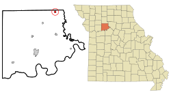 Location of Hale, Missouri | |
| Coordinates: 39°36′15″N 93°20′37″W / 39.60417°N 93.34361°WCoordinates: 39°36′15″N 93°20′37″W / 39.60417°N 93.34361°W | |
| Country | United States |
| State | Missouri |
| County | Carroll |
| Area | |
| • Total | 0.55 sq mi (1.42 km2) |
| • Land | 0.55 sq mi (1.42 km2) |
| • Water | 0.00 sq mi (0.00 km2) |
| Elevation | 764 ft (233 m) |
| Population (2020) | |
| • Total | 375 |
| • Estimate (2019)[2] | 397 |
| • Density | 723.13/sq mi (279.11/km2) |
| Time zone | UTC-6 (Central (CST)) |
| • Summer (DST) | UTC-5 (CDT) |
| ZIP code | 64643 |
| Area code(s) | 660 |
| FIPS code | 29-29908[3] |
| GNIS feature ID | 0718988[4] |

Hale is a city in Carroll County, Missouri, United States. The population was 375 at the 2020 census.[5]
History[]
Hale was platted in 1833.[6] The community was named after John P. Hale, a state legislator.[7]
Geography[]
Hale is located at 39°36′15″N 93°20′37″W / 39.60417°N 93.34361°W (39.604241, -93.343713).[8]
According to the United States Census Bureau, the city has a total area of 0.55 square miles (1.42 km2), all land.[9]
Demographics[]
| Historical population | |||
|---|---|---|---|
| Census | Pop. | %± | |
| 1890 | 530 | — | |
| 1900 | 665 | 25.5% | |
| 1910 | 587 | −11.7% | |
| 1920 | 690 | 17.5% | |
| 1930 | 574 | −16.8% | |
| 1940 | 562 | −2.1% | |
| 1950 | 452 | −19.6% | |
| 1960 | 504 | 11.5% | |
| 1970 | 461 | −8.5% | |
| 1980 | 529 | 14.8% | |
| 1990 | 480 | −9.3% | |
| 2000 | 473 | −1.5% | |
| 2010 | 419 | −11.4% | |
| 2019 (est.) | 397 | [2] | −5.3% |
| U.S. Decennial Census[10] | |||
As of 2000 the median income for a household in the city was $24,625, and the median income for a family was $45,250. Males had a median income of $33,214 versus $23,036 for females. The per capita income for the city was $17,790. About 9.5% of families and 15.6% of the population were below the poverty line.
2010 census[]
As of the census[3] of 2010, there were 419 people, 176 households, and 112 families residing in the city. The population density was 698 people per square mile). There were 209 housing units at an average density of 348 per square mile. The racial makeup of the city was 97.1% White, and 2.4% from two or more races. American Indian or of any race were .5% of the population.
There were 176 households, of which 30.7% had children under the age of 18 living with them, 44.9% were married couples living together, 8.5% were male householders with no wife present, 10.2% were female householders with no husband present, and 36.4% were non-families. 35.2% of all households were made up of individuals, and 34.7% had someone living alone who was 65 years of age or older. The average household size was 2.38 and the average family size was 3.01.
In the city the population was spread out, with 24.7% under the age of 18, 3.6% from 19 to 24, 24.9% from 25 to 44, 23.6% from 45 to 64, and 18.4% who were 65 years of age or older. The median age was 38.5 years.
References[]
- ^ "2019 U.S. Gazetteer Files". United States Census Bureau. Retrieved July 26, 2020.
- ^ a b "Population and Housing Unit Estimates". United States Census Bureau. May 24, 2020. Retrieved May 27, 2020.
- ^ a b "U.S. Census website". United States Census Bureau. Retrieved 2008-01-31.
- ^ "US Board on Geographic Names". United States Geological Survey. 2007-10-25. Retrieved 2008-01-31.
- ^ "Explore Census Data". data.census.gov. Retrieved 2021-12-23.
- ^ Eaton, David Wolfe (1916). How Missouri Counties, Towns and Streams Were Named. The State Historical Society of Missouri. pp. 271.
- ^ "Carroll County Place Names, 1928–1945 (archived)". The State Historical Society of Missouri. Archived from the original on 24 June 2016. Retrieved 10 September 2016.CS1 maint: bot: original URL status unknown (link)
- ^ "US Gazetteer files: 2010, 2000, and 1990". United States Census Bureau. 2011-02-12. Retrieved 2011-04-23.
- ^ "US Gazetteer files 2010". United States Census Bureau. Retrieved 2012-07-08.
- ^ "Census of Population and Housing". Census.gov. Retrieved June 4, 2015.
External links[]
- Historic maps of Hale in the Sanborn Maps of Missouri Collection at the University of Missouri
Municipalities and communities of Carroll County, Missouri, United States | ||
|---|---|---|
| Cities |  | |
| Village | ||
| Townships | ||
| Unincorporated communities | ||
| Ghost towns | ||
| Footnotes | ‡This populated place also has portions in an adjacent county or counties | |
| ||
- Cities in Carroll County, Missouri
- Cities in Missouri