Harich, Friesland
Harich | |
|---|---|
Village | |
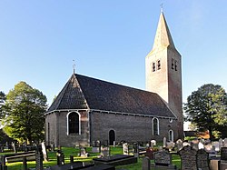 Harich church | |
 Location in the former Gaasterlân Sleat municipality | |
 Harich Location in the Netherlands | |
| Coordinates: Coordinates: 52°54′10″N 5°33′58″E / 52.90278°N 5.56611°E | |
| Country | |
| Province | |
| Municipality | |
| Population (2017) | |
| • Total | 470 |
| Time zone | UTC+1 (CET) |
| • Summer (DST) | UTC+2 (CEST) |
| Postal code | 8571 |
| Telephone area | 0514 |

Harich is a small village in De Fryske Marren municipality in the province of Friesland, the Netherlands. It had a population of around 470 in 2017.[1]
History[]
Before 2014, Harich was part of the Gaasterlân-Sleat municipality and before 1984 it belonged to Gaasterland.

An illustration depicting the village c. 1710–1735, from the , currently held at the Koninklijke Bibliotheek
References[]
External links[]
![]() Media related to Harich at Wikimedia Commons
Media related to Harich at Wikimedia Commons
This Friesland location article is a stub. You can help Wikipedia by . |
Categories:
- De Fryske Marren
- Populated places in Friesland
- Friesland geography stubs