Harku Parish
Harku Parish
Harku vald | |
|---|---|
 | |
 Flag  Coat of arms | |
 Harku Parish within Harju County (yellow) and within Estonia | |
| Country | |
| County | |
| Administrative centre | Tabasalu |
| Government | |
| • Mayor | Erik Sandla (IRL) |
| Area | |
| • Total | 159.77 km2 (61.69 sq mi) |
| Population (01.01.2020) | |
| • Total | 15,248 |
| ISO 3166 code | EE-198 |
| Website | www.harku.ee |
Harku Parish (Estonian: Harku vald) is a rural municipality in Harju County, northern Estonia, located west and neighbouring the capital Tallinn. It occupies an area of 159.77 km2 (61.69 sq mi) and has a population of 7,575 (as of 1 January 2012). The population density is 47.412/km2 (122.796/sq mi).[4]
The administrative centre of Harku Parish is Tabasalu a small borough with population of 3,217[citation needed].
History[]
First mentioned in 1891.
Local government[]
The current mayor of Harku Parish is Erik Sandla from the Union of Pro Patria and Res Publica.[1] Current chairman of the council (volikogu esimees) is Kalle Palling MP.[5]
Geography[]
Populated places[]
There are 2 small boroughs (alevikud, sg. - alevik) and 21 villages (külad, sg. - küla) in Harku Parish.
Small boroughs: Harku, Tabasalu.
Villages: Adra, Harkujärve, Humala, Ilmandu, Kumna, Kütke, Laabi, Liikva, Muraste, Naage, Rannamõisa, Sõrve, Suurupi, Tiskre, Türisalu, Tutermaa, Vääna, Vääna-Jõesuu, Vahi, Vaila, Viti.
Tabasalu

Muraste

Rannamõisa

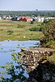
Ranna church

Vahiküla waterfall

Suurupi upper lighthouse

Harku manor

Kumna manor


References[]
- ^ Jump up to: a b "Vallavalitsuse koosseis" (in Estonian). Harku vald. Retrieved 28 May 2010.
- ^ "Population figure and composition". Statistics Estonia. 2010-04-19. Retrieved 28 May 2010.
- ^ "Elanike arv - Eesti Linnade ja Valdade Liit".
- ^ "Population figure and composition". Statistics Estonia. Retrieved 9 June 2012.
- ^ "Vallavolikogu" (in Estonian). Harku vald http://www.harku.ee. Retrieved 25 November 2017. External link in
|publisher=(help)
External links[]
- Official website (in Estonian)
- Map of Harku Parish
Coordinates: 59°26′N 24°33′E / 59.433°N 24.550°E

| hide | ||
|---|---|---|
| Urban municipalities | ||
| Rural municipalities | ||
This Harju County location article is a stub. You can help Wikipedia by . |
- Harku Parish
- Municipalities of Estonia
- Harju County geography stubs