Anija Parish

Anija Parish (Estonian: Anija vald) is a rural municipality in Harju County, Estonia, consisting of 33 settlements.
The parish has a population of 6274 and covers an area of 532.91 km2 (205.76 sq mi).[1]
The administrative centre of the municipality is Kehra. The municipality also has an office in the borough of Aegviidu.[2]
Anija Parish is bordered by Kuusalu, Jõelähtme, Raasiku, Kose parishes in Harju County, Järva parish in Järva County and Tapa Parish in Lääne-Viru County.
History[]
Anija Village (Hangægus) was first mentioned in the Danish Census Book in 1241.[3]
, the namesake of Anija Parish, was first mentioned in 1482.[4]
Anija Parish was first created in the 19th century as part of the bigger, now arhaic .
In 1939, Anija Parish ceded Aavere, Pillapalu and gained , Paasiku, and parts of Kiviloo.[5]
In 1945, Anija, Kehra and Pikva Rural Councils were created on the lands of Anija Parish.[6]
In 1950, Anija Parish was abolished, effectively being replaced by the three rural councils.[6]
In 1992, a new Anija Parish was created, which had the same borders as the preceding Anija Rural Council.
In 2002, the town of Kehra was merged with Anija Parish.[7]
In 2017, the borough of Aegviidu was merged with Anija Parish.[8]
Population[]
| Settlement | 2000[9] | 2010[10] | 2020[11] |
|---|---|---|---|
| Aavere | 21 | 19 | 11 |
| Aegviidu | - | - | 721 |
| Alavere | 432 | 382 | 335 |
| Anija | 125 | 128 | 105 |
| Arava | 50 | 40 | 42 |
| Härmakosu | 74 | 64 | 59 |
| Kaunissaare | 76 | 90 | 84 |
| Kehra | - | 2998 | 2625 |
| Kehra Village | 35 | 32 | 28 |
| Kihmla | 34 | 36 | 25 |
| Kuusemäe | 32 | 17 | 21 |
| Lehtmetsa | 799 | 763 | 697 |
| Lilli | 136 | 118 | 96 |
| Linnakse | 65 | 70 | 62 |
| Looküla | 59 | 53 | 50 |
| Lükati | 68 | 54 | 53 |
| Mustjõe | 16 | 19 | 22 |
| Paasiku | 40 | 44 | 44 |
| Parila | 56 | 80 | 85 |
| Partsaare | 18 | 24 | 16 |
| Pikva | 104 | 120 | 106 |
| Pillapalu | 109 | 71 | 93 |
| Rasivere | 59 | 53 | 47 |
| Raudoja | 40 | 44 | 53 |
| Rooküla | 77 | 97 | 80 |
| Salumetsa | 27 | 37 | 33 |
| Salumäe | 61 | 67 | 70 |
| Soodla | 74 | 80 | 63 |
| Uuearu | 47 | 49 | 46 |
| Vetla | 51 | 47 | 54 |
| Vikipalu | 53 | 61 | 90 |
| Voose | 79 | 78 | 65 |
| Ülejõe | 243 | 252 | 235 |
| Unknown | 240[12] | 40 | 19[13] |
| Total | 3400 | 6127 | 6235 |
Gallery[]

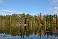
Väike Kalajärv, a lake in Kõrvemaa Nature Park

Tarvasjõgi river in Kõrvemaa Nature Park
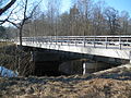
Soodla bridge
Lake Vahejärv

Lake Nikerjärv

Raudoja reservoir


References[]
- ^ "Population figure and composition". Statistics Estonia. Retrieved 9 June 2012.
- ^ "Vallavalitsus - Anija Vallavalitsus". anija.kovtp.ee. Retrieved 2020-08-28.
- ^ "Anija küla". www.eestigiid.ee. Retrieved 2020-08-28.
- ^ "History - Anija Mõis". Anija Mõis. Retrieved 2020-08-28.
- ^ "Vabariigi Presidendi otsus nr. 88". Riigi Teataja. 7 October 1938.
- ^ a b "Eesti haldusjaotuse kujunemine - Eesti Entsüklopeedia". entsyklopeedia.ee. Retrieved 2020-08-28.
- ^ "Haldusterritoriaalse korralduse muutmine Kehra linna ja Anija valla osas – Riigi Teataja". www.riigiteataja.ee. Retrieved 2020-08-28.
- ^ "Käimasolevad KOV-ide ühinemismenetlused ja piiride muutmise ettepanekud (29.12.2016)" (PDF).
- ^ "Rahvaarv soo ja vanuserühma järgi - Mehed ja naised, Vanuserühmad kokku (Asustusüksus)". estat.stat.ee. Retrieved 2020-08-28.
- ^ "Elanikud külades seisuga 01.01.2010". 2011-07-20. Archived from the original on 2011-07-20. Retrieved 2020-08-28.
- ^ "Asulate rahvaarv soo ja 3 peamise vanuserühma järgi - Mehed ja naised, Vanuserühmad kokku (Asustusüksus)". estat.stat.ee. 2020-09-30. Retrieved 2021-04-03.
- ^ "RV0282: RAHVAARV, 1. JAANUAR | Aasta, Haldusüksus või asustusüksuse liik, Sugu ning Vanuserühm". andmed.stat.ee. Retrieved 2021-04-13.
- ^ "Elanike arv - Eesti Linnade ja Valdade Liit". 2020-09-26. Archived from the original on 2020-09-26. Retrieved 2021-04-13.
External links[]
- Official website (available only in Estonian)
Coordinates: 59°20′14″N 25°20′00″E / 59.33731°N 25.33333°E

- Anija Parish
- Municipalities of Estonia