Harrison, Indiana
Harrison, Indiana | |
|---|---|
 Vigo County's location in Indiana | |
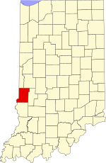
 Harrison location in Vigo County, Indiana | |
| Coordinates: 39°31′43″N 87°25′20″W / 39.52861°N 87.42222°WCoordinates: 39°31′43″N 87°25′20″W / 39.52861°N 87.42222°W | |
| Country | United States |
| State | Indiana |
| County | Vigo |
| Township | Fayette |
| Elevation | 456 ft (139 m) |
| Time zone | UTC-5 (Eastern (EST)) |
| • Summer (DST) | UTC-4 (EDT) |
| ZIP code | 47885 |
| Area code(s) | 812, 930 |
| GNIS feature ID | 452218 |

Harrison is an unincorporated community in southeastern Fayette Township, Vigo County, in the U.S. state of Indiana.[2]
It is part of the Terre Haute metropolitan area.
History[]
Harrison was platted August 4, 1837, by Ann Potts, on the west side of the river from Fort Harrison, a military outpost in the region built in 1811 by General William Henry Harrison.[3][4]
Geography[]
Harrison is located at 39°31′43″N 87°25′20″W / 39.52861°N 87.42222°W at an elevation of 456 feet.
References[]
- ^ "US Board on Geographic Names". United States Geological Survey. October 25, 2007. Retrieved 2016-07-14.
- ^ "Harrison, Indiana". Geographic Names Information System. United States Geological Survey. Retrieved August 7, 2017.
- ^ "Fort Harrison (historical)". Geographic Names Information System. United States Geological Survey. Retrieved 2010-06-25.
- ^ Bradsby, H.C. (1891). History of Vigo County, Indiana, with Biographical Selections. Chicago: S. B. Nelson & Co. p. 476.
Municipalities and communities of Vigo County, Indiana, United States | ||
|---|---|---|
| City | ||
| Towns | ||
| Townships | ||
| CDPs | ||
| Other unincorporated communities |
| |
| Footnotes | ‡This populated place also has portions in an adjacent county or counties | |
| ||
This Vigo County, Indiana location article is a stub. You can help Wikipedia by . |
Categories:
- Unincorporated communities in Indiana
- Unincorporated communities in Vigo County, Indiana
- Terre Haute metropolitan area
- Vigo County, Indiana geography stubs