Linton Township, Vigo County, Indiana
Linton Township | |
|---|---|
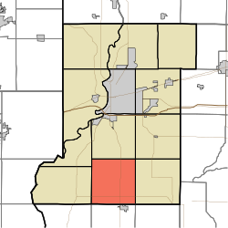 Location in Vigo County | |
| Coordinates: 39°18′23″N 87°24′43″W / 39.30639°N 87.41194°WCoordinates: 39°18′23″N 87°24′43″W / 39.30639°N 87.41194°W | |
| Country | United States |
| State | Indiana |
| County | Vigo |
| Government | |
| • Type | Indiana township |
| Area | |
| • Total | 35.43 sq mi (91.8 km2) |
| • Land | 34.97 sq mi (90.6 km2) |
| • Water | 0.46 sq mi (1.2 km2) 1.30% |
| Elevation | 574 ft (175 m) |
| Population (2010) | |
| • Total | 1,323 |
| • Density | 37.8/sq mi (14.6/km2) |
| ZIP codes | 47802, 47850, 47866 |
| GNIS feature ID | 453575 |

Linton Township is one of twelve townships in Vigo County, Indiana, United States. As of the 2010 census, its population was 1,323 and it contained 555 housing units.[1]
History[]
Linton Township High School and Community Building was listed on the National Register of Historic Places in 2002.[2]
Geography[]
According to the 2010 census, the township has a total area of 35.43 square miles (91.8 km2), of which 34.97 square miles (90.6 km2) (or 98.70%) is land and 0.46 square miles (1.2 km2) (or 1.30%) is water.[1]
Unincorporated communities[]
Adjacent townships[]
- Honey Creek Township (north)
- Riley Township (northeast)
- Pierson Township (east)
- Jackson Township, Sullivan County (southeast)
- Curry Township, Sullivan County (south)
- Fairbanks Township, Sullivan County (southwest)
- Prairie Creek Township (west)
- Prairieton Township (northwest)
Cemeteries[]
The township contains three cemeteries: Kester Family Cemetery, Brown, and Union.
Airports and landing strips[]
- Kester Fly Inn Airport
Lakes[]
- Fowler Lake
School districts[]
Political districts[]
- Indiana's 8th congressional district
- State House District 46
- State Senate District 39
References[]
- United States Census Bureau 2007 TIGER/Line Shapefiles
- United States Board on Geographic Names (GNIS)
- IndianaMap
- ^ a b "Population, Housing Units, Area, and Density: 2010 - County -- County Subdivision and Place -- 2010 Census Summary File 1". United States Census. Archived from the original on 2020-02-10. Retrieved 2013-05-10.
- ^ "National Register Information System". National Register of Historic Places. National Park Service. July 9, 2010.
External links[]
Municipalities and communities of Vigo County, Indiana, United States | ||
|---|---|---|
| City | ||
| Towns | ||
| Townships | ||
| CDPs | ||
| Other unincorporated communities |
| |
| Footnotes | ‡This populated place also has portions in an adjacent county or counties | |
| ||
Categories:
- Townships in Vigo County, Indiana
- Terre Haute metropolitan area
- Townships in Indiana