Harrison Township, Wayne County, Indiana
Harrison Township | |
|---|---|
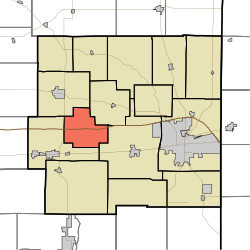 Location in Wayne County | |
| Coordinates: 39°51′11″N 85°06′08″W / 39.85306°N 85.10222°WCoordinates: 39°51′11″N 85°06′08″W / 39.85306°N 85.10222°W | |
| Country | United States |
| State | Indiana |
| County | Wayne |
| Government | |
| • Type | Indiana township |
| Area | |
| • Total | 16.51 sq mi (42.8 km2) |
| • Land | 16.36 sq mi (42.4 km2) |
| • Water | 0.16 sq mi (0.4 km2) 0.97% |
| Elevation | 981 ft (299 m) |
| Population (2010) | |
| • Total | 392 |
| • Density | 24/sq mi (9/km2) |
| Time zone | UTC-5 (Eastern (EST)) |
| • Summer (DST) | UTC-4 (EDT) |
| Area code(s) | 765 |
| GNIS feature ID | 453399 |

Harrison Township is one of fifteen townships in Wayne County, Indiana, United States. As of the 2010 census, its population was 392 and it contained 138 housing units.[2]
History[]
Harrison Township was organized in 1843.[3]
Geography[]
According to the 2010 census, the township has a total area of 16.51 square miles (42.8 km2), of which 16.36 square miles (42.4 km2) (or 99.09%) is land and 0.16 square miles (0.41 km2) (or 0.97%) is water.[2] The streams of Beard Run, Black Water Branch, College Corner Branch, Mud Run, Oser Creek, Silver Creek, Silver Station Brook and Square Run run through this township.
Unincorporated towns[]
- College Corner at 39°50′18″N 85°04′14″W / 39.8383799°N 85.0705194°W
- Jacksonburg at 39°51′11″N 85°06′21″W / 39.8531022°N 85.1057975°W
(This list is based on USGS data and may include former settlements.)
Adjacent townships[]
- Clay Township (northeast)
- Center Township (east)
- Jackson Township (west)
- Jefferson Township (northwest)
Cemeteries[]
The township contains one cemetery, Beard.
Major highways[]
References[]
- "Harrison Township, Wayne County, Indiana". Geographic Names Information System. United States Geological Survey. Retrieved 2009-09-24.
- United States Census Bureau cartographic boundary files
- ^ "US Board on Geographic Names". United States Geological Survey. October 25, 2007. Retrieved 2017-05-09.
- ^ a b "Population, Housing Units, Area, and Density: 2010 - County -- County Subdivision and Place -- 2010 Census Summary File 1". United States Census. Archived from the original on 2020-02-12. Retrieved 2013-05-10.
- ^ Young, Andrew White (1872). History of Wayne County, Indiana, from Its First Settlement to the Present Time. R. Clarke & Company. pp. 231.
External links[]
Municipalities and communities of Wayne County, Indiana, United States | ||
|---|---|---|
| City | ||
| Towns | ||
| Townships | ||
| Unincorporated communities | ||
| ||
Categories:
- Townships in Wayne County, Indiana
- Townships in Indiana