Hashimoto, Wakayama
Hashimoto
橋本市 | |
|---|---|
 Hashimoto City Hall | |
 Flag  Emblem | |
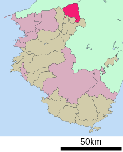 Location of Hashimoto in Wakayama Prefecture | |
 Hashimoto Location in Japan | |
| Coordinates: 34°19′N 135°36′E / 34.317°N 135.600°ECoordinates: 34°19′N 135°36′E / 34.317°N 135.600°E | |
| Country | Japan |
| Region | Kansai |
| Prefecture | Wakayama Prefecture |
| Government | |
| • Mayor | |
| Area | |
| • Total | 130.31 km2 (50.31 sq mi) |
| Population (February 1, 2021) | |
| • Total | 62,941 |
| • Density | 480/km2 (1,300/sq mi) |
| Time zone | UTC+09:00 (JST) |
| City hall address | 1-1-1, Tōge, Hashimoto-shi, Wakayama-ken 648-8585 |
| Website | www |
| Symbols | |
| Flower | Satsuki azalea |
| Tree | Osmanthus and sakura |

Hashimoto (橋本市, Hashimoto-shi) is a city located in Wakayama Prefecture, Japan. The city was founded on January 1, 1955. As of February 2021, the city has an estimated population of 62,941 and a population density of 480 persons per km². The total area is 130.31 km².
On March 1, 2006, the town of Kōyaguchi (from Ito District) was merged into Hashimoto.
Its sister city is Rohnert Park, California.
Notable people from Hashimoto[]
- Masaru Furukawa, swimmer
- Hideko Maehata, breaststroke swimmer
- Junpei Mizobata, actor
- Yoshitomo Tsutsugoh, baseball player
External links[]
![]() Media related to Hashimoto, Wakayama at Wikimedia Commons
Media related to Hashimoto, Wakayama at Wikimedia Commons
- Hashimoto City official website (in Japanese)
| show Authority control |
|---|
This Wakayama location article is a stub. You can help Wikipedia by . |
Categories:
- Hashimoto, Wakayama
- Cities in Wakayama Prefecture
- Populated places established in 1955
- 1955 establishments in Japan
- Wakayama geography stubs