Hayden, Idaho
Hayden, Idaho | |
|---|---|
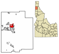 Location of Hayden in Kootenai County, Idaho. | |
 Hayden, Idaho Location in the United States | |
| Coordinates: 47°45′26″N 116°47′20″W / 47.75722°N 116.78889°WCoordinates: 47°45′26″N 116°47′20″W / 47.75722°N 116.78889°W | |
| Country | United States |
| State | Idaho |
| County | Kootenai |
| Area | |
| • Total | 10.43 sq mi (27.02 km2) |
| • Land | 10.42 sq mi (26.98 km2) |
| • Water | 0.01 sq mi (0.04 km2) |
| Elevation | 2,287 ft (697 m) |
| Population | |
| • Total | 13,294 |
| • Estimate (2019)[3] | 15,434 |
| • Density | 1,481.47/sq mi (572.01/km2) |
| Time zone | UTC−8 (Pacific (PST)) |
| • Summer (DST) | UTC−7 (PDT) |
| ZIP code | 83835 |
| Area code(s) | 208 |
| FIPS code | 16-36370 |
| GNIS feature ID | 0396630 |
| Website | www |

Hayden is a city in Kootenai County, Idaho, United States. Located in the northern portion of the state, it is a suburb of nearby Coeur d'Alene and its population was 13,294 at the 2010 census.
History[]
The Village of Hayden was incorporated in 1955 with a total of 440 acres with a population of around 700 people.[4]
The village received its name from a man named Matthew Hayden, a soldier from Fort Sherman who won the rights to name the lake, and therefore the city, by winning a game of “seven-up” against fellow soldiers John Hager and John Hickey and some other homesteaders in the late 1870s.[5]
The town became a center for the agriculture, logging, and recreation in the early 1900s. The Spokane and Inland Empire Railroad added service to Hayden in 1907 and in the same year the posh Hayden Lake Country Club was built. [6] With the advent of the automobile, the center of the town shifted from the lake and railroad and reoriented towards Government Way.[5] the post office moved from Bozanta Tavern (now the Hayden Lake Country Club) to Hayden Village in 1959.
Geography[]
Hayden is located at 47°45′26″N 116°47′20″W / 47.75722°N 116.78889°W (47.757112, -116.788877).[7]
According to the United States Census Bureau, the city has a total area of 9.61 square miles (24.89 km2), of which 9.60 square miles (24.86 km2) is land and 0.01 square miles (0.03 km2) is water.[8] It lies at the southwestern end of Hayden Lake, and the elevation of the city is 2,287 feet (697 m) above sea level.
Transportation[]
This section does not cite any sources. (October 2007) |
Hayden is located on U.S. Route 95 at the junction of Route 41. It is also four miles (6 km) north of Interstate 90 and Coeur d'Alene. The Coeur d'Alene airport is northwest of Hayden.
Demographics[]
| Historical population | |||
|---|---|---|---|
| Census | Pop. | %± | |
| 1960 | 901 | — | |
| 1970 | 1,285 | 42.6% | |
| 1980 | 2,586 | 101.2% | |
| 1990 | 3,744 | 44.8% | |
| 2000 | 9,159 | 144.6% | |
| 2010 | 13,294 | 45.1% | |
| 2019 (est.) | 15,434 | [3] | 16.1% |
| U.S. Decennial Census[9] | |||
2010 census[]
At the 2010 census there were 13,294 people, 5,212 households, and 3,645 families living in the city. The population density was 1,384.8 inhabitants per square mile (534.7/km2). There were 5,563 housing units at an average density of 579.5 per square mile (223.7/km2). The racial makeup of the city was 95.1% White, 0.2% African American, 0.9% Native American, 0.9% Asian, 0.1% Pacific Islander, 0.7% from other races, and 2.1% from two or more races. Hispanic or Latino of any race were 4.2%.[2]
Of the 5,212 households 33.6% had children under the age of 18 living with them, 55.6% were married couples living together, 9.5% had a female householder with no husband present, 4.8% had a male householder with no wife present, and 30.1% were non-families. 24.9% of households were one person and 12.8% were one person aged 65 or older. The average household size was 2.54 and the average family size was 3.01.
The median age was 39.4 years. 25.6% of residents were under the age of 18; 7.1% were between the ages of 18 and 24; 25% were from 25 to 44; 25.1% were from 45 to 64; and 17.2% were 65 or older. The gender makeup of the city was 48.3% male and 51.7% female.
2000 census[]
At the 2000 census there were 9,159 people, 3,501 households, and 2,562 families living in the city. The population density was 1,167.5 people per square mile (450.5/km2). There were 3,714 housing units at an average density of 473.4 per square mile (182.7/km2). The racial makeup of the city was 96.09% White, 0.19% African American, 0.76% Native American, 0.55% Asian, 0.08% Pacific Islander, 0.94% from other races, and 1.40% from two or more races. Hispanic or Latino of any race were 2.43%.[10]
Of the 3,501 households 36.9% had children under the age of 18 living with them, 60.3% were married couples living together, 9.1% had a female householder with no husband present, and 26.8% were non-families. 21.6% of households were one person and 9.5% were one person aged 65 or older. The average household size was 2.60 and the average family size was 3.04.
The age distribution was 27.6% under the age of 18, 7.4% from 18 to 24, 30.3% from 25 to 44, 21.2% from 45 to 64, and 13.5% 65 or older. The median age was 35 years. For every 100 females, there were 94.9 males. For every 100 females age 18 and over, there were 91.9 males.
The median household income was $37,097 and the median family income was $40,875. Males had a median income of $35,339 versus $21,388 for females. The per capita income for the city was $16,387. About 5.8% of families and 9.2% of the population were below the poverty line, including 13.5% of those under age 18 and 4.5% of those age 65 or over.
Economy[]
Empire Airlines has its headquarters in Hayden.[11] Rollercoaster designer Rocky Mountain Construction is also headquartered in Hayden.
Notable people[]
- Patty Duke, actress (lived in Hayden)
- Doug Okuniewicz, member of the Idaho House of Representatives
- Marshall Savage, futurist and author[citation needed]
- Don Larsen, MLB pitcher
- Trevor Prangley, professional MMA fighter
References[]
- ^ "2019 U.S. Gazetteer Files". United States Census Bureau. Retrieved July 9, 2020.
- ^ Jump up to: a b "U.S. Census website". United States Census Bureau. Retrieved 2012-12-18.
- ^ Jump up to: a b "Population and Housing Unit Estimates". United States Census Bureau. May 24, 2020. Retrieved May 27, 2020.
- ^ "Community History".
- ^ Jump up to: a b Dahlgren, Dorothy; Carbonneau Kincaid, Simone (2009). In All the West No Place Like This: A Pictorial History of the Coeur d'Alene Region. Coeur d'Alene, ID: Museum of North Idaho. p. 116. ISBN 978-0972335645. OCLC 466927090.
- ^ Dahlgren, Dorothy; Carbonneau Kincaid, Simone (2009). In All the West No Place Like This: A Pictorial History of the Coeur d'Alene Region. Coeur d'Alene, ID: Museum of North Idaho. p. 122-123. ISBN 978-0972335645. OCLC 466927090.
- ^ "US Gazetteer files: 2010, 2000, and 1990". United States Census Bureau. 2011-02-12. Retrieved 2011-04-23.
- ^ "US Gazetteer files 2010". United States Census Bureau. Retrieved 2012-12-18.
- ^ "Census of Population and Housing". Census.gov. Retrieved June 4, 2015.
- ^ "U.S. Census website". United States Census Bureau. Retrieved 2008-01-31.
- ^ "Contact Us Archived 2012-02-09 at the Wayback Machine." Empire Airlines. Retrieved on December 30, 2012. "11559 N Atlas Road Hayden, ID 83835"
External links[]
| show Municipalities and communities of Kootenai County, Idaho, United States |
|---|
| show Authority control |
|---|
- Cities in Idaho
- Cities in Kootenai County, Idaho