Helmetta, New Jersey
Helmetta, New Jersey | |
|---|---|
| Borough of Helmetta | |
 Looking north along Main Street (CR 615) | |
 Helmetta highlighted in Middlesex County. Inset: Location of Middlesex County highlighted in the State of New Jersey. | |
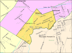 Census Bureau map of Helmetta, New Jersey | |
 Helmetta Location in Middlesex County | |
| Coordinates: 40°22′42″N 74°25′24″W / 40.378417°N 74.423384°WCoordinates: 40°22′42″N 74°25′24″W / 40.378417°N 74.423384°W[1][2] | |
| Country | |
| State | |
| County | Middlesex |
| Incorporated | March 20, 1888 |
| Named for | Olivia Antoinette "Etta" Helme |
| Government | |
| • Type | Borough |
| • Body | Borough Council |
| • Mayor | Chris Slavicek (I, term ends December 31, 2023)[3][4] |
| • Administrator | Matthew Crane[5] |
| • Municipal clerk | Sandra Bohinski[6] |
| Area | |
| • Total | 0.88 sq mi (2.27 km2) |
| • Land | 0.83 sq mi (2.15 km2) |
| • Water | 0.05 sq mi (0.13 km2) 5.57% |
| Area rank | 519th of 565 in state 25th of 25 in county[1] |
| Elevation | 59 ft (18 m) |
| Population | |
| • Total | 2,178 |
| • Estimate (2019)[12] | 2,155 |
| • Rank | 480th of 566 in state 25th of 25 in county[13] |
| • Density | 2,562.9/sq mi (989.5/km2) |
| • Density rank | 241st of 566 in state 19th of 25 in county[13] |
| Time zone | UTC−05:00 (Eastern (EST)) |
| • Summer (DST) | UTC−04:00 (Eastern (EDT)) |
| ZIP Code | |
| Area code(s) | 732 Exchange: 521[16] |
| FIPS code | 3402330840[1][17][18] |
| GNIS feature ID | 885250[1][19] |
| Website | www |


Helmetta is a borough in Middlesex County, New Jersey, United States. The borough is nestled within the heart of the Raritan Valley region, with Manalapan Brook (a Raritan River tributary) flowing through the center of the community. As of the 2010 United States Census, the borough's population was 2,178,[9][10][11] reflecting an increase of 353 (+19.3%) from the 1,825 counted in the 2000 Census, which had in turn increased by 614 (+50.7%) from the 1,211 counted in the 1990 Census.[20] The community was established around a snuff mill opened in the 1820s that was acquired by George Washington Helme in the 1880s.
Helmetta was formed as a borough by an act of the New Jersey Legislature on March 20, 1888, when it was created from portions of East Brunswick, based on the results of a referendum held on March 10, 1888. Helmetta's boundary with East Brunswick Township was changed as of March 24, 1897.[21] The borough was named for Helme's daughter, Olivia Antoinette "Etta" Helme.[22][23]
History[]
G. W. Helme Snuff Mill District[]
G. W. Helme Snuff Mill District | |
U.S. National Register of Historic Places | |
U.S. Historic district | |
 The Helmetta Snuff Mill in Spring 2012 | |
| |
| Location | Main Street Helmetta, New Jersey |
|---|---|
| Coordinates | 40°22′39″N 74°25′31″W / 40.37750°N 74.42528°W |
| NRHP reference No. | 79001511[24] |
| NJRHP No. | 1842[25] |
| Significant dates | |
| Added to NRHP | August 15, 1980 |
| Designated NJRHP | February 1, 1980 |


Helmetta's main landmark is the large, abandoned Helme Products Inc. plant that sits adjacent to the Camden and Amboy Railroad line running through the borough.[26] The mill began producing snuff in the 1880s. On February 23, 1900, the mill was bought by the American-Sniff Company in a merger with Helme Products Inc., but the merger was dissolved in 1911. In 1925, the mill became the largest of its kind in the world, and by 1934 it employed 400 people. In 1986, the mill was bought out by American Maize-Products. Finally, in 1993, it was purchased by Swisher International, and operations were moved to Wheeling, West Virginia.[27] It has remained inactive since.
The G. W. Helme Snuff Mill District is a classic example of a late 1800s mill town. The district consists of the George Washington Helme snuff mill, housing for employees, accessory buildings, St. George Episcopal Church, Holy Trinity Roman Catholic Church, and Helmetta Pond, which at one time served as a source of power for the mill. About 115 buildings were originally in the district, which was named to the New Jersey Register of Historic Places on February 1, 1980, and to the National Register of Historic Places listings in Middlesex County, New Jersey on August 15, 1980.[25]
Geography[]
According to the United States Census Bureau, the borough had a total area of 0.88 square miles (2.27 km2), including 0.83 square miles (2.15 km2) of land and 0.05 square miles (0.13 km2) of water (5.57%).[1][2]
The borough borders the Middlesex County municipalities of East Brunswick, Monroe Township and Spotswood.[28][29][30]
Demographics[]
| Historical population | |||
|---|---|---|---|
| Census | Pop. | %± | |
| 1900 | 447 | — | |
| 1910 | 661 | 47.9% | |
| 1920 | 687 | 3.9% | |
| 1930 | 801 | 16.6% | |
| 1940 | 667 | −16.7% | |
| 1950 | 580 | −13.0% | |
| 1960 | 779 | 34.3% | |
| 1970 | 955 | 22.6% | |
| 1980 | 955 | 0.0% | |
| 1990 | 1,211 | 26.8% | |
| 2000 | 1,825 | 50.7% | |
| 2010 | 2,178 | 19.3% | |
| 2019 (est.) | 2,155 | [12][31] | −1.1% |
| Population sources: 1900-1920[32] 1900-1910[33] 1910-1930[34] 1930-1990[35] 2000[36][37] 2010[9][10][11] | |||
Census 2010[]
The 2010 United States census counted 2,178 people, 891 households, and 596 families in the borough. The population density was 2,562.9 per square mile (989.5/km2). There were 920 housing units at an average density of 1,082.6 per square mile (418.0/km2). The racial makeup was 88.61% (1,930) White, 3.95% (86) Black or African American, 0.09% (2) Native American, 4.87% (106) Asian, 0.00% (0) Pacific Islander, 1.15% (25) from other races, and 1.33% (29) from two or more races. Hispanic or Latino of any race were 7.53% (164) of the population.[9]
Of the 891 households, 27.8% had children under the age of 18; 52.5% were married couples living together; 10.4% had a female householder with no husband present and 33.1% were non-families. Of all households, 26.0% were made up of individuals and 5.3% had someone living alone who was 65 years of age or older. The average household size was 2.44 and the average family size was 2.97.[9]
20.8% of the population were under the age of 18, 7.1% from 18 to 24, 31.7% from 25 to 44, 30.8% from 45 to 64, and 9.6% who were 65 years of age or older. The median age was 40.3 years. For every 100 females, the population had 93.6 males. For every 100 females ages 18 and older there were 90.2 males.[9]
The Census Bureau's 2006-2010 American Community Survey showed that (in 2010 inflation-adjusted dollars) median household income was $80,690 (with a margin of error of +/- $4,944) and the median family income was $96,875 (+/- $8,073). Males had a median income of $63,625 (+/- $7,838) versus $48,333 (+/- $6,040) for females. The per capita income for the borough was $36,941 (+/- $2,537). About 3.4% of families and 3.7% of the population were below the poverty line, including 5.8% of those under age 18 and 3.2% of those age 65 or over.[38]
Census 2000[]
As of the 2000 United States Census[17] there were 1,825 people, 746 households, and 495 families residing in the borough. The population density was 2,153.6 people per square mile (829.0/km2). There were 769 housing units at an average density of 907.5 per square mile (349.3/km2). The racial makeup of the borough was 93.15% White, 2.41% African American, 0.22% Native American, 2.41% Asian, 0.05% Pacific Islander, 0.88% from other races, and 0.88% from two or more races. Hispanic or Latino of any race were 5.32% of the population.[36][37]
There were 746 households, out of which 33.0% had children under the age of 18 living with them, 54.7% were married couples living together, 8.4% had a female householder with no husband present, and 33.6% were non-families. 25.6% of all households were made up of individuals, and 5.1% had someone living alone who was 65 years of age or older. The average household size was 2.45 and the average family size was 3.01.[36][37]
In the borough the population was spread out, with 22.1% under the age of 18, 6.5% from 18 to 24, 44.1% from 25 to 44, 21.2% from 45 to 64, and 6.2% who were 65 years of age or older. The median age was 36 years. For every 100 females, there were 98.4 males. For every 100 females age 18 and over, there were 97.2 males.[36][37]
The median income for a household in the borough was $60,125, and the median income for a family was $64,659. Males had a median income of $47,604 versus $33,929 for females. The per capita income for the borough was $26,668. About 3.2% of families and 3.3% of the population were below the poverty line, including 5.2% of those under age 18 and 1.8% of those age 65 or over.[36][37]
Government[]
Local government[]
Helmetta is governed under the Borough form of New Jersey municipal government, which is used in 218 municipalities (of the 565) statewide, making it the most common form of government in New Jersey.[39] The governing body is comprised of the Mayor and the Borough Council, with all positions elected at-large on a partisan basis as part of the November general election. The Mayor is elected directly by the voters to a four-year term of office. The Borough Council has six members elected to serve three-year terms on a staggered basis, with two seats coming up for election each year in a three-year cycle.[7] The Borough form of government used by Helmetta is a "weak mayor / strong council" government in which council members act as the legislative body with the mayor presiding at meetings and voting only in the event of a tie. The mayor can veto ordinances subject to an override by a two-thirds majority vote of the council. The mayor makes committee and liaison assignments for council members, and most appointments are made by the mayor with the advice and consent of the council.[40][41]
As of 2020, the Mayor of Helmetta Borough is Independent Christopher Slavicek, whose term of office ends December 31, 2023. Members of the Helmetta Borough Council are Councilman Peter Karczewski (I, 2021), Noreen Carolan-Genthe (R, 2020), Michael Duffy (I, 2021), Council President Ronald Dzingleski (I, 2022), Joseph J. Perez (I, 2020) and Joseph W. Reid (I, 2022).[3][42][43][44][45][46]
In January 2016, Ronald Dzingleski and Joseph Reid were appointed to fill two of the three vacant council seats.[47]
In April 2016, the Borough Council selected Noreen Carolan to fill the term expiring in December 2016 that had been held temporarily by Brian Hackett who had in turn been appointed to fill the seat held by Yvette Bruno.[48]
In 2014, a recording of a police officer telling a cameraperson stating that he has the constitutional right to take video that he doesn't "give a damn" about constitutional rights was made public. In response, the city government proposed an ordinance banning video and photography inside public buildings without a permit.[49]
In April 2018, Helmetta disbanded its three-officer police force and entered into a six-year shared services agreement with Spotswood to provide police, dispatch and EMS services to Helmetta residents.[50] The Spotswood Police Department is a 24/7 law enforcement agency that serves both Spotswood and Helmetta. The department has 22 officers, 3 full-time dispatchers, and 4 part-time dispatchers, led by Chief Michael Zarro.[51]
In 2018, the borough had an average property tax bill of $6,270, the lowest in the county, compared to an average bill of $8,092 in Middlesex County and $8,767 statewide.[52][53]
Federal, state and county representation[]
Helmetta is located in the 12th Congressional District[54] and is part of New Jersey's 18th state legislative district.[10][55][56]
For the 117th United States Congress, New Jersey's Twelfth Congressional District is represented by Bonnie Watson Coleman (D, Ewing Township).[57][58] New Jersey is represented in the United States Senate by Democrats Cory Booker (Newark, term ends 2027)[59] and Bob Menendez (Harrison, term ends 2025).[60][61]
For the 2018–2019 session (Senate, General Assembly), the 18th Legislative District of the New Jersey Legislature is represented in the State Senate by Patrick J. Diegnan (D, South Plainfield) and in the General Assembly by Robert Karabinchak (D, Edison) and Sterley Stanley (D, East Brunswick).[62][63]
Middlesex County is governed by a Board of Commissioners, whose seven members are elected at-large on a partisan basis to serve three-year terms of office on a staggered basis, with either two or three seats coming up for election each year as part of the November general election. At an annual reorganization meeting held in January, the board selects from among its members a Commissioner Director and Deputy Director. As of 2021, Middlesex County's Commissioners (with party affiliation, term-end year, and residence listed in parentheses) are Commissioner Director Ronald G. Rios (D, term ends December 31, 2021, Carteret; Ex-officio on all committees),[64] Commissioner Deputy Director Shanti Narra (D, 2021; North Brunswick),[65] Claribel A. Azcona-Barber (D, 2022, New Brunswick),[66] Charles Kenny (D, 2022, Woodbridge Township),[67] Leslie Koppel (D, 2023, Monroe),[68] Charles E. Tomaro (D, 2023, Edison)[69] and Chanelle Scott McCullum (D, 2021, Piscataway).[70][71]
Constitutional officers are County Clerk Nancy J. Pinkin (D, 2025, East Brunswick),[72] Sheriff Mildred S. Scott (D, 2022, Piscataway)[73] and Surrogate Claribel Cortes (D, 2021; North Brunswick).[71][74]
Politics[]
As of March 23, 2011, there were a total of 1,399 registered voters in Helmetta, of which 403 (28.8%) were registered as Democrats, 264 (18.9%) were registered as Republicans and 731 (52.3%) were registered as Unaffiliated. There was one voter registered to another party.[75]
| Year | Republican | Democratic | Third Parties |
|---|---|---|---|
| 2016[76] | 57.7% 619 | 39.2% 420 | 3.1% 33 |
| 2012[77] | 48.1% 442 | 50.4% 463 | 1.4% 13 |
| 2008[78] | 52.1% 557 | 44.9% 480 | 2.0% 21 |
| 2004[79] | 56.2% 587 | 42.3% 442 | 0.6% 8 |
In the 2012 presidential election, Democrat Barack Obama received 50.4% of the vote (463 cast), ahead of Republican Mitt Romney with 48.1% (442 votes), and other candidates with 1.4% (13 votes), among the 925 ballots cast by the borough's 1,372 registered voters (7 ballots were spoiled), for a turnout of 67.4%.[80][81] In the 2008 presidential election, Republican John McCain received 52.1% of the vote (557 cast), ahead of Democrat Barack Obama with 44.9% (480 votes) and other candidates with 2.0% (21 votes), among the 1,069 ballots cast by the borough's 1,438 registered voters, for a turnout of 74.3%.[82] In the 2004 presidential election, Republican George W. Bush received 56.2% of the vote (587 ballots cast), outpolling Democrat John Kerry with 42.3% (442 votes) and other candidates with 0.6% (8 votes), among the 1,044 ballots cast by the borough's 1,382 registered voters, for a turnout percentage of 75.5.[83]
| Year | Republican | Democratic | Third Parties |
|---|---|---|---|
| 2017[84] | 57.9% 334 | 37.4% 216 | 4.7% 27 |
| 2013[85] | 71.7% 503 | 26.1% 183 | 2.3% 16 |
| 2009[86] | 67.5% 476 | 25.4% 179 | 6.4% 45 |
| 2005[87] | 49.0% 375 | 39.5% 302 | 1.0% 76 |
In the 2013 gubernatorial election, Republican Chris Christie received 71.7% of the vote (503 cast), ahead of Democrat Barbara Buono with 26.1% (183 votes), and other candidates with 2.3% (16 votes), among the 718 ballots cast by the borough's 1,374 registered voters (16 ballots were spoiled), for a turnout of 52.3%.[85][88] In the 2009 gubernatorial election, Republican Chris Christie received 67.5% of the vote (476 ballots cast), ahead of Democrat Jon Corzine with 25.4% (179 votes), Independent Chris Daggett with 4.4% (31 votes) and other candidates with 2.0% (14 votes), among the 705 ballots cast by the borough's 1,402 registered voters, yielding a 50.3% turnout.[89]
Education[]
All public school students from Helmetta attend the Spotswood Public Schools, with the districts having been consolidated after a July 2009 decision by the New Jersey Department of Education that merged Helmetta into the Spotswood district.[90] Students from Milltown attend the high school as part of a sending/receiving relationship with the Milltown Public Schools.[91][92][93]
The Spotswood Public Schools serves students in pre-kindergarten through twelfth grade.[94] As of the 2017–18 school year, the district, comprised of four schools, had an enrollment of 1,740 students and 140.1 classroom teachers (on an FTE basis), for a student–teacher ratio of 12.4:1.[95] Schools in the district (with 2017-18 enrollment data from the National Center for Education Statistics[96]) are G. Austin Schoenly Elementary School[97] (235 students; in grades PreK-1), E. Raymond Appleby Elementary School[98] (442; 2-5), Spotswood Memorial Middle School[99] (362; 6-8) and Spotswood High School[100] (679; 9-12).[101][102]
Eighth grade students from all of Middlesex County are eligible to apply to attend the high school programs offered by the Middlesex County Vocational and Technical Schools, a county-wide vocational school district that offers full-time career and technical education at Middlesex County Academy in Edison, the Academy for Allied Health and Biomedical Sciences in Woodbridge Township and at its East Brunswick, Perth Amboy and Piscataway technical high schools, with no tuition charged to students for attendance.[103][104]
Transportation[]
Roads and highways[]

As of May 2010, the borough had a total of 8.79 miles (14.15 km) of roadways, of which 7.28 miles (11.72 km) were maintained by the municipality and 1.51 miles (2.43 km) by Middlesex County.[105]
The major thoroughfare in the borough is Main Street (County Route 615) which connects with Monroe to the southwest and Spotswood to the northeast.[106] Main Street is largely known as Bordentown-Amboy Turnpike between Jamesburg and South Amboy.
The New Jersey Turnpike (Interstate 95) is accessible at Exit 8A in neighboring Monroe Township.[107]
An analysis of speeding tickets issued over an 18-month period between 2011 and 2013 showed that 222 tickets were issued in that timeframe with only two given to borough residents, which was cited as supporting claims that the borough's police department is unfairly targeting non-residents.[108]
Public transportation[]
Middlesex County Area Transit (MCAT) shuttles provide service to and from Helmetta on routes operating across the county.[109] The M2 Route connects Jamesburg, Helmetta and Spotswood with East Brunswick including the Brunswick Square Mall.[110]
References[]
- ^ Jump up to: a b c d e f 2019 Census Gazetteer Files: New Jersey Places, United States Census Bureau. Accessed July 1, 2020.
- ^ Jump up to: a b US Gazetteer files: 2010, 2000, and 1990, United States Census Bureau. Accessed September 4, 2014.
- ^ Jump up to: a b Borough Mayor & Council, Borough of Helmetta. Accessed May 4, 2020.
- ^ 2020 New Jersey Mayors Directory, New Jersey Department of Community Affairs. Accessed February 1, 2020.
- ^ Administration, Borough of Helmetta. Accessed May 4, 2020.
- ^ Contact Directory, Borough of Helmetta. Accessed May 4, 2020.
- ^ Jump up to: a b 2012 New Jersey Legislative District Data Book, Rutgers University Edward J. Bloustein School of Planning and Public Policy, March 2013, p. 84.
- ^ U.S. Geological Survey Geographic Names Information System: Borough of Helmetta, Geographic Names Information System. Accessed March 5, 2013.
- ^ Jump up to: a b c d e f DP-1 - Profile of General Population and Housing Characteristics: 2010 for Helmetta borough, Middlesex County, New Jersey Archived 2020-02-12 at archive.today, United States Census Bureau. Accessed November 23, 2012.
- ^ Jump up to: a b c d Municipalities Sorted by 2011-2020 Legislative District, New Jersey Department of State. Accessed February 1, 2020.
- ^ Jump up to: a b c Profile of General Demographic Characteristics: 2010 for Helmetta borough Archived 2014-09-05 at the Wayback Machine, New Jersey Department of Labor and Workforce Development. Accessed November 23, 2012.
- ^ Jump up to: a b Annual Estimates of the Resident Population for Minor Civil Divisions in New Jersey: April 1, 2010 to July 1, 2019, United States Census Bureau. Accessed May 21, 2020.
- ^ Jump up to: a b GCT-PH1 Population, Housing Units, Area, and Density: 2010 - State -- County Subdivision from the 2010 Census Summary File 1 for New Jersey Archived 2020-02-12 at archive.today, United States Census Bureau. Accessed November 23, 2012.
- ^ Look Up a ZIP Code for Helmetta, NJ, United States Postal Service. Accessed November 23, 2012.
- ^ Zip Codes, State of New Jersey. Accessed August 28, 2013.
- ^ Area Code Lookup - NPA NXX for Helmetta, NJ, Area-Codes.com. Accessed October 15, 2013.
- ^ Jump up to: a b U.S. Census website , United States Census Bureau. Accessed September 4, 2014.
- ^ Geographic codes for New Jersey, Missouri Census Data Center. Accessed September 1, 2019.
- ^ US Board on Geographic Names, United States Geological Survey. Accessed September 4, 2014.
- ^ Table 7. Population for the Counties and Municipalities in New Jersey: 1990, 2000 and 2010, New Jersey Department of Labor and Workforce Development, February 2011. Accessed November 23, 2012.
- ^ Snyder, John P. The Story of New Jersey's Civil Boundaries: 1606-1968, Bureau of Geology and Topography; Trenton, New Jersey; 1969. p. 170. Accessed October 26, 2012.
- ^ Hutchinson, Viola L. The Origin of New Jersey Place Names, New Jersey Public Library Commission, May 1945. Accessed September 1, 2015.
- ^ Cheslow, Jerry. "If You're Thinking of Living In/Helmetta, N.J.; Middlesex County's Version of Mayberry", The New York Times, March 26, 2000. Accessed September 1, 2015. "Started in 1825, the snuff mill was sold to George W. Helme in 1879. In 1888, the borough split from East Brunswick in a dispute over services. It was named in honor of Mr. Helme's daughter Olivia Antoinette Helme, who was known as Etta."
- ^ "New Jersey - Middlesex County". National Register of Historic Places. Retrieved July 5, 2011.
- ^ Jump up to: a b New Jersey and National Registers of Historic Places in Middlesex County, New Jersey Department of Environmental Protection Historic Preservation Office, updated September 18, 2019. Accessed December 4, 2019.
- ^ Map of the Railroads in New Jersey, Rutgers University. Accessed December 4, 2019. Map shows Helmetta on a Camden and Amboy Railroad route.
- ^ History of Helmetta Timeline accessed December 24, 2006.
- ^ Areas touching Helmetta, MapIt. Accessed July 13, 2016.
- ^ Municipalities, Middlesex County, New Jersey. Accessed December 1, 2019.
- ^ New Jersey Municipal Boundaries, New Jersey Department of Transportation. Accessed November 15, 2019.
- ^ Census Estimates for New Jersey April 1, 2010 to July 1, 2019, United States Census Bureau. Accessed May 21, 2020.
- ^ Compendium of censuses 1726-1905: together with the tabulated returns of 1905, New Jersey Department of State, 1906. Accessed October 15, 2013.
- ^ Thirteenth Census of the United States, 1910: Population by Counties and Minor Civil Divisions, 1910, 1900, 1890, United States Census Bureau, p. 337. Accessed November 23, 2012.
- ^ Fifteenth Census of the United States : 1930 - Population Volume I, United States Census Bureau, p. 716. Accessed November 23, 2012.
- ^ Table 6. New Jersey Resident Population by Municipality: 1930 - 1990, New Jersey Department of Labor and Workforce Development. Accessed June 28, 2015.
- ^ Jump up to: a b c d e Census 2000 Profiles of Demographic / Social / Economic / Housing Characteristics for Helmetta borough, New Jersey Archived 2014-08-20 at the Wayback Machine, United States Census Bureau. Accessed November 23, 2012.
- ^ Jump up to: a b c d e DP-1: Profile of General Demographic Characteristics: 2000 - Census 2000 Summary File 1 (SF 1) 100-Percent Data for Helmetta borough, Middlesex County, New Jersey Archived 2020-02-12 at archive.today, United States Census Bureau. Accessed November 23, 2012.
- ^ DP03: Selected Economic Characteristics from the 2006-2010 American Community Survey 5-Year Estimates for Helmetta borough, Middlesex County, New Jersey Archived 2020-02-12 at archive.today, United States Census Bureau. Accessed November 23, 2012.
- ^ Inventory of Municipal Forms of Government in New Jersey, Rutgers University Center for Government Studies, July 1, 2011. Accessed November 18, 2019.
- ^ Cerra, Michael F. "Forms of Government: Everything You've Always Wanted to Know, But Were Afraid to Ask" Archived 2014-09-24 at the Wayback Machine, New Jersey State League of Municipalities. Accessed November 30, 2014.
- ^ "Forms of Municipal Government in New Jersey", p. 6. Rutgers University Center for Government Studies. Accessed June 3, 2015.
- ^ 2019 Municipal Data Sheet, Borough of Helmetta. Accessed May 3, 2020.
- ^ Borough of Helmetta, Middlesex County, New Jersey. Accessed May 3, 2020.
- ^ November 5, 2019 General Election Official Results, Middlesex County, New Jersey. Accessed January 1, 2020.
- ^ November 6, 2018 General Election Official Results, Middlesex County, New Jersey. Accessed January 1, 2019.
- ^ November 7, 2017 General Election Official Results, Middlesex County, New Jersey. Accessed January 1, 2018.
- ^ Minutes of the January 26, 2016 Meeting of Mayor and Council, Borough of Helmetta. Accessed July 12, 2016.
- ^ Chang, Kathy. "Helmetta appoints new councilwoman" Archived 2016-08-16 at the Wayback Machine, EB Sentinel News, May 3, 2016. Accessed July 12, 2016. "Noreen Carolan was appointed at a meeting on April 28 to serve out the rest of Brian Hackett's term ending on Dec. 31. He sent in his resignation notice on April 11. Hackett, who was appointed to fill Councilwoman Yvette Bruno's seat in December 2015, said he began a new job as the New Jersey state director for the Humane Society of the United States and due to his federal status, he is technically prohibited from continuing to serve as a council member."
- ^ Loyer, Susan. "After cop's viral Obama rant, town seeks ban on videos", MyCentralJersey.com, August 29, 2014. Accessed September 7, 2014.
- ^ Loyer, Susan. "Helmetta disbands police force, enters into shared services agreement with Spotswood", Courier-News, April 19, 2018. Accessed August 7, 2018. "Helmetta's police force will be disbanded at the end month and replaced by a shared services agreement that will have Spotswood providing police services to the borough, while saving the borough hundreds of thousands of dollars annually. Borough Council members approved on second reading Wednesday evening an ordinance to eliminate its police department in its entirety. The termination date for borough police officers is April 30."
- ^ Home Page, Spotswood Police Department. Accessed August 7, 2018.
- ^ 2018 Property Tax Information, New Jersey Department of Community Affairs, updated January 16, 2019. Accessed November 7, 2019.
- ^ Marcus, Samantha. "These are the towns with the lowest property taxes in each of N.J.’s 21 counties", NJ Advance Media for NJ.com, April 30, 2019. Accessed November 7, 2019. "New Jersey’s average property tax bill may have hit $8,767 last year — a new record — but taxpayers in some parts of the state pay just a fraction of that.... The average property tax bill in Helmetta Borough was $6,270 in 2018, the lowest in Middlesex County."
- ^ Plan Components Report, New Jersey Redistricting Commission, December 23, 2011. Accessed February 1, 2020.
- ^ 2019 New Jersey Citizen's Guide to Government, New Jersey League of Women Voters. Accessed October 30, 2019.
- ^ Districts by Number for 2011-2020, New Jersey Legislature. Accessed January 6, 2013.
- ^ Directory of Representatives: New Jersey, United States House of Representatives. Accessed January 3, 2019.
- ^ Biography, Congresswoman Bonnie Watson Coleman. Accessed January 3, 2019. "Watson Coleman and her husband William reside in Ewing Township and are blessed to have three sons; William, Troy, and Jared and three grandchildren; William, Kamryn and Ashanee."
- ^ [1], United States Senate. Accessed April 30, 2021. "He now owns a home and lives in Newark's Central Ward community."
- ^ Biography of Bob Menendez, United States Senate, January 26, 2015. "Menendez, who started his political career in Union City, moved in September from Paramus to one of Harrison's new apartment buildings near the town's PATH station.."
- ^ [2]. United States Senate. Accessed April 30, 2021. "Booker, Cory A. - (D - NJ) Class II; Menendez, Robert - (D - NJ) Class I"
- ^ Legislative Roster 2018-2019 Session, New Jersey Legislature. Accessed January 22, 2018.
- ^ District 18 Legislators, New Jersey Legislature. Accessed January 22, 2018.
- ^ [3], Middlesex County, New Jersey. Accessed June 11, 2021.
- ^ [4], Middlesex County, New Jersey. Accessed June 11, 2021.
- ^ [5], Middlesex County, New Jersey. Accessed June 11, 2021.
- ^ [6], Middlesex County, New Jersey. Accessed June 11, 2021.
- ^ [7], Middlesex County, New Jersey. Accessed June 11, 2021.
- ^ [8], Middlesex County, New Jersey. Accessed June 11, 2021.
- ^ [9]. Accessed June 11, 2021.
- ^ Jump up to: a b [10], Middlesex County, New Jersey. Accessed June 11, 2021.
- ^ [11], Middlesex County, New Jersey. Accessed June 11, 2021.
- ^ [12], Middlesex County, New Jersey. Accessed June 11, 2021.
- ^ [13], Middlesex County, New Jersey. June January 11, 2021.
- ^ Voter Registration Summary - Middlesex, New Jersey Department of State Division of Elections, March 23, 2011. Accessed November 23, 2012.
- ^ "Presidential General Election Results - November 8, 2016 - Middlesex County" (PDF). New Jersey Department of Elections. Retrieved December 31, 2017.
- ^ "Presidential General Election Results - November 6, 2012 - Middlesex County" (PDF). New Jersey Department of Elections. March 15, 2013. Retrieved December 23, 2014.
- ^ 2008 Presidential General Election Results: Middlesex County, New Jersey Department of State Division of Elections, December 23, 2008. Accessed November 22, 2012.
- ^ 2004 Presidential Election: Middlesex County, New Jersey Department of State Division of Elections, December 13, 2004. Accessed November 22, 2012.
- ^ "Presidential General Election Results - November 6, 2012 - Middlesex County" (PDF). New Jersey Department of Elections. March 15, 2013. Retrieved December 24, 2014.
- ^ "Number of Registered Voters and Ballots Cast - November 6, 2012 - General Election Results - Middlesex County" (PDF). New Jersey Department of Elections. March 15, 2013. Retrieved December 24, 2014.
- ^ 2008 Presidential General Election Results: Middlesex County, New Jersey Department of State Division of Elections, December 23, 2008. Accessed November 23, 2012.
- ^ 2004 Presidential Election: Middlesex County, New Jersey Department of State Division of Elections, December 13, 2004. Accessed November 23, 2012.
- ^ "Governor - Middlesex County" (PDF). New Jersey Department of Elections. Archived from the original (PDF) on January 1, 2018. Retrieved December 31, 2017.
- ^ Jump up to: a b "Governor - Middlesex County" (PDF). New Jersey Department of Elections. January 29, 2014. Archived from the original (PDF) on September 10, 2015. Retrieved December 24, 2014.
- ^ "Governor - Middlesex County" (PDF). New Jersey Department of Elections. Retrieved January 2, 2018.
- ^ "Governor - Middlesex County" (PDF). New Jersey Department of Elections. Retrieved January 2, 2018.
- ^ "Number of Registered Voters and Ballots Cast - November 5, 2013 - General Election Results - Middlesex County" (PDF). New Jersey Department of Elections. January 29, 2014. Retrieved December 24, 2014.
- ^ 2009 Governor: Middlesex County Archived 2012-10-17 at the Wayback Machine, New Jersey Department of State Division of Elections, December 31, 2009. Accessed November 23, 2012.
- ^ Donahue, Brian. "State forces school districts to merge; Helmetta district folded into Spotswood school system", Sentinel, July 9, 2009. Accessed February 2, 2017. "State officials last week ordered the consolidation of the Helmetta and Spotswood school districts, a move that some local officials described as abrupt and worrisome.... There will be no change in school attendance as a result of the merger, since Helmetta's 291 K-12 students will continue to be educated in Spotswood's schools."
- ^ Milltown Fact Sheet 2015-2016, Milltown Public Schools. Accessed February 2, 2017. "Through a formal send–receive contract, approved by the Department of Education, our high school students are sent on a tuition basis to Spotswood High School. Our 2015-2016 operating budget of $15.9 million supports Parkview School and Joyce Kilmer School, as well as the tuition for students attending Spotswood High School."
- ^ Spotswood High School 2015 Report Card Narrative, New Jersey Department of Education. Accessed July 11, 2016. "I want to welcome you to Spotswood High School, a comprehensive institution that focuses on excellence in academics, the arts, athletics, and community service. Spotswood High School has served the residents in Spotswood, Helmetta, and Milltown since 1976."
- ^ Principal's Corner Archived 2016-03-29 at the Wayback Machine, Spotswood High School. Accessed February 2, 2017. "I want to welcome you to Spotswood High School, a comprehensive institution that focuses on excellence in academics, the arts, athletics, and community service. Spotswood High School has served the residents in Spotswood, Helmetta, and Milltown since 1976."
- ^ Public School Directory 2017-2018, Middlesex County, New Jersey. Accessed December 1, 2019.
- ^ District information for Spotswood Public School District, National Center for Education Statistics. Accessed November 1, 2019.
- ^ School Data for the Spotswood Public Schools, National Center for Education Statistics. Accessed November 1, 2019.
- ^ G. Austin Schoenly Elementary School, Spotswood Public Schools. Accessed December 4, 2019.
- ^ E. Raymond Appleby Elementary School, Spotswood Public Schools. Accessed December 4, 2019.
- ^ Spotswood Memorial Middle School, Spotswood Public Schools. Accessed December 4, 2019.
- ^ Spotswood High School, Spotswood Public Schools. Accessed December 4, 2019.
- ^ Schools, Spotswood Public Schools. Accessed December 4, 2019.
- ^ New Jersey School Directory for the Spotswood Public Schools, New Jersey Department of Education. Accessed December 29, 2016.
- ^ Heyboer, Kelly. "How to get your kid a seat in one of N.J.'s hardest-to-get-into high schools", NJ Advance Media for NJ.com, May 2017. Accessed November 18, 2019. "Middlesex County has two stand-alone career academies for high-achieving students: the Academy for Science, Math and Engineering Technology, located on the campus of Middlesex County College in Edison, and the Academy for Allied Health and Biomedical Sciences in Woodbridge. How to apply: Students must attend a mandatory information session and submit an application by November of their 8th grade year."
- ^ Locations, Middlesex County Vocational and Technical Schools. Accessed December 2, 2019.
- ^ Middlesex County Mileage by Municipality and Jurisdiction, New Jersey Department of Transportation, May 2010. Accessed July 24, 2014.
- ^ Middlesex County Route 615 Straight Line Diagram, New Jersey Department of Transportation, updated May 2011. Accessed December 4, 2019.
- ^ Middlesex County Road Map, New Jersey Department of Transportation. Accessed December 1, 2019.
- ^ Amaral, Brian. "Speed trap: Records show out-of-town drivers targeted by small N.J. town's cops", NJ.com, October 23, 2013. Accessed September 17, 2014. "Between September of 2011 and March of 2013, Helmetta police gave 222 speeding tickets in this square-mile borough in southern Middlesex County, according to police department records. Of those, only two lived in Helmetta."
- ^ Middlesex County Area Transit (MCAT), Middlesex County, New Jersey. Accessed December 5, 2019.
- ^ M2 Brunswick Square Mall - Monroe - Jamesburg Shuttle Schedule, Middlesex County, New Jersey. Accessed December 5, 2019.
External links[]
| Wikimedia Commons has media related to Helmetta, New Jersey. |
- Official Website
- Middlesex County profile for Helmetta Borough
- Spotswood Public Schools
- Spotswood Public Schools's 2015–16 School Report Card from the New Jersey Department of Education
- School Data for the Spotswood Public Schools, National Center for Education Statistics
- Helmetta Historical Society
| show Municipalities and communities of Middlesex County, New Jersey, United States |
|---|

| show Places adjacent to Helmetta, New Jersey |
|---|
- Helmetta, New Jersey
- 1888 establishments in New Jersey
- Borough form of New Jersey government
- Boroughs in Middlesex County, New Jersey
- Historic districts on the National Register of Historic Places in New Jersey
- National Register of Historic Places in Middlesex County, New Jersey
- New Jersey District Factor Group none
- Populated places established in 1888
- Tourist attractions in Middlesex County, New Jersey
- New Jersey Register of Historic Places