Henry Township, Henry County, Indiana
Henry Township | |
|---|---|
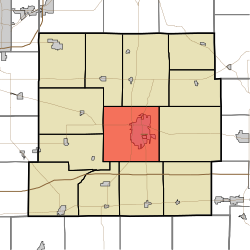 Location in Henry County | |
| Coordinates: 39°55′02″N 85°23′08″W / 39.91722°N 85.38556°WCoordinates: 39°55′02″N 85°23′08″W / 39.91722°N 85.38556°W | |
| Country | United States |
| State | Indiana |
| County | Henry |
| Government | |
| • Type | Indiana township |
| Area | |
| • Total | 36.9 sq mi (96 km2) |
| • Land | 36.38 sq mi (94.2 km2) |
| • Water | 0.52 sq mi (1.3 km2) 1.41% |
| Elevation | 1,020 ft (311 m) |
| Population (2010) | |
| • Total | 22,560 |
| • Density | 620.1/sq mi (239.4/km2) |
| GNIS feature ID | 0453407 |

Henry Township is one of thirteen townships in Henry County, Indiana, United States. As of the 2010 census, its population was 22,560 and it contained 10,863 housing units.[1]
Geography[]
According to the 2010 census, the township has a total area of 36.9 square miles (96 km2), of which 36.38 square miles (94.2 km2) (or 98.59%) is land and 0.52 square miles (1.3 km2) (or 1.41%) is water.[1] The streams of Baker Branch, Boulder Run, Castle Run, Dark Run, Elliott Cemetery Run, Elliott Run, Grove Run, Hillcrest Brook, Little Blue River, Memorial Creek, Mound Run, Penns Run, Pink Creek, Saint Creek, Saint Johns Drain, Sky Run, Sugar Drain, Suncrest Brook, West Leg Westwood Run, Westwood Run and Wood Brook run through this township.
Cities and towns[]
- New Castle (the county seat)
Unincorporated towns[]
(This list is based on USGS data and may include former settlements.)
Adjacent townships[]
- Prairie Township (north)
- Liberty Township (east)
- Franklin Township (south)
- Spiceland Township (southwest)
- Greensboro Township (west)
- Harrison Township (west)
- Jefferson Township (northwest)
Cemeteries[]
The township contains three cemeteries: Elliott, Saint Johns and South Mound.
Major highways[]
Airports and landing strips[]
- New Castle Municipal Airport
References[]
- "Henry Township, Henry County, Indiana". Geographic Names Information System. United States Geological Survey. Retrieved 2009-09-24.
- United States Census Bureau cartographic boundary files
- ^ a b "Population, Housing Units, Area, and Density: 2010 - County -- County Subdivision and Place -- 2010 Census Summary File 1". United States Census. Archived from the original on 2020-02-12. Retrieved 2013-05-10.
External links[]
Municipalities and communities of Henry County, Indiana, United States | ||
|---|---|---|
| City | ||
| Towns | ||
| Townships | ||
| Unincorporated communities | ||
| Footnotes | ‡This populated place also has portions in an adjacent county or counties | |
| ||
- Townships in Henry County, Indiana
- Townships in Indiana