Heritage Field Airport
Heritage Field | |||||||||||
|---|---|---|---|---|---|---|---|---|---|---|---|
| Summary | |||||||||||
| Airport type | Public use | ||||||||||
| Owner | Limerick Aviation LP | ||||||||||
| Operator | PennAirways, INC | ||||||||||
| Serves | Pottstown, Pennsylvania | ||||||||||
| Location | Limerick Township | ||||||||||
| Elevation AMSL | 309 ft / 94 m | ||||||||||
| Coordinates | 40°14′22″N 075°33′24″W / 40.23944°N 75.55667°WCoordinates: 40°14′22″N 075°33′24″W / 40.23944°N 75.55667°W | ||||||||||
| Website | www.heritagefield.org | ||||||||||
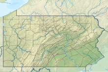
| Map | |||||||||||
 PTW Location of airport in Pennsylvania | |||||||||||
| Runways | |||||||||||
| |||||||||||
| Statistics (2011) | |||||||||||
| |||||||||||
Heritage Field (IATA: PTW[2], ICAO: KPTW, FAA LID: PTW) is a public use airport in Montgomery County, Pennsylvania, United States.[1] It is located three nautical miles (6 km) east of Pottstown,[1] in Limerick Township. The airport is privately owned by Limerick Aviation LP.[1]
Previously known as Pottstown Limerick Airport, the airport was sold in 2009 by its former owner, the Exelon Generation Company, which also owns the nearby Limerick Nuclear Power Plant.[3][4] It is now referred as Heritage Field on the local UNICOM.
This is included in the National Plan of Integrated Airport Systems for 2011–2015, which categorized it as a general aviation reliever airport.[5]
Facilities and aircraft[]
Heritage Field covers an area of 220 acres (89 ha) at an elevation of 309 feet (94 m) above mean sea level. It has one runway designated 10/28 with an asphalt surface measuring 3,371 by 75 feet (1,027 x 23 m).[1]
Penn Airways is a fixed-base operator located on the field.
For the 12-month period ending November 3, 2011, the airport had 37,217 aircraft operations, an average of 101 per day: 83% general aviation, 17% air taxi, and <1% military. At that time there were 91 aircraft based at this airport: 86% single-engine, 9% multi-engine, 2% jet, 1% helicopter, 1% glider, and 1% ultralight.[1]
References[]
- ^ a b c d e f FAA Airport Form 5010 for PTW PDF. Federal Aviation Administration. Effective May 31, 2012.
- ^ "IATA Airport Code Search (PTW: Pottstown/Limerick)". International Air Transport Association. Retrieved December 12, 2012.
- ^ "Transfer of Pottstown-Limerick Airport NPDES Permit" (PDF). Nuclear Regulatory Commission. May 15, 2009.[permanent dead link]
- ^ "KPTW – Pottstown Limerick Airport". FAA data republished by AirNav. June 3, 2010. Archived from the original on July 10, 2010.
- ^ "2011–2015 NPIAS Report, Appendix A" (PDF). National Plan of Integrated Airport Systems. Federal Aviation Administration. October 4, 2010. Archived from the original (PDF, 2.03 MB) on September 27, 2012.
External links[]
- Pottstown Aircraft Owners & Pilots
- History of Pottstown Limerick Airport
- Pottstown Limerick Airport (PTW) at PennDOT Bureau of Aviation
- Aerial photo as of February 2002 from USGS The National Map via MSR Maps
- FAA Terminal Procedures for PTW, effective December 2, 2021
- Resources for this airport:
- FAA airport information for PTW
- AirNav airport information for KPTW
- ASN accident history for PTW
- FlightAware airport information and live flight tracker
- NOAA/NWS weather observations: current, past three days
- SkyVector aeronautical chart, Terminal Procedures
- Airports in Pennsylvania
- Transportation buildings and structures in Montgomery County, Pennsylvania

