Hialeah Gardens, Florida
Hialeah Gardens | |
|---|---|
| City of Hialeah Gardens | |
 Seal | |
 Location in Miami-Dade County and the state of Florida | |
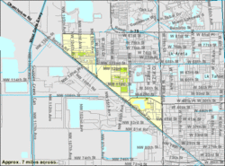 U.S. Census Bureau map showing city limits prior to the most recent annexation | |
| Coordinates: 25°52′42.03″N 80°20′53.06″W / 25.8783417°N 80.3480722°WCoordinates: 25°52′42.03″N 80°20′53.06″W / 25.8783417°N 80.3480722°W | |
| Country | |
| State | |
| County | |
| Incorporated | December 1, 1948 |
| Government | |
| • Type | Council-Mayor |
| • Mayor | Yioset De La Cruz |
| • Chairman | Luciano "Lucky" Garcia |
| • Councilmembers | Jorge Gutierrez, Elmo L. Urra, Vice Chairman Rolando "Roly" Piña, and Finance Chairman Jorge A. Merida |
| • City Manager | Mayor Yioset De La Cruz |
| • City Clerk | Maria L. Joffee |
| Area | |
| • City | 3.67 sq mi (9.51 km2) |
| • Land | 3.22 sq mi (8.34 km2) |
| • Water | 0.45 sq mi (1.16 km2) 2.78% |
| Elevation | 7 ft (2 m) |
| Population (2010) | |
| • City | 21,744 |
| • Estimate (2019)[4] | 23,474 |
| • Density | 7,285.54/sq mi (2,813.02/km2) |
| • Metro | 5,422,200 |
| Time zone | UTC-5 (EST) |
| • Summer (DST) | UTC-4 (EDT) |
| Zip Codes | 33018, 33178 |
| Area code(s) | 305, 786 |
| FIPS code | 12-30025[2] |
| GNIS feature ID | 0305060[3] |
| Website | http://www.cityofhialeahgardens.com/ |

Hialeah Gardens is a city in Miami-Dade County, Florida, United States. The population was 19,297 at the 2000 census. As of 2010, the population recorded by the U.S. Census Bureau is 21,744, with a population density of 6690.1 per mi2, made up of mostly single story development.
History[]
The municipality sprouted from humble beginnings at Walter C. Ohlerts Tourist Camp. By way of 26 unanimous votes, the town of Hialeah Gardens achieved incorporation in December 1948.
In February 1949, Hialeah Gardens adopted its first building code, its first traffic ordinance, and the first laws regarding hunting. Hialeah Gardens served mainly as a rural community in which one of its main industries was raising horses. This existed until 1968 when the city adopted an aggressive land use and zoning master plan to lead the growth of the city. Only a small number of small businesses existed along the Okeechobee Road corridor. The city's close proximity to major roadways, such as Okeechobee Road (U.S. Route 27 / State Road 25) and the Palmetto Expressway (State Road 826), provided opportunity for Hialeah Gardens to become one of the fastest growing municipalities in the county.
Geography[]
Hialeah Gardens is located at 25°52′42″N 80°20′53″W / 25.87833°N 80.34806°W (25.878342, -80.348072).[5]
According to the United States Census Bureau, the city has a total area of 2.5 square miles (6.5 km2). 2.5 square miles (6.5 km2) of it is land and 0.1 square miles (0.26 km2) of it (2.78%) is water.
Surrounding areas[]
- Unincorporated Miami-Dade County, Hialeah
- Unincorporated Miami-Dade County


 Hialeah
 - Unincorporated Miami-Dade County, Medley

 Hialeah
 - Medley


 Hialeah
 - Medley
Demographics[]
| Historical population | |||
|---|---|---|---|
| Census | Pop. | %± | |
| 1950 | 121 | — | |
| 1960 | 172 | 42.1% | |
| 1970 | 492 | 186.0% | |
| 1980 | 2,700 | 448.8% | |
| 1990 | 7,713 | 185.7% | |
| 2000 | 19,297 | 150.2% | |
| 2010 | 21,744 | 12.7% | |
| 2019 (est.) | 23,474 | [4] | 8.0% |
| U.S. Decennial Census[6] | |||
| Hialeah Gardens Demographics | |||
|---|---|---|---|
| 2010 Census | Hialeah Gardens | Miami-Dade County | Florida |
| Total population | 21,744 | 2,496,435 | 18,801,310 |
| Population, percent change, 2000 to 2010 | +12.7% | +10.8% | +17.6% |
| Population density | 6,690.1/sq mi | 1,315.5/sq mi | 350.6/sq mi |
| White or Caucasian (including White Hispanic) | 92.9% | 73.8% | 75.0% |
| (Non-Hispanic White or Caucasian) | 4.1% | 15.4% | 57.9% |
| Black or African-American | 2.2% | 18.9% | 16.0% |
| Hispanic or Latino (of any race) | 94.9% | 65.0% | 22.5% |
| Asian | 0.7% | 1.5% | 2.4% |
| Native American or Native Alaskan | 0.1% | 0.2% | 0.4% |
| Pacific Islander or Native Hawaiian | 0.0% | 0.0% | 0.1% |
| Two or more races (Multiracial) | 1.4% | 2.4% | 2.5% |
| Some Other Race | 2.7% | 3.2% | 3.6% |
As of 2010, there were 6,629 households, out of which 3.6% were vacant. In 2000, 47.5% had children under the age of 18 living with them, 64.7% were married couples living together, 15.7% had a female householder with no husband present, and 13.0% were non-families. 9.7% of all households were made up of individuals, and 4.7% had someone living alone who was 65 years of age or older. The average household size was 3.38 and the average family size was 3.56.
In 2000, the city population was spread out, with 27.7% under the age of 18, 8.1% from 18 to 24, 32.9% from 25 to 44, 20.9% from 45 to 64, and 10.5% who were 65 years of age or older. The median age was 34 years. For every 100 females, there were 92.9 males. For every 100 females age 18 and over, there were 88.1 males.
In 2000, the median income for a household in the city was $38,858, and the median income for a family was $39,804. Males had a median income of $25,540 versus $20,862 for females. The per capita income for the city was $14,043. About 10.9% of families and 13.3% of the population were below the poverty line, including 16.4% of those under age 18 and 21.0% of those age 65 or over.
As of 2000, Hialeah Gardens has the highest percentage of Spanish-speakers of any city in United States (neighboring Hialeah is second). As of 2000, 95.69% of the population spoke Spanish at home, while those who spoke only English made up 4.31% of the population.[7]
As of 2000, Hialeah Gardens had the eighth highest percentage of Cuban residents in the US, with 54.31% of the population.[8] It had the fourth highest percentage of Nicaraguan residents in the US, at 4.87% of the city's population,[9] and the twenty-fourth highest percentage of Colombian residents in the US, at 4.62% of its population.[10] It also had the forty-third most Dominicans in the US, at 2.86%,[11] while it had the thirty-seventh highest percentage of Hondurans, at 1.16% of all residents (tied with North Atlanta, Georgia and Conroe, Texas.)[12]
Education[]
This section does not cite any sources. (July 2019) |
Miami-Dade County Public Schools serves Hialeah Gardens.
From 2007 to 2009 construction began on 3 new schools in the Area along Hialeah Gardens Blvd and Okeechobee. West Hialeah Gardens Elementary School opened in the 2007–2008 school year and was used to Alleviate nearby Hialeah Gardens Elementary School and Ernest R Graham Elementary School. Hialeah Gardens Middle opened in 2008–2009 school year to alleviate Jose Marti Middle School in neighboring West Hialeah as well as Mater Academy Middle School and Youth Co-Op Charter School. Hialeah Gardens High was opened in the Fall of 2009 to alleviate Barbara Goleman Senior High in Miami Lakes
Hialeah Gardens High School serves Hialeah Gardens.
Mater Academy Middle/High School also serves the Hialeah Gardens area
Notable residents[]
- Albert Almora — Baseball player for the New York Mets
- Manny Machado — Baseball player for the San Diego Padres
References[]
- ^ "2019 U.S. Gazetteer Files". United States Census Bureau. Retrieved July 2, 2020.
- ^ "U.S. Census website". United States Census Bureau. Retrieved January 31, 2008.
- ^ "US Board on Geographic Names". United States Geological Survey. October 25, 2007. Retrieved January 31, 2008.
- ^ Jump up to: a b "Population and Housing Unit Estimates". United States Census Bureau. May 24, 2020. Retrieved May 27, 2020.
- ^ "US Gazetteer files: 2010, 2000, and 1990". United States Census Bureau. February 12, 2011. Retrieved April 23, 2011.
- ^ "Census of Population and Housing". Census.gov. Retrieved June 4, 2015.
- ^ "MLA Data Center Results of Hialeah Gardens, FL". Modern Language Association. Retrieved October 30, 2007.
- ^ "Ancestry Map of Cuban Communities". Epodunk.com. Retrieved October 30, 2007.
- ^ "Ancestry Map of Nicaraguan Communities". Epodunk.com. Archived from the original on October 17, 2010. Retrieved October 30, 2007.
- ^ "Ancestry Map of Colombian Communities". Epodunk.com. Retrieved October 30, 2007.
- ^ "Ancestry Map of Dominican Communities". Epodunk.com. Archived from the original on October 17, 2010. Retrieved October 30, 2007.
- ^ "Ancestry Map of Honduran Communities". Epodunk.com. Archived from the original on October 17, 2010. Retrieved October 30, 2007.
External links[]
| Wikimedia Commons has media related to Hialeah Gardens, Florida. |
- City of Hialeah Gardens Official City Website
| show Municipalities and communities of Miami-Dade County, Florida, United States |
|---|

| show Greater Miami Area |
|---|
| show |
|---|

| show Authority control |
|---|
- Cities in Miami-Dade County, Florida
- Cities in Florida
- Hispanic and Latino American culture in Florida
- Cities in Miami metropolitan area
- Populated places established in 1948
- 1948 establishments in Florida