Palmetto Estates, Florida
Palmetto Estates, Florida | |
|---|---|
 | |
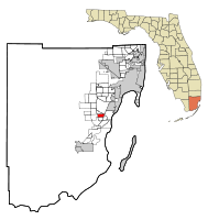 Location in Miami-Dade County and the state of Florida | |
 U.S. Census Bureau map showing CDP boundaries | |
| Coordinates: 25°37′11″N 80°21′42″W / 25.61972°N 80.36167°WCoordinates: 25°37′11″N 80°21′42″W / 25.61972°N 80.36167°W | |
| Country | |
| State | |
| County | Miami-Dade |
| Area | |
| • Total | 2.21 sq mi (5.71 km2) |
| • Land | 2.16 sq mi (5.59 km2) |
| • Water | 0.05 sq mi (0.12 km2) |
| Elevation | 10 ft (3 m) |
| Population (2020) | |
| • Total | 13,498 |
| • Density | 6,254.87/sq mi (2,414.69/km2) |
| Time zone | UTC-5 (Eastern (EST)) |
| • Summer (DST) | UTC-4 (EDT) |
| FIPS code | 12-54300[2] |
| GNIS feature ID | 1867184[3] |

Palmetto Estates is a census-designated place (CDP) in Miami-Dade County, Florida, United States. The population was 13,675 at the 2000 census.
Geography[]
Palmetto Estates is located at 25°37′11″N 80°21′42″W / 25.61972°N 80.36167°W (25.619782, -80.361752).[4]
According to the United States Census Bureau, the CDP has a total area of 2.2 square miles (5.7 km2), of which, 2.1 square miles (5.4 km2) of it is land and 0.04 square miles (0.10 km2) of it (0.93%) is water.
Demographics[]
| Historical population | |||
|---|---|---|---|
| Census | Pop. | %± | |
| 1980 | 11,116 | — | |
| 1990 | 12,293 | 10.6% | |
| 2000 | 13,675 | 11.2% | |
| 2020 | 13,498 | — | |
| source:[5] | |||
2020 census[]
| Race | Number | Percentage |
|---|---|---|
| White (NH) | 1,206 | 8.93% |
| Black or African American (NH) | 3,873 | 28.69% |
| Native American or Alaska Native (NH) | 17 | 0.13% |
| Asian (NH) | 326 | 2.42% |
| Pacific Islander (NH) | 1 | 0.01% |
| Some Other Race (NH) | 152 | 1.13% |
| Mixed/Multi-Racial (NH) | 338 | 2.5% |
| Hispanic or Latino | 7,585 | 56.19% |
| Total | 13,498 |
As of the 2020 United States census, there were 13,498 people, 3,881 households, and 3,176 families residing in the CDP.
2000 census[]
As of the census[2] of 2000, there were 13,675 people, 4,054 households, and 3,344 families residing in the CDP. The population density was 6,437.3 people per square mile (2,490.5/km2). There were 4,187 housing units at an average density of 1,971.0/sq mi (762.6/km2). The racial makeup of the CDP was 37.68% White (16.9% were Non-Hispanic White,)[7] 48.77% African American, 0.21% Native American, 3.06% Asian, 0.01% Pacific Islander, 4.82% from other races, and 5.44% from two or more races. Hispanic or Latino of any race were 28.91% of the population.
There were 4,054 households, out of which 45.8% had children under the age of 18 living with them, 55.9% were married couples living together, 20.7% had a female householder with no husband present, and 17.5% were non-families. 13.7% of all households were made up of individuals, and 3.5% had someone living alone who was 65 years of age or older. The average household size was 3.35 and the average family size was 3.66.
In the CDP, the population was spread out, with 31.2% under the age of 18, 9.1% from 18 to 24, 30.2% from 25 to 44, 22.1% from 45 to 64, and 7.5% who were 65 years of age or older. The median age was 33 years. For every 100 females, there were 92.6 males. For every 100 females age 18 and over, there were 88.8 males.
The median income for a household in the CDP was $48,338, and the median income for a family was $49,565. Males had a median income of $31,440 versus $26,921 for females. The per capita income for the CDP was $16,701. About 7.8% of families and 10.9% of the population were below the poverty line, including 13.3% of those under age 18 and 11.7% of those age 65 or over.
As of 2000, speakers of English as a first language accounted for 65.94% of residents, while Spanish made up 29.75%, French Creole was at 2.08%, and French was the mother tongue of 0.88% of the population.[8]
References[]
- ^ "2020 U.S. Gazetteer Files". United States Census Bureau. Retrieved October 31, 2021.
- ^ a b "U.S. Census website". United States Census Bureau. Retrieved 2008-01-31.
- ^ "US Board on Geographic Names". United States Geological Survey. 2007-10-25. Retrieved 2008-01-31.
- ^ "US Gazetteer files: 2010, 2000, and 1990". United States Census Bureau. 2011-02-12. Retrieved 2011-04-23.
- ^ "CENSUS OF POPULATION AND HOUSING (1790-2000)". U.S. Census Bureau. Retrieved 2010-07-17.
- ^ "Explore Census Data". data.census.gov. Retrieved 2022-02-09.
- ^ "Demographics of Palmetto Estates, FL". MuniNetGuide.com. Retrieved 2007-11-07.
- ^ "MLA Data Center Results of Palmetto Estates, FL". Modern Language Association. Retrieved 2007-11-07.

Tallahassee (capital) | ||
| Topics |
| |
| History |
| |
| Geography |
| |
| Major hurricanes |
| |
| Society |
| |
| Regions |
| |
| Metro areas |
| |
| Largest cities |
| |
| Counties |
| |

- Census-designated places in Miami-Dade County, Florida
- Census-designated places in Florida