Hamilton County, Florida
Hamilton County | |
|---|---|
U.S. county | |
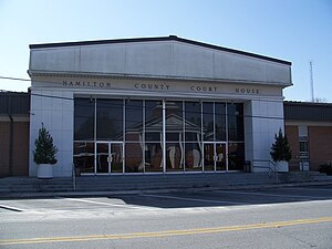 Hamilton County Courthouse in Jasper | |
 Seal | |
 Location within the U.S. state of Florida | |
 Florida's location within the U.S. | |
| Coordinates: 30°29′N 82°57′W / 30.49°N 82.95°W | |
| Country | |
| State | |
| Founded | December 26, 1827 |
| Named for | Alexander Hamilton |
| Seat | Jasper |
| Largest city | Jasper |
| Area | |
| • Total | 519 sq mi (1,340 km2) |
| • Land | 514 sq mi (1,330 km2) |
| • Water | 5.3 sq mi (14 km2) 1.0%% |
| Population | |
| • Estimate (2019) | 14,428 |
| • Density | 29/sq mi (11/km2) |
| Time zone | UTC−5 (Eastern) |
| • Summer (DST) | UTC−4 (EDT) |
| Congressional district | 5th |
| Website | www |

Hamilton County is a county located in the north central portion of the U.S. state of Florida. As of the 2010 census, the population was 14,799.[1] Its county seat is Jasper.[2]
History[]
Hamilton County was created in 1827[3] from portions of Jefferson County. It was named for Alexander Hamilton, first United States Secretary of the Treasury.[4]
Geography[]
According to the U.S. Census Bureau, the county has a total area of 519 square miles (1,340 km2), of which 514 square miles (1,330 km2) is land and 5.3 square miles (14 km2) (1.0%) is water.[5] It is the only county in Florida entirely north of Interstate 10.[6]
Adjacent counties[]
- Echols County, Georgia - north
- Columbia County - east
- Suwannee County - south
- Madison County - west
- Lowndes County, Georgia - northwest
Major Highway[]
 Interstate 75
 U.S. Route 41
 U.S. Route 129
 State Road 6
 State Road 100
 State Road 136
 State Road 143
Politics[]

Demographics[]
| Historical population | |||
|---|---|---|---|
| Census | Pop. | %± | |
| 1830 | 553 | — | |
| 1840 | 1,464 | 164.7% | |
| 1850 | 2,511 | 71.5% | |
| 1860 | 4,154 | 65.4% | |
| 1870 | 5,749 | 38.4% | |
| 1880 | 6,790 | 18.1% | |
| 1890 | 8,507 | 25.3% | |
| 1900 | 11,881 | 39.7% | |
| 1910 | 11,825 | −0.5% | |
| 1920 | 9,873 | −16.5% | |
| 1930 | 9,454 | −4.2% | |
| 1940 | 9,778 | 3.4% | |
| 1950 | 8,981 | −8.2% | |
| 1960 | 7,705 | −14.2% | |
| 1970 | 7,787 | 1.1% | |
| 1980 | 8,761 | 12.5% | |
| 1990 | 10,930 | 24.8% | |
| 2000 | 13,327 | 21.9% | |
| 2010 | 14,799 | 11.0% | |
| 2019 (est.) | 14,428 | [8] | −2.5% |
| U.S. Decennial Census[9] 1790-1960[10] 1900-1990[11] 1990-2000[12] 2010-2019[1] | |||
As of the census[13] of 2000, there were 13,327 people, 4,161 households, and 2,995 families residing in the county. The population density was 26 people per square mile (10/km2). There were 4,966 housing units at an average density of 10 per square mile (4/km2). The racial makeup of the county was 58.79% White, 37.72% Black or African American, 0.42% Native American, 0.20% Asian, 0.02% Pacific Islander, 1.69% from other races, and 1.17% from two or more races. 6.36% of the population were Hispanic or Latino of any race.
There were 4,161 households, out of which 32.90% had children under the age of 18 living with them, 50.30% were married couples living together, 16.80% had a female householder with no husband present, and 28.00% were non-families. 24.10% of all households were made up of individuals, and 9.10% had someone living alone who was 65 years of age or older. The average household size was 2.60 and the average family size was 3.07.
In the county, the population was spread out, with 23.50% under the age of 18, 10.80% from 18 to 24, 31.80% from 25 to 44, 22.80% from 45 to 64, and 11.20% who were 65 years of age or older. The median age was 35 years. For every 100 females there were 135.00 males. For every 100 females age 18 and over, there were 145.40 males.
The median income for a household in the county was $25,638, and the median income for a family was $30,677. Males had a median income of $26,999 versus $20,552 for females. The per capita income for the county was $10,562. About 21.70% of families and 26.00% of the population were below the poverty line, including 35.70% of those under age 18 and 16.10% of those age 65 or over.
Education[]


Hamilton County School District operates public schools in the county. The sole high school is Hamilton County High School.
Hamilton County is served by the Suwannee River Regional Library System, which contains eight branches and also serves Madison and Suwannee counties.
Libraries in Hamilton County include:
- Jasper
- Jennings
- White Springs
Communities[]
City[]
Towns[]
Unincorporated communities[]
Genoa Facil
See also[]
References[]
- ^ Jump up to: a b "State & County QuickFacts". United States Census Bureau. Retrieved February 14, 2014.[permanent dead link]
- ^ "Find a County". National Association of Counties. Retrieved June 7, 2011.
- ^ Publications of the Florida Historical Society. Florida Historical Society. 1908. p. 31.
- ^ Gannett, Henry (1905). The Origin of Certain Place Names in the United States. Govt. Print. Off. p. 147.
- ^ "US Gazetteer files: 2010, 2000, and 1990". United States Census Bureau. February 12, 2011. Retrieved April 23, 2011.
- ^ https://www.google.com/maps/place/Hamilton+County,+FL/@30.4761319,-83.2577017,10z/data=!3m1!4b1!4m5!3m4!1s0x88ef44d1f1b4c58b:0xb39fbbf379a16d3d!8m2!3d30.4755958!4d-82.9501558
- ^ Leip, David. "Dave Leip's Atlas of U.S. Presidential Elections". uselectionatlas.org. Retrieved June 15, 2018.
- ^ "Population and Housing Unit Estimates". Retrieved May 21, 2020.
- ^ "U.S. Decennial Census". United States Census Bureau. Retrieved June 14, 2014.
- ^ "Historical Census Browser". University of Virginia Library. Retrieved June 14, 2014.
- ^ "Population of Counties by Decennial Census: 1900 to 1990". United States Census Bureau. Retrieved June 14, 2014.
- ^ "Census 2000 PHC-T-4. Ranking Tables for Counties: 1990 and 2000" (PDF). United States Census Bureau. Retrieved June 14, 2014.
- ^ "U.S. Census website". United States Census Bureau. Retrieved May 14, 2011.
External links[]
| Wikimedia Commons has media related to Hamilton County, Florida. |
Government links/Constitutional offices[]
- Hamilton County Board of County Commissioners
- Hamilton County Supervisor of Elections
- Hamilton County Property Appraiser
- Hamilton County Sheriff's Office
- Hamilton County Tax Collector
Special districts[]
Judicial branch[]
- Hamilton County Clerk of Courts
- Public Defender, 3rd Judicial Circuit of Florida serving Columbia, Dixie, Hamilton, Lafayette, Madison, Suwannee, and Taylor Counties
- Office of the State Attorney, 3rd Judicial Circuit of Florida
- Circuit and County Court for the 3rd Judicial Circuit of Florida
Tourism links[]
| show Places adjacent to Hamilton County, Florida |
|---|
| show Municipalities and communities of Hamilton County, Florida, United States |
|---|


Coordinates: 30°29′N 82°57′W / 30.49°N 82.95°W
| show Authority control |
|---|
- Florida counties
- Hamilton County, Florida
- 1827 establishments in Florida Territory
- Populated places established in 1827
- North Florida