Monroe County, Florida
Parts of this article (those related to rebuilding following hurricanes, specifically the 2017 Hurricane Irma, and developing discussions of urban resilience, climate resilience planning and the facts about the mainland population) need to be updated. (September 2017) |
Monroe County | |
|---|---|
County | |
| County of Monroe | |
 The Monroe County Courthouse in Key West | |
 Flag  Seal | |
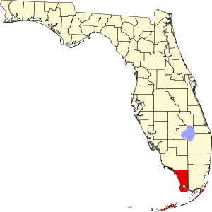 Location within the U.S. state of Florida | |
 Florida's location within the U.S. | |
| Coordinates: 25°07′N 81°09′W / 25.12°N 81.15°W | |
| Country | |
| State | |
| Founded | July 3, 1823 |
| Named for | James Monroe |
| Seat | Key West |
| Largest city | Key West |
| Area | |
| • Total | 3,738 sq mi (9,680 km2) |
| • Land | 983 sq mi (2,550 km2) |
| • Water | 2,754 sq mi (7,130 km2) 73.7%% |
| Population | |
| • Estimate (2019) | 74,228 |
| • Density | 74/sq mi (29/km2) |
| Time zone | UTC−5 (Eastern) |
| • Summer (DST) | UTC−4 (EDT) |
| Congressional district | 26th |
| Website | www |

Monroe County is a county in the state of Florida. As of the 2010 census, the population was 73,090.[1] Its county seat is Key West.[2] Monroe County includes the islands of the Florida Keys and comprises the Key West Micropolitan Statistical Area. Over 99.9% of the county's population lives on the Florida Keys. The mainland, which is part of the Everglades, comprises 87% of the county's land area and is virtually uninhabited with only 19 people in total.[3]
History[]
Monroe County was created in 1823. It was named for James Monroe, the fifth president of the United States from 1817 to 1825.[4]
The Monroe County Public Library was South Florida's first public library.[5][6][7] By September 1892, the new library was established.[5][6][7] The original Key West library had 1,200 volumes, and it was funded by the dues and fees of its members.[7]
The Key West Library Association rescinded its charge of the library in 1896, and the library was run by various civic groups for the next nineteen years.[6] In 1915, the Key West Women's Association took charge of the library. This club ran the library for 44 years. Through fundraising activities, this group was able save enough money to build a new library that opened in November 1959.[6] The new library was the official Monroe County Public Library, and it serves as the Key West branch of the Monroe County Public Library.
Geography[]
According to the U.S. Census Bureau, the county has a total area of 3,738 square miles (9,680 km2), of which 983 square miles (2,550 km2) (26.3%) is land and 2,754 square miles (7,130 km2) (73.7%) is water.[8] It is the largest county in Florida by total area.
More than 99.9 percent of the Monroe County population lives in the island chain known as the Florida Keys.
Two thirds of the large area in what local residents call "mainland Monroe" is uninhabited by virtue of being part of the Everglades National Park, and the remainder by the Big Cypress National Preserve in the northeastern interior. The area, officially named Cape Sable Census County Division, is virtually uninhabited. As of the census of 2000, this area had 86.9 percent of the county's land area (866.25 out of 983 sq mi (2,546 km2)), but only 0.075 percent of its population (60 out of 79,589). The Census Bureau defines this area as Census Tract 9701 of Monroe County, Florida. With a population density of only 0.0693/sq mi (0.0267/km2), if it were a separate county or county-equivalent, only the Yukon-Koyukuk Census Area of central Alaska would have a lower population density out of all U.S. counties.[9]
The only three populated places appearing on detailed maps and in the USGS geographic name database are Flamingo, Pinecrest, (not to be confused with much larger Pinecrest of neighboring Miami-Dade County), and . Flamingo, on the south coast and at the end of State Road 9336 (Flamingo Lodge Highway), is the location of the Flamingo Lodge and the Flamingo Ranger Station (with Visitor Center & Marina). 7 mi (11 km) northeast on the highway is the West Lake Trail (station). Pinecrest, located in the northern interior of the county (in the Big Cypress National Preserve) on Loop Road (given that name since it forms a loop with U.S. Highway 41 further north), hosts the Loop Road Education Center. Trail City is 4 mi (6 km) west of Pinecrest on Loop Road. Loop Road can be found on most maps as CR 94, although the roadway no longer has a numbered designation and is now managed by the National Park Service.
Between the south coast of Florida's mainland and the Florida Keys is Florida Bay, which is encompassed by the Everglades National Park and contains numerous islets or keys.
Adjacent counties[]
- Collier County – north (on mainland)
- Miami-Dade County – east (on mainland) and north (over water)
National protected areas[]
- Bahia Honda State Park
- Big Cypress National Preserve
- Crocodile Lake National Wildlife Refuge
- Curry Hammock State Park
- Dagny Johnson Key Largo Hammock Botanical State Park
- Dry Tortugas National Park
- Everglades National Park
- Fort Zachary Taylor Historic State Park
- Great White Heron National Wildlife Refuge
- Indian Key State Historic Site
- John Pennekamp Coral Reef State Park
- Key West National Wildlife Refuge
- Lignumvitae Key Botanical State Park
- Long Key State Park
- National Key Deer Refuge
- San Pedro Underwater Archaeological Preserve State Park
- Windley Key Fossil Reef Geological State Park
Demographics[]
| Historical population | |||
|---|---|---|---|
| Census | Pop. | %± | |
| 1830 | 517 | — | |
| 1840 | 688 | 33.1% | |
| 1850 | 2,645 | 284.4% | |
| 1860 | 2,913 | 10.1% | |
| 1870 | 5,657 | 94.2% | |
| 1880 | 10,940 | 93.4% | |
| 1890 | 18,786 | 71.7% | |
| 1900 | 18,006 | −4.2% | |
| 1910 | 21,563 | 19.8% | |
| 1920 | 19,550 | −9.3% | |
| 1930 | 13,624 | −30.3% | |
| 1940 | 14,078 | 3.3% | |
| 1950 | 29,957 | 112.8% | |
| 1960 | 47,921 | 60.0% | |
| 1970 | 52,586 | 9.7% | |
| 1980 | 63,188 | 20.2% | |
| 1990 | 78,024 | 23.5% | |
| 2000 | 79,589 | 2.0% | |
| 2010 | 73,090 | −8.2% | |
| 2019 (est.) | 74,228 | [10] | 1.6% |
| U.S. Decennial Census[11] 1790-1960[12] 1900-1990[13] 1990-2000[14] 2010-2019[1] | |||
As of the census[16] of 2010, there were 73,090 people, 32,629 households, and 18,219 families living in the county. The racial makeup of the county was 89.5% White (71.3% Non-Hispanic White), 5.7% Black or African American, 0.4% Native American, 1.1% Asian, 0.1% Pacific Islander, 1.4% from other races, and 1.8% from two or more races 20.6% of the population were Hispanic or Latino of any race.
As of the census[16] of 2000, there were 79,589 people, 35,086 households, and 20,384 families living in the county. The population density was 80 people per square mile (31/km2). There were 51,617 housing units at an average density of 52 per square mile (20/km2). The racial makeup of the county was 90.65% White, 4.77% Black or African American, 0.38% Native American, 0.83% Asian, 0.04% Pacific Islander, 1.55% from other races, and 1.78% from two or more races. 15.77% of the population were Hispanic or Latino of any race.
In 2005 Monroe County had a population that was 75.1% non-Hispanic white, 17.7% Latino, 5.4% African-American and 1.1% Asian.[17]
In 2000 there were 35,086 households, out of which 20.80% had children under the age of 18 living with them, 46.80% were married couples living together, 7.30% had a female householder with no husband present, and 41.90% were non-families. 28.80% of all households were made up of individuals, and 8.20% had someone living alone who was 65 years of age or older. The average household size was 2.23 and the average family size was 2.73.
In the county, the population was spread out, with 17.10% under the age of 18, 6.30% from 18 to 24, 31.10% from 25 to 44, 30.90% from 45 to 64, and 14.60% who were 65 years of age or older. The median age was 43 years. For every 100 females there were 113.90 males. For every 100 females age 18 and over, there were 114.80 males.
The median income for a household in the county was $42,283, and the median income for a family was $50,734. Males had a median income of $31,266 versus $25,709 for females. The per capita income for the county was $26,102. About 6.80% of families and 10.20% of the population were below the poverty line, including 11.80% of those under age 18 and 8.80% of those age 65 or over.
Languages[]
As of 2010, 77.57% spoke English as a first language, and 17.56% spoke Spanish, 0.96% spoke French Creole (mainly Haitian Creole), 0.74% spoke French, and 0.50% spoke Russian as their primary language. In total, 22.43% of the population spoke a main language other than English.[18]
Transportation[]
Airports[]
Major highways[]

 US 1 / SR 5 (Overseas Highway)
 SR A1A (Roosevelt Boulevard)
 CR 905 (Key Largo Drive)
 CR 905A (Card Sound Road)
Culture[]
This section does not cite any sources. (March 2021) |
Monroe County cultural organizations include the Key West Literary Seminar, The Studios of Key West, the Red Barn Theatre, Key West Symphony, Sculpture Key West, Fantasy Fest, the San Carlos Institute, Hemingway House and Museum, Customs House Museum, and Key West Art and Historical Society.
The Florida Keys Council for the Arts is the primary cultural umbrella for the Florida Keys, and serves the population from Key Largo to Key West. A non-profit local arts agency, it makes grants, operates the Monroe County Art in Public Places program, sponsors seminars, and manages the on-line cultural calendar for the region. It also manages the county's Tourism Development Council arts marketing grants and serves as a leading advocate for cultural tourism in lower Florida. In 1998, the Florida Keys Council of the Arts was designated by the Board of Monroe County Commissioners as the area's Local Arts Agency as provided by Florida Statute 286.011. Established in 1997 as the Monroe Council of the Arts Corporation. The name was changed to the Florida Keys Council of the Arts in 2001. Today the organization is the liaison among cultural organizations, all levels of government and the private sector in encouraging and promoting the arts throughout Monroe County. The council endeavors to make the arts a part of the fabric of daily life. From its inception through fiscal year end 2006, FKCA has awarded $433,916 in privately raised funds and grants to literary, visual and performing artists and cultural organizations. Add to that sum the Cultural Umbrella event funding, the South Florida Cultural Consortium Visual & Media Artists Fellowships and The Art in Public Places commissions, and the total distributed in the Keys cultural community through FKCA's efforts come to $2.5 million to date. The annual economic impact of the non-profit cultural community in the Keys is estimated at over $22 million. The Florida Keys Council of the Arts, a non-profit, 501 (c) (3) corporation in a public-private partnership with local county government since 1997 serves 76,329 local residents and three million visitors annually. A ten-member board of directors guides the council, assisted by three alternate directors, two directors Emeritus and twenty-five advisory board members.
Education[]
The Monroe County School District serves the county, as well as several private schools for primary and secondary education.
Florida Keys Community College is the primary college education provider with main campus in Key West, Florida. FKCC also operates two additional campuses in the Florida Keys; one in Marathon and another in Key Largo.
Government[]
Elections[]
Although Monroe County has voted mostly for the Democratic candidate since 1992, it is a competitive county in presidential elections; it was won by the Democratic Party by margins of 5% in 2008 and 0.5% in 2004 and 2012. Barack Obama was the first candidate for president to win a majority, 51.7%, of the vote since George H.W. Bush's Electoral College-landslide victory in 1988. In 2016 Donald Trump was the first Republican to carry the county in almost three decades winning 51% of its vote in the 2016 Election, by an even bigger margin than the 2008 election, which was a very notable shift--only to then widen that margin in the subsequent 2020 election.
Politics[]
On July 17, 2014, a county court judge ruled the state's ban on same sex marriage unconstitutional, ordering the county clerk of court to issue marriage licenses on July 22, 2014.
Libraries[]
The Monroe County Public Library system serves residents of the Florida Keys in five locations: Key West, Big Pine, Marathon, Key Largo, and Islamorada.[20]
The Monroe County Public Library provides various programs and services to the Monroe County community, including job finding tools. There is a program that preserves the history of the Keys for use by customers. In 2010 the library worked to digitize historical photographs of the Keys.[20][21]
Annual visitors cards can be purchased for $30. The library provides access to PCs with internet and word processing capabilities. The library also provides free Wi-Fi for all.[20]
The Monroe County Public Library is served by the Miami-Dade County subregional library of Florida Bureau of Braille and Talking Books Library.
Economy[]
54% of the people in the county work in the tourist industry. In 2016, tourism brought $2.7 billion to the county.[22]
Communities[]

Cities[]
- Key West (1)
- Marathon (2)
- Key Colony Beach (3)
- Layton (4)
Village[]
- Islamorada (5)
Census-designated places[]
- Stock Island (a)
- Big Coppitt Key (b)
- Cudjoe Key (c)
- Big Pine Key (d)
- Duck Key (e)
- Tavernier (f)
- Key Largo (g)
- North Key Largo (h)
Other unincorporated areas[]
- Flamingo (i)
- Bay Point (j)
- Sugarloaf Shores (k)
- Marquesas Keys (l)
- Bahia Honda Key (m)
- Everglades (n)
See also[]
References[]
- ^ Jump up to: a b "State & County QuickFacts". United States Census Bureau. Archived from the original on June 7, 2011. Retrieved June 15, 2014.
- ^ "Find a County". National Association of Counties. Retrieved June 7, 2011.
- ^ "Census Reporter Profile page for Census Tract 9800, Monroe, FL". U.S. Census Bureau. American Community Survey 5-year estimates. 2018. Retrieved March 30, 2020.
- ^ Publications of the Florida Historical Society. Florida Historical Society. 1908. p. 33.
- ^ Jump up to: a b Burke, J. W. (2004). The streets of Key West: A history through street names. Sarasota, FL: Pineapple Press, Inc.
- ^ Jump up to: a b c d Florida Department of State Division of Historical Resources, [1], 2013
- ^ Jump up to: a b c KeysNews.com, [2] Archived 2016-03-03 at the Wayback Machine, 2013, April 13
- ^ "US Gazetteer files: 2010, 2000, and 1990". United States Census Bureau. February 12, 2011. Retrieved April 23, 2011.
- ^ Bureau, U.S. Census. "U.S. Census website". United States Census Bureau. Retrieved March 15, 2018.
- ^ "Population and Housing Unit Estimates". Retrieved May 21, 2020.
- ^ "U.S. Decennial Census". United States Census Bureau. Retrieved June 15, 2014.
- ^ "Historical Census Browser". University of Virginia Library. Retrieved June 15, 2014.
- ^ "Population of Counties by Decennial Census: 1900 to 1990". United States Census Bureau. Retrieved June 15, 2014.
- ^ "Census 2000 PHC-T-4. Ranking Tables for Counties: 1990 and 2000" (PDF). United States Census Bureau. Retrieved June 15, 2014.
- ^ "U.S. Census Bureau QuickFacts: Monroe County, Florida". www.census.gov. Retrieved February 25, 2019.
- ^ Jump up to: a b "U.S. Census website". United States Census Bureau. Retrieved May 14, 2011.
- ^ Monroe County QuickFacts from the US Census Bureau Archived 2011-06-07 at the Wayback Machine
- ^ Modern Language Association for Monroe County, Florida, Census 2010
- ^ Leip, David. "Dave Leip's Atlas of U.S. Presidential Elections". uselectionatlas.org. Retrieved March 15, 2018.
- ^ Jump up to: a b c Monroe County Public Library, [3], 2010
- ^ Florida Keys Public Library Photostream, [4], 2013
- ^ Gomez, Alan (September 16, 2017). "Keys boat captains fear loss of income". USA Today. Melbourne, Florida. pp. 1B. Retrieved September 16, 2017.
External links[]
| Wikimedia Commons has media related to Monroe County, Florida. |
| show Places adjacent to Monroe County, Florida |
|---|
| show Municipalities and communities of Monroe County, Florida, United States |
|---|

| show |
|---|

Coordinates: 25°07′N 81°09′W / 25.12°N 81.15°W
| show Authority control |
|---|
- Florida counties
- Monroe County, Florida
- 1823 establishments in Florida Territory
- Populated places established in 1823
- Florida Keys