Goulds, Florida
Goulds, Florida | |
|---|---|
 Location in Miami-Dade County and the state of Florida | |
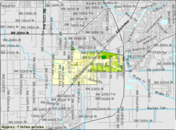 U.S. Census Bureau map showing CDP boundaries | |
| Coordinates: 25°33′39″N 80°23′0″W / 25.56083°N 80.38333°WCoordinates: 25°33′39″N 80°23′0″W / 25.56083°N 80.38333°W | |
| Country | |
| State | |
| County | Miami-Dade |
| Area | |
| • Total | 2.93 sq mi (7.58 km2) |
| • Land | 2.91 sq mi (7.53 km2) |
| • Water | 0.02 sq mi (0.05 km2) |
| Elevation | 10 ft (3 m) |
| Population (2020) | |
| • Total | 11,446 |
| • Density | 3,934.69/sq mi (1,519.21/km2) |
| Time zone | UTC-5 (Eastern (EST)) |
| • Summer (DST) | UTC-4 (EDT) |
| ZIP code | 33170 |
| Area code(s) | 305 |
| FIPS code | 12-26950[2] |
| GNIS feature ID | 0283239[3] |

Goulds is a census-designated place (CDP) in Miami-Dade County, within the U.S. state of Florida. The area was originally populated as the result of a stop on the Florida East Coast Railroad. The railroad depot was located near the current Southwest 224th Street. The community was named after its operator, Lyman Gould, who cut trees for railroad ties. As of the 2009 census, the population stood at 10,103.[4]
Geography[]
Goulds is located at 25°33′39″N 80°23′0″W / 25.56083°N 80.38333°W (25.560885, -80.383353).[5] According to the United States Census Bureau, the CDP has a total area of 3.0 square miles (7.8 km2), all of it land. Cauley Square Historic Village is notably located in Goulds.
History[]
The area that became Goulds was settled in 1900 by homesteaders. It received its name when the Florida East Coast Railway built a siding in 1903, operated by an employee of the railroad named Lyman Goulds. It was first known as Gould's Siding, and later shortened to Goulds. Many packing houses were built along Old Dixie Highway. Early on, Goulds had a reputation as a rough town, with several saloons serving itinerant field workers. Most of the packing houses were destroyed by a tornado in 1919, or the 1926 Miami Hurricane, but were rebuilt.[6] Today, Goulds is now a small community of African-Americans, sharing borders with the neighboring communities of South Miami Heights, Cutler Bay, Quail Heights, Redland, and Princeton.
Cauley Square Historic Village[]
Cauley Square Village, after its humble beginnings in 1903 as a shipping hub for tomatoes, is currently the last railroad village in Florida.[7] The commercial nature of the village was established by Mary Ann Ballard after the Great Depression, in an effort to keep the peaceful vintage aura the village brought to the area. It began with the opening of the Tea Room in 1979 and has since grown to include a multitude of stores for visitors to enjoy.[7] In the village one can currently find a mini perfume factory that sells hand-made perfumes, soaps, and creams; a Himalayan Salt room with Himalayan Salts imported from Pakistan, Spiritual shops, children painting classes, peaceful gardens, and many more.[8]
All the homes and buildings have been maintained since its original build in the 1900s, even the chapel contains original Bibles with notes from the original owner. This historic village is keen on its conservation of the original structure. Even though it has experienced many devastating hurricanes, the historic site has remained a resilient landmark in Gould's history; Frances Varela has stated "Hurricanes Andrew, Wilma and Katrina have nothing on Cauley Square”. [9]
Demographics[]
| Historical population | |||
|---|---|---|---|
| Census | Pop. | %± | |
| 2020 | 11,446 | — | |
2020 census[]
| Race | Number | Percentage |
|---|---|---|
| White (NH) | 508 | 4.44% |
| Black or African American (NH) | 4,446 | 38.84% |
| Native American or Alaska Native (NH) | 9 | 0.08% |
| Asian (NH) | 71 | 0.62% |
| Pacific Islander (NH) | 1 | 0.01% |
| Some Other Race (NH) | 60 | 0.52% |
| Mixed/Multi-Racial (NH) | 165 | 1.44% |
| Hispanic or Latino | 6,186 | 54.05% |
| Total | 11,446 |
As of the 2020 United States census, there were 11,446 people, 3,350 households, and 2,729 families residing in the CDP.
2009[]
As of the census of 2009, there were 10,103 people, 2,987 households, and 2,391 families residing in the CDP.[12] The population density was 2,514.5 people per square mile (972.2/km2). There were 2,367 housing units at an average density of 798.6/sq mi (308.8/km2). The racial makeup of the CDP was 39.1% White 55.2% African American, 0.2% Native American, 0.6% Asian, 0.01% Pacific Islander, 3.48% from other races, and 2.46% from two or more races. Hispanic or Latino of any race were 41.0% of the population.[12]
There were 2,987 households, out of which 42.4% had children under the age of 18 living with them, 35.5% were married couples living together, 35.5% had a female householder with no husband present, and 20.0% were non-families.[12] 20.0% of all households were made up of individuals, and 15.9% had someone living alone who was 65 years of age or older. The average household size was 3.36 and the average family size was 3.71.[12]
In the CDP, the population was spread out, with 35.7% under the age of 20, 14.2% from 20 to 29, 13.6% from 30 to 39, 27.3% from 40 to 64, and 9.0% who were 65 years of age or older.[12] The median age was 30 years old. The female population stood at 5,370 while for males at 4,733.[12]
The median income for a household in the CDP was $33,200, and the median income for a family was $35,374.[13] Males had a median income of $26,822 versus $25,265 for females.[13] The per capita income for the CDP was $12,259. About 31.2% of families and 37.8% of the population were below the poverty line, including 47.9% of those under age 18 and 27.4% of those age 65 or over.[13]
As of 2009, speakers of English as a first language accounted for 54.4% of residents, while Spanish made up 41.8%, and other languages were at 3.6% of the population.[14]
Education[]
The Miami-Dade County Public Schools district serves Goulds.
References[]
- ^ "2020 U.S. Gazetteer Files". United States Census Bureau. Retrieved October 31, 2021.
- ^ "U.S. Census website". United States Census Bureau. Retrieved 2008-01-31.
- ^ "US Board on Geographic Names". United States Geological Survey. 2007-10-25. Retrieved 2008-01-31.
- ^ "ACS Demographic and Housing Estimates". U.S. Census Bureau. Retrieved 2014-12-11.
- ^ "US Gazetteer files: 2010, 2000, and 1990". United States Census Bureau. 2011-02-12. Retrieved 2011-04-23.
- ^ Taylor, Jean (1985). Villages of South Dade. St. Petersburg, Fla: B. Kennedy. pp. 89–90. LCCN 88132899. OCLC 18906834.
- ^ a b Discovering vintage Miami: a guide to the city's timeless shops, hotels, restaurants & more. Florida: Globe Pequot Press. 2014. ISBN 9781493013999.
- ^ "Shops". Cauley Square. Retrieved 2020-12-04.
- ^ Monique, Madan (4 September 2016). "Cauley Square: the village that 'refuses to die'". Miami Herald. Retrieved 4 December 2020.
- ^ "Census of Population and Housing". Census.gov. Retrieved June 4, 2016.
- ^ "Explore Census Data". data.census.gov. Retrieved 2022-02-09.
- ^ a b c d e f "2010 Demographic Profile Data". U.S. Census Bureau. Retrieved 2014-12-11.
- ^ a b c "Selected Economic Characteristics". U.S. Census Bureau. Retrieved 2014-12-11.
- ^ "Selected Social Characteristics". U.S. Census Bureau. Retrieved 2014-12-11.
Municipalities and communities of Miami-Dade County, Florida, United States | ||
|---|---|---|
| Cities |  | |
| Towns | ||
| Villages | ||
| CDPs |
| |
| Unincorporated communities |
| |
| Ghost town | ||
| Indian reservation | ||
| Footnotes | ‡This populated place also has portions in an adjacent county or counties | |
| ||
- Census-designated places in Miami-Dade County, Florida
- Census-designated places in Florida