Highgrove, California
This article uses bare URLs, which may be threatened by link rot. (June 2021) |
This article needs additional citations for verification. (May 2021) |
Highgrove | |
|---|---|
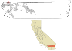 Location in Riverside County and the state of California | |
 Highgrove Location in the United States | |
| Coordinates: 34°00′57″N 117°20′00″W / 34.01583°N 117.33333°WCoordinates: 34°00′57″N 117°20′00″W / 34.01583°N 117.33333°W[1] | |
| Country | United States |
| State | California |
| County | Riverside |
| Area | |
| • Total | 3.219 sq mi (8.336 km2) |
| • Land | 3.219 sq mi (8.336 km2) |
| • Water | 0 sq mi (0 km2) 0% |
| Elevation | 951 ft (290 m) |
| Population (2020) | |
| • Total | 7,166 |
| • Density | 2,200/sq mi (860/km2) |
| Time zone | UTC-8 (PST) |
| • Summer (DST) | UTC-7 (PDT) |
| ZIP code | 92507 |
| Area code(s) | 951 |
| FIPS code | 06-33574 |
| GNIS feature ID | 1652721 |

Highgrove is a census-designated place (CDP) in Riverside County, California, United States. The population was 3,988 at the 2010 census, up from 3,445 at the 2000 census. The latest 2020 census shows 7,515 total population in Highgrove, a 88.4% increase from last 2010 census, which makes it the fastest-growing location in entire Riverside County.[3]
The city of Riverside, CA has plans to annex Highgrove soon.[4][when?] Currently at Spring Mountain Ranch community,[5] Avalon, Cambria, and Sonoma (all opening by February 2022) are the three, newest largest master-planned communities being built at the Highgrove eastside area. These are the only known new single-family homes currently available for sale, closer to Downtown Riverside and University of California, Riverside. In addition, 846 new townhomes with up to 3 stories are in consideration too, next to the elementary school.
This community publishes its own newsletter, Highgrove Happenings, each month, since 1994.[6]
History[]
Highgrove was founded in 1886, originally called East Riverside, but in 1897 during a naming contest, it was renamed to Highgrove, after not getting it confused with the city of Riverside.[7] Citrus-farm growers have occupied Highgrove area since beginning of history, with its superior fresh wind conditions from the west, blowing into east of a cove-shape like terrain, making it one the most valuable places in Inland Empire for citrus-farming by generations of farmers. Due to the stronger wind conditions that can easily move air out, a landfill dumping ground was opened in 1947 for discarded farm waste. Originally, it operated as a fire-burn dump during the 1950s, until 1960 when there was a concern of heavy-smog in southern California.[8]
In 1970, the Highgrove Agricultural Preserve conservation was formed in order to support the growing number of orange trees from farmers.[9] More diverse of citrus fruits were being grown for the packing houses in Riverside. However, farming output could only peaked by the mid-1980s. More competition on fruit prices had increased daily from new farming businesses at the Central California region. Highgrove's another biggest threat was its rising land-value and water cost for the groves by the end of 1980s, due to its close-proximity to downtown Riverside, which made farm crops more unprofitable. By 1990, the preserve contract was not renewed, citing increases of population density, housing shortage, traffic jam, and smog near Riverside. Citrus (mostly orange) trees were gradually phased out and torn down completely by year 2000.
The Highgrove sanitary landfill closed permanently in 1998, after 51 years of operation. Since the 2018 inspection yearly report, no methane output has been detected in any of the designated area.[10] Today, new construction homes occupy near front of it, across Pigeon Pass Road. The citrus industry declined in the area as more agricultural areas were replaced by new subdivisions. In 2007, Spring Mountain Ranch master-planned community was originally conceived by RWR Homes, but construction halted due to the 2008 recession, and now KB Home, in 2014, will be completing this long-awaited project today, with no HOA fee as its main selling point.[11] Other builders included are D.R. Horton, Lennar, and Pulte with some HOA fee.
Future Annexation[]
Currently, Highgrove is experiencing a transformation with over 2,500 new single-family homes and 846 new townhomes proposed at the eastside, at the once former Highgrove Agricultural Preserve that was officially diminished by 2008.[12] To improve its infrastructure with new commercial buildings, Highgrove is currently the only area in Riverside County where cannabis dispensary stores are allowed to open within 250 ft. apart. Up to 10 cannabis stores are being considered within a one-half mile corridor along the I-215 freeway. At present, 4 locations have been approved, while the 5th is seeking approval from the planning department. Based upon its census data, 8 locations can be approved within the current Highgrove boundaries, as more new homes, townhomes, and apartments are being built.
Due to a possible annexation to city of Riverside in the near future, it is expanding the downtown area corridor, further, into east of 91 & 215 freeway area for future developments and spreading up north to Highgrove on Main St. north-end, just before the San Bernardino County borderline of Grand Terrace. The, once, agricultural area will become more integrated and urbanized into a new college-town suburb, with new boundary lines shaping-up like a crescent from UC Riverside campus of the southeast, next to Highgrove of the northwest, and then to Spring Mountain Ranch community of the east. In addition, new cannabis dispensary stores are now opened and within easy reach for University of California, Riverside students, plus new generation of homeowners and renters in Highgrove.
Geography[]
Highgrove is located at 34°00′55″N 117°19′51″W / 34.015253°N 117.330926°W.[13] Highgrove is between the city of Riverside and Grand Terrace. It is located east of Interstate 215 and north of the University of California, Riverside campus.
According to the United States Census Bureau, the CDP has a total area of 3.2 square miles (8.3 km2), all of it land.
The highest-elevation point in Highgrove with homes built is up to 1,420 feet.
Demographics[]
| Historical population | |||
|---|---|---|---|
| Census | Pop. | %± | |
| 1990 | 3,175 | — | |
| 2000 | 3,445 | 8.5% | |
| 2010 | 3,988 | 15.8% | |
| 2020 | 7,515 | 88.4% | |
| U.S. Decennial Census[14] | |||
2020[]
As of the 2020 census, Highgrove had a population of 7,515, a 88.4% increase from last 2010 census.
2010[]
As of the 2010 census, Highgrove had a population of 3,988. The population density was 1,239.0 people per square mile (478.4/km2). The racial makeup of Highgrove was 2,104 (52.8%) White, 162 (4.1%) African American, 41 (1.0%) Native American, 113 (2.8%) Asian, 13 (0.3%) Pacific Islander, 1,388 (34.8%) from other races, and 167 (4.2%) from two or more races. Hispanic or Latino of any race were 2,604 persons (65.3%).[15]
The census reported that 3,982 people (99.8% of the population) lived in households, 6 (0.2%) lived in non-institutionalized group quarters, and no one was institutionalized.
There were 1,136 households, 553 (48.7%) had children under the age of 18 living in them, 610 (53.7%) were opposite-sex married couples living together, 188 (16.5%) had a female householder with no husband present, 102 (9.0%) had a male householder with no wife present. There were 101 (8.9%) unmarried opposite-sex partnerships, and 6 (0.5%) same-sex married couples or partnerships. 181 households (15.9%) were one person and 50 (4.4%) had someone living alone who was 65 or older. The average household size was 3.51. There were 900 families (79.2% of households); the average family size was 3.90.
The age distribution was 1,246 people (31.2%) under the age of 18, 464 people (11.6%) aged 18 to 24, 1,038 people (26.0%) aged 25 to 44, 952 people (23.9%) aged 45 to 64, and 288 people (7.2%) who were 65 or older. The median age was 30.2 years. For every 100 females, there were 102.8 males. For every 100 females age 18 and over, there were 101.9 males.
There were 1,227 housing units at an average density of 381.2 per square mile, of the occupied units 633 (55.7%) were owner-occupied and 503 (44.3%) were rented. The homeowner vacancy rate was 2.8%; the rental vacancy rate was 7.5%. 2,217 people (55.6% of the population) lived in owner-occupied housing units and 1,765 people (44.3%) lived in rental housing units.
2000[]
From the 2000 census, there were 3,445 people, 1,026 households, and 777 families in the CDP. The population density was 3,133.5 people per square mile (1,209.2/km2). There were 1,090 housing units at an average density of 991.5 per square mile (382.6/km2). The racial makeup of the CDP was 54.0% White, 4.3% Black or African American, 1.1% Native American, 2.4% Asian, 0.5% Pacific Islander, 33.6% from other races, and 4.1% from two or more races. 56.7% of the population were Hispanic or Latino of any race.[16] Of the 1,026 households 48.9% had children under the age of 18 living with them, 51.3% were married couples living together, 16.4% had a female householder with no husband present, and 24.2% were non-families. 16.6% of households were one person and 4.2% were one person aged 65 or older. The average household size was 3.4 and the average family size was 3.8.
The age distribution was 36.4% under the age of 18, 10.1% from 18 to 24, 31.1% from 25 to 44, 16.1% from 45 to 64, and 6.2% 65 or older. The median age was 27 years. For every 100 females, there were 105.9 males. For every 100 females age 18 and over, there were 103.7 males.
The median household income was $30,685 and the median family income was $33,929. Males had a median income of $32,199 versus $27,177 for females. The per capita income for the CDP was $16,422. About 22.4% of families and 27.8% of the population were below the poverty line, including 38.7% of those under age 18 and 8.2% of those age 65 or over.
Government[]
Federal:
- In the United States House of Representatives, Highgrove is in California's 41st congressional district, represented by Democrat Mark Takano.[17]
- In the United States Senate, California is represented by Democrats Dianne Feinstein and Alex Padilla.
State:
- In the California State Legislature, Highgrove is in the 31st Senate District, represented by Democrat Richard Roth, and in the 61st Assembly District, represented by Democrat Jose Medina.[18]
Local:
- In the Riverside County Board of Supervisors, Highgrove is in the Second District, represented by Karen Spiegel.
References[]
- ^ a b "Highgrove". Geographic Names Information System. United States Geological Survey. Retrieved November 12, 2014.
- ^ "2010 Census U.S. Gazetteer Files – Places – California". United States Census Bureau.
- ^ https://www.sbsun.com/2021/08/20/how-much-did-your-inland-empire-city-grow-in-the-2020-census/
- ^ https://www.riversideca.gov/planning/annex.asp
- ^ https://www.kbhome.com/new-homes-california/riverside
- ^ "Highgrove Community 92507". highgrovehappenings.net.
- ^ Jarrell Johnson, Kim (July 13, 2012). "Back in the Day: Highgrove had many names". The Press-Enterprise. Archived from the original on May 6, 2021.
- ^ https://www.waterboards.ca.gov/santaana/board_decisions/adopted_orders/orders/2013/13_002_WDR_Riverside_County_WMD_Highgrove_Sanitary_LF.pdf
- ^ http://www.rivcocob.org/agenda/2004/2004_12_21/16.10.pdf
- ^ "SWIS Facility/Site Summary". www2.calrecycle.ca.gov.
- ^ Khouri, Andrew (September 11, 2014). "Riverside County development to test vigor of area's housing recovery". Los Angeles Times. Archived from the original on May 8, 2021.
- ^ http://www.rivcocob.org/agenda/2008/02_05_2008/03.35.pdf
- ^ "US Gazetteer files: 2010, 2000, and 1990". United States Census Bureau. 2011-02-12. Retrieved 2011-04-23.
- ^ "Census of Population and Housing". Census.gov. Retrieved June 4, 2016.
- ^ "2010 Census Interactive Population Search: CA - Highgrove CDP". U.S. Census Bureau. Archived from the original on July 15, 2014. Retrieved July 12, 2014.
- ^ "U.S. Census website". United States Census Bureau. Retrieved 2008-01-31.
- ^ "California's 41st Congressional District - Representatives & District Map". Civic Impulse, LLC.
- ^ "Statewide Database". UC Regents. Archived from the original on February 1, 2015. Retrieved December 8, 2014.
Municipalities and communities of Riverside County, California, United States | ||
|---|---|---|
| Cities |  | |
| CDPs |
| |
| Unincorporated communities | ||
| Indian reservations |
| |
| Ghost towns | ||
| ||
- Census-designated places in Riverside County, California
- Populated places on the Santa Ana River
- Census-designated places in California