Highland Township, Greene County, Indiana
Highland Township | |
|---|---|
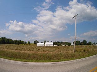 Countryside in Highland Township | |
 Location in Greene County | |
| Coordinates: 39°07′17″N 86°53′13″W / 39.12139°N 86.88694°WCoordinates: 39°07′17″N 86°53′13″W / 39.12139°N 86.88694°W | |
| Country | United States |
| State | Indiana |
| County | Greene |
| Government | |
| • Type | Indiana township |
| Area | |
| • Total | 32.69 sq mi (84.7 km2) |
| • Land | 32.47 sq mi (84.1 km2) |
| • Water | 0.22 sq mi (0.6 km2) 0.67% |
| Elevation | 545 ft (166 m) |
| Population (2010) | |
| • Total | 718 |
| • Density | 22.1/sq mi (8.5/km2) |
| GNIS feature ID | 0453411 |

Highland Township is one of fifteen townships in Greene County, Indiana, USA. As of the 2010 census, its population was 718.[1]
| Historical population | |||
|---|---|---|---|
| Census | Pop. | %± | |
| 2000 | 655 | — | |
| 2010 | 718 | 9.6% | |
| Source: US Census Bureau | |||
Geography[]
According to the 2010 census, the township has a total area of 32.69 square miles (84.7 km2), of which 32.47 square miles (84.1 km2) (or 99.33%) is land and 0.22 square miles (0.57 km2) (or 0.67%) is water.[1] The streams of Camp Creek, Clark Creek, Dead Horse Branch, Goose Creek, Jim Creek and Kelly Branch run through this township.
Unincorporated towns[]
(This list is based on USGS data and may include former settlements.)
Adjacent townships[]
- Franklin Township, Owen County (north)
- Beech Creek Township (east)
- Richland Township (south)
- Fairplay Township (southwest)
- Jefferson Township (west)
Cemeteries[]
The township contains nine cemeteries: Bucher, Calvertville, Goodwin, Kelley, Owens, Snyder, Stalcup, Wall and Walnut Grove.
Major highways[]
References[]
- "Highland Township, Greene County, Indiana". Geographic Names Information System. United States Geological Survey. Retrieved 2009-09-24.
- United States Census Bureau cartographic boundary files
- ^ a b "Population, Housing Units, Area, and Density: 2010 - County -- County Subdivision and Place -- 2010 Census Summary File 1". United States Census. Archived from the original on 2020-02-10. Retrieved 2013-05-10.
External links[]
Municipalities and communities of Greene County, Indiana, United States | ||
|---|---|---|
| Cities | ||
| Towns | ||
| Townships | ||
| CDPs | ||
| Other unincorporated communities |
| |
| Footnotes | ‡This populated place also has portions in an adjacent county or counties | |
| ||
This Greene County, Indiana location article is a stub. You can help Wikipedia by . |
Categories:
- Townships in Greene County, Indiana
- Bloomington metropolitan area, Indiana
- Townships in Indiana
- Southern Indiana geography stubs