Wright Township, Greene County, Indiana
Wright Township | |
|---|---|
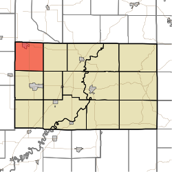 Location in Greene County | |
| Coordinates: 39°07′31″N 87°11′11″W / 39.12528°N 87.18639°WCoordinates: 39°07′31″N 87°11′11″W / 39.12528°N 87.18639°W | |
| Country | United States |
| State | Indiana |
| County | Greene |
| Government | |
| • Type | Indiana township |
| Area | |
| • Total | 36.18 sq mi (93.7 km2) |
| • Land | 35.68 sq mi (92.4 km2) |
| • Water | 0.5 sq mi (1 km2) 1.38% |
| Elevation | 633 ft (193 m) |
| Population (2010) | |
| • Total | 3,921 |
| • Density | 109.9/sq mi (42.4/km2) |
| GNIS feature ID | 0454065 |

Wright Township is one of fifteen townships in Greene County, Indiana, USA. As of the 2010 census, its population was 3,921.[1]
History[]
The Shakamak State Park Historic District was listed on the National Register of Historic Places in 2000.[2]
Geography[]
According to the 2010 census, the township has a total area of 36.18 square miles (93.7 km2), of which 35.68 square miles (92.4 km2) (or 98.62%) is land and 0.5 square miles (1.3 km2) (or 1.38%) is water.[1]
Cities and towns[]
Unincorporated towns[]
(This list is based on USGS data and may include former settlements.)
Adjacent townships[]
- Lewis Township, Clay County (north)
- Smith Township (east)
- Grant Township (southeast)
- Stockton Township (south)
- Cass Township, Sullivan County (west)
- Jackson Township, Sullivan County (northwest)
Cemeteries[]
The township contains three cemeteries: Bethel, Frye and Terhune.
Major highways[]
Airports and landing strips[]
- Shakamak Airport
References[]
- ^ a b "Population, Housing Units, Area, and Density: 2010 - County -- County Subdivision and Place -- 2010 Census Summary File 1". United States Census. Archived from the original on 2020-02-10. Retrieved 2013-05-10.
- ^ "National Register Information System". National Register of Historic Places. National Park Service. July 9, 2010.
External links[]
Municipalities and communities of Greene County, Indiana, United States | ||
|---|---|---|
| Cities | ||
| Towns | ||
| Townships | ||
| CDPs | ||
| Other unincorporated communities |
| |
| Footnotes | ‡This populated place also has portions in an adjacent county or counties | |
| ||
This Greene County, Indiana location article is a stub. You can help Wikipedia by . |
Categories:
- Townships in Greene County, Indiana
- Bloomington metropolitan area, Indiana
- Townships in Indiana
- Southern Indiana geography stubs