Hilton, South Australia
| Hilton Adelaide, South Australia | |||||||||||||||
|---|---|---|---|---|---|---|---|---|---|---|---|---|---|---|---|
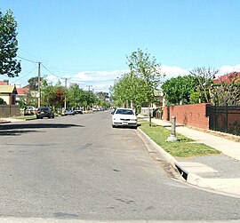 Residential street in Hilton | |||||||||||||||
| Population | 839 (2016 census)[1] | ||||||||||||||
| Established | c. 1849[2] | ||||||||||||||
| Postcode(s) | 5033[3] | ||||||||||||||
| Location | 2.8 km (2 mi) W of Adelaide city centre[3] | ||||||||||||||
| LGA(s) | City of West Torrens | ||||||||||||||
| State electorate(s) | Ashford (2011)[4] | ||||||||||||||
| Federal division(s) | Adelaide | ||||||||||||||
| |||||||||||||||
Hilton, on , is an inner western suburb of Adelaide, South Australia. It is located in the City of West Torrens, for which it is the council seat.
History[]
The land now covering the suburb of Hilton was received by Matthew Davenport Hill in 1839. About ten years later, The 'Village of Hilton' was laid out by his attorney, George Milner Stephen.[2]
The historic 1935 are listed on the South Australian Heritage Register.[5]
Geography[]
Hilton is a rectangular suburb lying across Sir Donald Bradman Drive.[6]
Demographics[]
In the 2016 Census, there were 839 people in Hilton. 62.9% of people were born in Australia and 61.7% of people spoke only English at home. The most common responses for religion were No Religion 38.4% and Catholic 17.1%.[1]
Community[]
The local newspaper is the Weekly Times Messenger. Other regional and national newspapers such as The Advertiser and The Australian are also available.[7]
Facilities and attractions[]
The West Torrens Civic Centre (council offices) are on the corner of Sir Donald Bradman Drive and Brooker Terrace. The Hamra Centre Library is located next door.[6]
Shopping and dining[]
Hilton Plaza shopping centre is located on the corner of Sir Donald Bradman Drive and Bagot Avenue.[6]
Transportation[]
Roads[]
Hilton is serviced by Sir Donald Bradman Drive, connecting the suburb to Adelaide City Centre.[6]
Public transport[]
Hilton is serviced by public transport run by the Adelaide Metro.[8] The bus routes that serve Hilton are 163, J1 and J1X express bus to the city.
See also[]
References[]
- ^ a b Australian Bureau of Statistics (27 June 2017). "Hilton (State Suburb)". 2016 Census QuickStats. Retrieved 15 June 2019.

 Material was copied from this source, which is available under a Creative Commons Attribution 4.0 International License.
- ^ a b "Place Names of South Australia". The Manning Index of South Australian History. State Library of South Australia. Retrieved 20 April 2011.
- ^ a b "Hilton, South Australia (Adelaide)". Postcodes-Australia. Postcodes-Australia.com. Retrieved 20 April 2011.
- ^ "Electoral Districts - Electoral District for the 2010 Election". Electoral Commission SA. Archived from the original on 22 August 2011. Retrieved 20 April 2011.
- ^ "West Torrens Council Chambers (1935 Building only)". South Australian Heritage Register. Department of Environment, Water and Natural Resources. Retrieved 11 September 2016.
- ^ a b c d Adelaide and surrounds street directory (47th ed.). UBD. 2009. ISBN 978-0-7319-2336-6.
- ^ "South Australian Newspapers". Newspapers.com.au. Australia G'day. Archived from the original on 29 April 2011. Retrieved 20 April 2011.
- ^ "Public Transport in Adelaide". Adelaide Metro official website. Dept. for Transport, Energy and Infrastructure, Public Transport Division. 12 January 2011. Archived from the original on 26 April 2011. Retrieved 20 April 2011.
External links[]
- "City of West Torrens". Official website. City of West Torrens. Retrieved 20 April 2011.

- Suburbs of Adelaide
- Populated places established in 1849
- 1849 establishments in Australia