Himi, Toyama
Himi
氷見市 | |
|---|---|
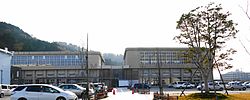 Himi City Hall | |
 Flag  Seal | |
 Location of Himi in Toyama Prefecture | |
 Himi | |
| Coordinates: 36°51′24″N 136°58′23″E / 36.85667°N 136.97306°ECoordinates: 36°51′24″N 136°58′23″E / 36.85667°N 136.97306°E | |
| Country | Japan |
| Region | Chūbu (Hokuriku) |
| Prefecture | Toyama |
| Area | |
| • Total | 230.56 km2 (89.02 sq mi) |
| Population (March 1, 2018) | |
| • Total | 48,725 |
| • Density | 210/km2 (550/sq mi) |
| Time zone | UTC+9 (Japan Standard Time) |
| Symbols | |
| • Tree | Machilus thunbergii |
| • Flower | Lilium |
| Phone number | 0766-74-8100 |
| Address | 1-1 Marunouchi, Himi-shi, Toyama-ken 935-8686 |
| Website | http://www.city.himi.toyama.jp/ |

Himi (氷見市, Himi-shi) is a city in western Toyama Prefecture, Japan. As of 1 March 2018, the city had an estimated population of 48,275 in 17632 households,[1] and a population density of 210 persons per km². Its total area is 230.56 square kilometres (89.02 sq mi). Himi is known primarily for its commercial fishing industry. The city was founded on August 1, 1952.
Geography[]
Himi is in the far northwestern Toyama Prefecture, and is bordered by Ishikawa Prefecture (the Noto Peninsula to the west and north, and the Sea of Japan (Toyama Bay) to the east. Much of the area is a dispersed settlement typical of this region of Japan. Himi has a humid continental climate (Köppen Cfa) characterized by mild summers and cold winters with heavy snowfall. The average annual temperature in Himi is 13.9 °C. The average annual rainfall is 2409 mm with September as the wettest month. The temperatures are highest on average in August, at around 26.4 °C, and lowest in January, at around 2.8 °C.[2]
Surrounding municipalities[]
- Toyama Prefecture
- Ishikawa Prefecture
Demographics[]
Per Japanese census data,[3] the population of Himi has declined over the past 40 years.
| Census Year | Population |
|---|---|
| 1970 | 60,883 |
| 1980 | 62,413 |
| 1990 | 60,766 |
| 2000 | 56,680 |
| 2010 | 51,726 |
History[]
The area of present-day Himi was part of ancient Etchū Province. The town of Himi was created within Imizu District, Toyama with the establishment of the municipalities system on April 1, 1889. Izumi District was divided on March 29, 1896 into Izumi District and Himi District. The town annexed the neighboring villages of Kanno and Inazumi in 1940, and the villages of Goishi, Yashiro, Yokawa in 1952. In 1953, the town further annexed the villages of Kubo, Miyata, Kamijo and Kumanashi. In 1954, Himi annexed the villages of Ao, Yabuta, Unami, Mera, Kume, Kojiro, Junicho, Hayakawa, Fuse, and Busshoji, so that in its final form it encompassed the entire district of Himi with the exception of the village of Ota (which was annexed by Takaoka).
Government[]
Himi has a mayor-council form of government with a directly elected mayor and a unicameral city legislature of 17 members.
Education[]
Himi has twelve public elementary schools and five public junior high schools operated by the town government, and one public high school operated by the Toyama Prefectural Board of Education.
Transportation[]
Railway[]
 West Japan Railway Company (JR West) - Himi Line
Highway[]
- Nōetsu Expressway
 National Route 160
 National Route 415
Regional Specialties[]
- Himi Udon
- Himi Buri
- Himi Beef
- Himi Iwashi
- Himi Curry
- Kintsuba
- Himi Hatomugi Tea
- Cold Yellowtail
Points of interest[]
- Himi Seaside Botanical Garden
- Himi Banya[4]
- Shimao Seaside Park
- Ōzakai Cave Dwelling Site, a National Historic Site [5]
- Yanaidanu-no-Oyama Kofun, a National Historic Site
- Asahi Shell Mound, a National Historic Site
References[]
- ^ official home page statistics (in Japanese)
- ^ Himi climate data
- ^ Himi population statistics
- ^ http://himi-banya.jp/
- ^ 大境洞窟住居跡 [Ōzakai dōkutsu jūkyo ato] (in Japanese). Agency for Cultural Affairs.
External links[]
![]() Media related to Himi, Toyama at Wikimedia Commons
Media related to Himi, Toyama at Wikimedia Commons
- Official Website (in Japanese)
| show Authority control |
|---|
This Toyama location article is a stub. You can help Wikipedia by . |
- Himi, Toyama
- Cities in Toyama Prefecture
- Populated coastal places in Japan
- Toyama Prefecture geography stubs