Asahi, Toyama
Asahi
朝日町 | |
|---|---|
Town | |
 Asahi Town Hall | |
 Flag  Seal | |
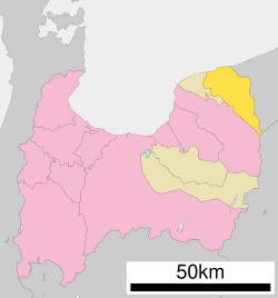 Location of Asahi in Toyama Prefecture | |
 Asahi | |
| Coordinates: 36°56′46.2″N 137°33′35.8″E / 36.946167°N 137.559944°ECoordinates: 36°56′46.2″N 137°33′35.8″E / 36.946167°N 137.559944°E | |
| Country | Japan |
| Region | Chūbu (Hokuriku) |
| Prefecture | Toyama |
| District | Shimoniikawa |
| Area | |
| • Total | 226.30 km2 (87.37 sq mi) |
| Population (April 2018) | |
| • Total | 11,574 |
| • Density | 51.1/km2 (132/sq mi) |
| Time zone | UTC+9 (Japan Standard Time) |
| Symbols | |
| • Tree | Pinus parviflora |
| • Flower | Azalea |
| Phone number | 0765-83-1100 |
| Address | 1133 Michishita, Asahi-machi, Shimoniikawa-gun, Toyama-ken 939-0793 |
| Website | www |

Asahi (朝日町, Asahi-machi) is a town located in Shimoniikawa District, Toyama Prefecture, Japan. As of 1 April 2018, the town had an estimated population of 11,574 and a population density of 51.1 persons per km2. Its total area was 226.30 square kilometres (87.37 sq mi). The town claims to be the birthplace of beach volleyball.
Geography[]
Asahi is located in north-west Toyama Prefecture, in between the North Alps and the Sea of Japan. Mount Shirouma is the highest point, with an elevation of 2,932 meters.
Demographics[]
Per Japanese census data,[1] the population of Asahi has decreased over the past 40 years.
| Census Year | Population |
|---|---|
| 1970 | 19,311 |
| 1980 | 18,631 |
| 1990 | 17,569 |
| 2000 | 15,915 |
| 2010 | 13,651 |
Climate[]
The town has a Humid subtropical climate (Köppen Cfa) characterized by hot summers and cold winters with heavy snowfall. The average annual temperature in Asahi is 13.9 °C. The average annual rainfall is 2219 mm with September as the wettest month. The temperatures are highest on average in August, at around 26.2 °C, and lowest in January, at around 2.5 °C.[2]
Surrounding municipalities[]
- Toyama Prefecture
- Niigata Prefecture
- Nagano Prefecture
- Hakuba
History[]
The area of present-day Asahi was part of ancient Etchū Province. During the Edo period, the Tomari developed as a post station on the Hokurikudo highway. The area was organised as part of Shimoniikawa District, Toyama after the Meiji restoration. The modern town of Tomari was created with the establishment of the municipalities system on April 1, 1889. It merged with six surrounding villages to form the town of Asahi on August 1, 1954.
Economy[]
Asahi is dependent on agriculture and commercial fishing. Notable crops include rice, asparagus, and Spaghetti squash.
Education[]
Asahi has two public elementary schools and one public middle school operated by the town government, and one public high school operated by the Toyama Prefectural Board of Education.
Transportation[]
Railway[]
 Ainokaze Toyama Railway Line
Highway[]
Local attractions[]
- Fudōdō Site, ruins of a Jōmon period settlement and a National Historic Site.[3]
References[]
- ^ Asahi population statistics
- ^ Asahi climate data
- ^ 不動堂遺跡 [Fudōdō Site] (in Japanese). Agency for Cultural Affairs.
External links[]
 Media related to Asahi, Toyama at Wikimedia Commons
- Official website (in Japanese)
| show Authority control |
|---|
- Asahi, Toyama
- Towns in Toyama Prefecture
- Populated coastal places in Japan