Tonami, Toyama
Tonami
砺波市 | |
|---|---|
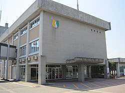 Tonami City Hall | |
 Flag  Seal | |
 Location of Tonami in Toyama Prefecture | |
 Tonami | |
| Coordinates: 36°38′51″N 136°57′44″E / 36.64750°N 136.96222°ECoordinates: 36°38′51″N 136°57′44″E / 36.64750°N 136.96222°E | |
| Country | Japan |
| Region | Chūbu (Kōshin'etsu) |
| Prefecture | Toyama |
| Government | |
| • - Mayor | Osamu Natsuno (since November 2012) |
| Area | |
| • Total | 127.03 km2 (49.05 sq mi) |
| Population (March 31, 2018) | |
| • Total | 48,659 |
| • Density | 380/km2 (990/sq mi) |
| Time zone | UTC+9 (Japan Standard Time) |
| Symbols | |
| • Tree | Cryptomeria |
| • Flower | Tulip |
| • Bird | Brown-eared bulbul |
| Phone number | 0763-33-1111 |
| Address | 7-3 Sakae, Tonami-shi, Toyama-ken 939-1398 |
| Website | www |


Tonami (砺波市, Tonami-shi) is a city in Toyama Prefecture, Japan. As of 31 March 2018, the city had an estimated population of 48,659 in 16,739 households [1] and a population density of 384 persons per km². Its total area was 127.03 square kilometres (49.05 sq mi).[2]
Geography[]

Tonami is located in the Tonami plains of western Toyama Prefecture. Much of the area is a dispersed settlement typical of this region of Japan.
Surrounding municipalities[]
Demographics[]
Per Japanese census data,[3] the population of Tonami has increased over the past 40 years.
| Census Year | Population |
|---|---|
| 1970 | 41,403 |
| 1980 | 43,530 |
| 1990 | 44,521 |
| 2000 | 48,092 |
| 2010 | 49,410 |
Climate[]
Tonami has a humid continental climate (Köppen Cfa) characterized by mild summers and cold winters with heavy snowfall. The average annual temperature in Himi is 13.8 °C. The average annual rainfall is 2414 mm with September as the wettest month. The temperatures are highest on average in August, at around 26.4 °C, and lowest in January, at around 2.4 °C.[4]
| hideClimate data for Tonami | |||||||||||||
|---|---|---|---|---|---|---|---|---|---|---|---|---|---|
| Month | Jan | Feb | Mar | Apr | May | Jun | Jul | Aug | Sep | Oct | Nov | Dec | Year |
| Average high °C (°F) | 5.4 (41.7) |
6.0 (42.8) |
10.1 (50.2) |
16.8 (62.2) |
21.4 (70.5) |
24.7 (76.5) |
28.3 (82.9) |
30.3 (86.5) |
26.1 (79.0) |
20.6 (69.1) |
14.7 (58.5) |
9.2 (48.6) |
17.8 (64.0) |
| Average low °C (°F) | −1.2 (29.8) |
−1.4 (29.5) |
1.2 (34.2) |
6.3 (43.3) |
12.1 (53.8) |
16.9 (62.4) |
20.9 (69.6) |
21.8 (71.2) |
17.9 (64.2) |
11.6 (52.9) |
6.2 (43.2) |
1.6 (34.9) |
9.5 (49.1) |
| Average precipitation mm (inches) | 260.4 (10.25) |
164.4 (6.47) |
146.3 (5.76) |
109.4 (4.31) |
125.0 (4.92) |
181.4 (7.14) |
232.9 (9.17) |
169.0 (6.65) |
217.0 (8.54) |
159.7 (6.29) |
231.0 (9.09) |
251.7 (9.91) |
2,248.2 (88.5) |
| Average snowfall cm (inches) | 177 (70) |
143 (56) |
36 (14) |
1 (0.4) |
0 (0) |
0 (0) |
0 (0) |
0 (0) |
0 (0) |
0 (0) |
1 (0.4) |
62 (24) |
420 (164.8) |
| Average precipitation days (≥ 1.0 mm) | 23.3 | 19.9 | 17.8 | 12.5 | 11.2 | 11.6 | 13.9 | 10.4 | 13.5 | 13.7 | 17.5 | 21.7 | 187 |
| Mean monthly sunshine hours | 62.4 | 84.7 | 125.1 | 172.4 | 188.4 | 137.1 | 139.5 | 191.6 | 127.9 | 136.5 | 100.1 | 71.1 | 1,536.8 |
| Source: Japan Meteorological Agency | |||||||||||||
History[]
The area of present-day Tonami was part of ancient Etchū Province, and was part of the holdings of Kaga Domain under the Edo period Tokugawa shogunate. The town of Tonami was founded on April 1, 1952 by the merger of the town of Demachi with the villages of Gokaya, Aburaden, Shoge, Nakamura and Hayashi. The villages of Aoshima and Ogami joined two months later on June 1, 1952. The villages of Ota, Minamihannya, Higachi-Nojiri, Yanaze and Nishi-Tonami were annexed on January 15, 1954, followed by Sendan, Sendanyama, Hannya, and Higashi-Hannya on March 1. The expanded town of Tonami was raised to city status on April 1, 1954. On November 1, 2004, the town of Shōgawa (from Higashitonami District) was merged into Tonami.
Government[]
Tonami has a mayor-council form of government with a directly elected mayor and a unicameral city legislature of 18 members.
Education[]
Tonami has eight public elementary schools and four public junior high schools operated by the town government, and two public high schools operated by the Toyama Prefectural Board of Education.[citation needed]
Transportation[]
Railway[]
 West Japan Railway Company (JR West) - Jōhana Line
Highway[]
International relations[]
 - Lisse, Netherlands,[5] sister city since April 21, 1992
 – Panjin, Liaoning, China,[5] friendship city since April 25, 1991
 – Yalova, Turkey,[5] friendship city since October 3, 1989
Local attractions[]
- Masuyama Castle, ruins of a Sengoku period castle and National Historic Site.[6] It was also known as Wada Castle (和田城, Wada-jō)
- Yotaka festival, held in June, with many parade floats which purposely collide during the festival, drawing large crowds to witness the spectacle. The Yotaka festival event originally began in the neighboring town of Fukuno. It features competitions between groups carrying mikoshi portable shrines. "Yoiyasa" is a traditional saying shouted by many during the event. When it is night, lamps using paper shades are lit. This festival is a prayer for a good harvest of the fields.
Tulips[]
There is a tulip park in Tonami, as well as a nationally recognized tulip festival that is held every year. There is a windmill transferred by the Netherlands, inscribed "DE VRIENDSCHAP" (friendship). The Tonami tulip festival has over 600 different kinds of tulips, and more than 2.5 million tulips in recent years.[7]
References[]
- ^ Tonami city official statistics(in Japanese)
- ^ official home page(in Japanese)
- ^ Tonami population statistics
- ^ Tonami climate data
- ^ Jump up to: a b c "International Exchange". List of Affiliation Partners within Prefectures. Council of Local Authorities for International Relations (CLAIR). Retrieved 21 November 2015.
- ^ 増山城跡. Cultural Heritage Online (in Japanese). Agency for Cultural Affairs. Retrieved 25 December 2017.
- ^ "2021 Tonami Tulip Fair".
External links[]
| Wikimedia Commons has media related to Tonami, Toyama. |
- Official website (in Japanese)
| show Authority control |
|---|
- Tonami, Toyama
- Cities in Toyama Prefecture