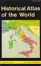
Historical Atlas of the World
This article has multiple issues. Please help or discuss these issues on the talk page. (Learn how and when to remove these template messages)
|
 | |
| Author | , , Maps by: |
|---|---|
| Country | Norway |
| Language | English |
| Genre | Atlas, History |
| Publisher | Barnes & Noble |
Publication date | 1962 |
| Media type | Print (Paperback) |
| Pages | ~170 |
| ISBN | 0-389-01087-1 |
| OCLC | 100071 |
| 911 | |
| LC Class | G1030 .B452 1970 |
Historical Atlas of the World is a historical atlas that contains 108 color maps showing religious boundaries, countries, cities, buildings army movements and expeditions. It contains an index to place, peoples, historical and military events and explorers. Covers the span from 3000 BC to ~1970 (Rhodesia, not Zimbabwe; Pakistan, not Bangladesh; North and South Vietnam)
Broken into four sections:
- Ancient Times (3000 BC – 200 AD): 31 maps
- The Middles Ages (200–1500): 24 maps
- (1500–1900): 38 maps
- Twentieth Century (1900–1970): 15 maps
There is no commentary on the maps, but nearly all maps have a thorough legend. Occasionally a map will have an unreferenced symbol.
Compact (0.5" x 4.75"x 7.75") and tightly bound.
Last known printing: 1981
Categories:
- 1962 non-fiction books
- Historical atlases