Horní Bludovice
Horní Bludovice | |
|---|---|
 Municipal office | |
 Flag  Coat of arms | |
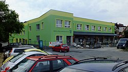
 Horní Bludovice Location in the Czech Republic | |
| Coordinates: 49°44′59″N 18°26′13″E / 49.74972°N 18.43694°ECoordinates: 49°44′59″N 18°26′13″E / 49.74972°N 18.43694°E | |
| Country | |
| Region | Moravian-Silesian |
| District | Karviná |
| First mentioned | 1335 |
| Government | |
| • Mayor | Petra Ficková |
| Area | |
| • Total | 8.99 km2 (3.47 sq mi) |
| Elevation | 280 m (920 ft) |
| Population (2020-01-01[1]) | |
| • Total | 2,441 |
| • Density | 270/km2 (700/sq mi) |
| Time zone | UTC+1 (CET) |
| • Summer (DST) | UTC+2 (CEST) |
| Postal code | 739 37 |
| Website | www |

Horní Bludovice (Polish: Błędowice Górne, German: Ober Bludowitz) is a municipality and village in the Karviná District in the Moravian-Silesian Region of the Czech Republic. It has about 2,400 inhabitants. Lučina River flows through the municipality. It lies in the historical region of Cieszyn Silesia.
Administrative parts[]
Village of Prostřední Bludovice is an administrative part of Horní Bludovice.
History[]
The village of Bludovice (which was later known as Dolní Bludovice) was first mentioned in 1335. The division to Lower (Dolní/Dolne/Nieder) and Upper (Horní/Górne/Ober) developed in the 15th century. In 1450 duas Blandowicze willas were mentioned and finally Superiori Blauda is attested in 1485.[2]
Politically the village belonged then to the Duchy of Teschen, since 1327 a fee of the Kingdom of Bohemia, which after 1526 became part of the Habsburg Monarchy.
References[]
- ^ "Population of Municipalities – 1 January 2020". Czech Statistical Office. 2020-04-30.
- ^ Mrózek, Robert (1984). Nazwy miejscowe dawnego Śląska Cieszyńskiego [Local names of former Cieszyn Silesia] (in Polish). Katowice: University of Silesia in Katowice. p. 41. ISSN 0208-6336.
| Wikimedia Commons has media related to Horní Bludovice. |


| Authority control: National libraries |
|---|
This Moravian-Silesian Region location article is a stub. You can help Wikipedia by . |
- Populated places in Karviná District
- Villages in Karviná District
- Cieszyn Silesia
- Moravian-Silesian Region geography stubs