Horoměřice
Horoměřice | |
|---|---|
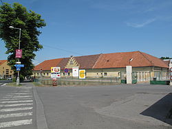 Horoměřice Castle | |
 Flag  Coat of arms | |
 Horoměřice Location in the Czech Republic | |
| Coordinates: 50°7′54″N 14°20′20″E / 50.13167°N 14.33889°ECoordinates: 50°7′54″N 14°20′20″E / 50.13167°N 14.33889°E | |
| Country | |
| Region | Central Bohemian |
| District | Prague-West |
| First mentioned | 1088 |
| Government | |
| • Mayor | Jan Herčík |
| Area | |
| • Total | 8.05 km2 (3.11 sq mi) |
| Elevation | 308 m (1,010 ft) |
| Population (2021-01-01)[1] | |
| • Total | 4,653 |
| • Density | 580/km2 (1,500/sq mi) |
| Time zone | UTC+1 (CET) |
| • Summer (DST) | UTC+2 (CEST) |
| Postal code | 252 62 |
| Website | www |

Horoměřice is a municipality and village in Prague-West District in the Central Bohemian Region of the Czech Republic. It has about 4,700 inhabitants.
Geography[]
Horoměřice is situated on the north-western border of Prague, between Prague city districts Suchdol, Lysolaje, Nebušice, Přední Kopanina, and municipalities of Statenice and Únětice from the other side. It is the most populated municipality in Prague-West District without the town status.
History[]
The first written mention of Horoměřice is from 1273. Back then it was owned by the Strahov Monastery.[2] Today in the central part of Horoměřice there is a simple castle from the 18th century, which belonged to Strahov Monastery until 1945.
In the past, the village inhabitants were agricultural workers. Although the village is surrounded by fields, today almost none of the inhabitants are agricultural workers.
Economy[]
The majority of inhabitants work in Prague traveling there every day. Average travel to the closest Prague metro take 7–15 minutes by bus to travel.
Notable people[]
- Benedikt Roezl (1824–1885), traveller, gardener and botanist
References[]
- ^ "Population of Municipalities – 1 January 2021". Czech Statistical Office. 2021-04-30.
- ^ "Historie" (in Czech). Obec Horoměřice. Retrieved 2020-11-14.
| Wikimedia Commons has media related to Horoměřice. |
| Authority control: National libraries |
|---|
- Populated places in Prague-West District
- Villages in Prague-West District
- Prague-West geography stubs