Hoxie, Kansas
Hoxie, Kansas | |
|---|---|
City and County seat | |
 Location within Sheridan County and Kansas | |
 | |
| Coordinates: 39°21′16″N 100°26′24″W / 39.35444°N 100.44000°WCoordinates: 39°21′16″N 100°26′24″W / 39.35444°N 100.44000°W | |
| Country | United States |
| State | Kansas |
| County | Sheridan |
| Founded | 1886 |
| Incorporated | 1886 |
| Named for | Herbert Hoxie |
| Area | |
| • Total | 0.86 sq mi (2.23 km2) |
| • Land | 0.86 sq mi (2.23 km2) |
| • Water | 0.00 sq mi (0.00 km2) |
| Elevation | 2,713 ft (827 m) |
| Population | |
| ��� Total | 1,201 |
| • Estimate (2019)[3] | 1,193 |
| • Density | 1,387.21/sq mi (535.70/km2) |
| Time zone | UTC-6 (CST) |
| • Summer (DST) | UTC-5 (CDT) |
| ZIP code | 67740 |
| Area code | 785 |
| FIPS code | 20-33350 [4] |
| GNIS ID | 0471273 [5] |

Hoxie is a city in and the county seat of Sheridan County, Kansas, United States.[6] As of the 2010 census, the city population was 1,201.[7]
History[]
Hoxie was laid out in early 1886. The town founders then soon convinced the residents of Kenneth, a community three miles to the north and the current county seat, to move south (including their buildings) at their expense to the new site of Hoxie. The residents of Kenneth knew the coming rail line would pass through Hoxie and not their town as they had hoped, so the offer was promising. The towns agreed to consolidate and carry out that plan, making Hoxie the new county seat.[8] It was named for H.M. Hoxie, a railroad official.[9][10] The railroad (which became part of the Union Pacific Railroad) arrived in 1888.[11]
The 99-mile Plainville-Colby branch of the Union Pacific railroad which passed through Hoxie was abandoned in 1998.[12][13]
Geography[]
Hoxie is located at 39°21′16″N 100°26′24″W / 39.35444°N 100.44000°W (39.354329, -100.439952).[14] According to the United States Census Bureau, the city has a total area of 0.84 square miles (2.18 km2), all of it land.[15]
Climate[]
The climate in this area is characterized by hot, humid summers and generally mild to cool winters. According to the Köppen Climate Classification system, Hoxie has a humid subtropical climate, abbreviated "Cfa" on climate maps.
Demographics[]
| Historical population | |||
|---|---|---|---|
| Census | Pop. | %± | |
| 1890 | 245 | — | |
| 1900 | 250 | 2.0% | |
| 1910 | 532 | 112.8% | |
| 1920 | 616 | 15.8% | |
| 1930 | 800 | 29.9% | |
| 1940 | 957 | 19.6% | |
| 1950 | 1,157 | 20.9% | |
| 1960 | 1,289 | 11.4% | |
| 1970 | 1,419 | 10.1% | |
| 1980 | 1,462 | 3.0% | |
| 1990 | 1,342 | −8.2% | |
| 2000 | 1,244 | −7.3% | |
| 2010 | 1,201 | −3.5% | |
| 2019 (est.) | 1,193 | [3] | −0.7% |
| U.S. Decennial Census | |||
2010 census[]
As of the census[2] of 2010, there were 1,201 people, 546 households, and 341 families residing in the city. The population density was 1,429.8 inhabitants per square mile (552.0/km2). There were 605 housing units at an average density of 720.2 per square mile (278.1/km2). The racial makeup of the city was 96.5% White, 0.1% Native American, 0.3% Asian, 1.4% from other races, and 1.7% from two or more races. Hispanic or Latino of any race were 3.6% of the population.
There were 546 households, of which 24.5% had children under the age of 18 living with them, 50.9% were married couples living together, 6.6% had a female householder with no husband present, 4.9% had a male householder with no wife present, and 37.5% were non-families. 34.8% of all households were made up of individuals, and 19.6% had someone living alone who was 65 years of age or older. The average household size was 2.14 and the average family size was 2.72.
The median age in the city was 48.9 years. 21.4% of residents were under the age of 18; 5.4% were between the ages of 18 and 24; 17.9% were from 25 to 44; 28.2% were from 45 to 64; and 27.1% were 65 years of age or older. The gender makeup of the city was 48.4% male and 51.6% female.
2000 census[]
As of the census[4] of 2000, there were 1,244 people, 543 households, and 350 families residing in the city. The population density was 1,472.2 people per square mile (571.8/km2). There were 601 housing units at an average density of 711.3 per square mile (276.2/km2). The racial makeup of the city was 98.79% White, 0.16% African American, 0.16% Native American, 0.08% Asian, 0.48% from other races, and 0.32% from two or more races. Hispanic or Latino of any race were 1.37% of the population.
There were 543 households, out of which 25.6% had children under the age of 18 living with them, 56.2% were married couples living together, 6.6% had a female householder with no husband present, and 35.4% were non-families. 33.5% of all households were made up of individuals, and 20.4% had someone living alone who was 65 years of age or older. The average household size was 2.21 and the average family size was 2.81.
In the city, the population was spread in with 21.7% under the age of 18, 6.3% from 18 to 24, 21.2% from 25 to 44, 25.0% from 45 to 64, and 25.8% who were 65 years of age or older. The median age was 45 years. For every 100 females, there were 89.1 males. For every 100 females age 18 and over, there were 82.4 males.
The median income for a household in the city was $33,810, and the median income for a family was $41,641. Males had a median income of $28,235 versus $15,804 for females. The per capita income for the city was $17,286. About 10.7% of families and 13.9% of the population were below the poverty line, including 25.7% of those under age 18 and 7.5% of those age 65 or over.
Education[]
The community is served by Hoxie USD 412 public school district.
Media[]
Hoxie has one weekly newspaper titled The Sheridan Sentinel, which was renamed when The Hoxie Sentinel changed owner in 2016. The Hoxie Sentinel was founded in 1884 as the Weekly Sentinel in the community of Kenneth, and was generally titled as The Hoxie Sentinel from 1886 to 2016.[16][17]
Notable people[]
- Les Barnhart, Major League Baseball player
- Nick Hague, NASA astronaut
- Dirk Johnson, professional football player, NFL
- Brad Lambert, Head Coach, Charlotte 49ers (Collegiate football)
- Urbane Pickering, Major League Baseball player
- Gordon Sloan, associate justice of the Oregon Supreme Court
- Erastus Turner, U.S. Representative from Kansas
References[]
- ^ "2019 U.S. Gazetteer Files". United States Census Bureau. Retrieved July 24, 2020.
- ^ Jump up to: a b "U.S. Census website". United States Census Bureau. Retrieved 2012-07-06.
- ^ Jump up to: a b "Population and Housing Unit Estimates". United States Census Bureau. May 24, 2020. Retrieved May 27, 2020.
- ^ Jump up to: a b "U.S. Census website". United States Census Bureau. Retrieved 2008-01-31.
- ^ "US Board on Geographic Names". United States Geological Survey. 2007-10-25. Retrieved 2008-01-31.
- ^ "Find a County". National Association of Counties. Archived from the original on 2011-05-31. Retrieved 2011-06-07.
- ^ "2010 City Population and Housing Occupancy Status". U.S. Census Bureau. Retrieved March 6, 2011.[dead link]
- ^ Blackmar, Frank Wilson (1912). Kansas: A Cyclopedia of State History, Embracing Events, Institutions, Industries, Counties, Cities, Towns, Prominent Persons, Etc. Standard Publishing Company. pp. 877.
- ^ "Origin of Town Names" (PDF). Solomon Valley Highway 24 Heritage Alliance. p. 6. Retrieved 9 April 2018.
- ^ Gannett, Henry (1905). The Origin of Certain Place Names in the United States. Govt. Print. Off. pp. 162.
- ^ Kansas State Historical Society (1916). Biennial Report of the Board of Directors of the Kansas State Historical Society. Kansas State Printing Plant. pp. 299.
- ^ Surfact Transportation Board Decision, Docket No. AB-33, March 21, 1997, STB.gov, Retrieved 23 October 2017
- ^ The Plainville Branch, Abandonedrails.com, Retrieved 23 October 2017
- ^ "US Gazetteer files: 2010, 2000, and 1990". United States Census Bureau. 2011-02-12. Retrieved 2011-04-23.
- ^ "US Gazetteer files 2010". United States Census Bureau. Archived from the original on 2012-01-25. Retrieved 2012-07-06.
- ^ About the Weekly Sentinel, Chronicling America, Retrieved 24 October 2017
- ^ History of Kansas newspapers, p. 299 (1916)
Further reading[]
External links[]
- Hoxie - Directory of Public Officials
- Sheridan County Historical Society & Mickey’s Museum
- Hoxie City Map, KDOT
| hide Municipalities and communities of Sheridan County, Kansas, United States | ||
|---|---|---|
| Cities | 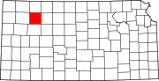 | |
| Unincorporated communities | ||
| Ghost towns | ||
| Townships | ||
| ||
| show Authority control |
|---|
- Cities in Kansas
- County seats in Kansas
- Cities in Sheridan County, Kansas